 |
|
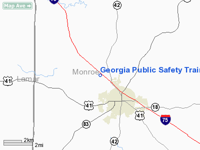
Georgia Public Safety Training Center Heliport |
Location
& QuickFacts
|
FAA Information Effective: |
2007-01-18 |
|
Airport
Identifier: |
90GA |
|
Airport
Status: |
Operational |
|
Longitude/Latitude: |
083-57-49.6750W/33-03-36.4660N
-83.963799/33.060129 (Estimated) |
|
Elevation: |
590 ft / 179.83 m (Estimated) |
|
Land: |
1
acres |
|
From
nearest city: |
1 nautical miles N of Forsyth, GA |
|
Location: |
Monroe County, GA |
|
Magnetic Variation: |
02W (1990) |
Owner
& Manager
|
Ownership: |
Publicly owned |
|
Owner: |
State Of Georgia
GEORGIA PUBLIC SAFETY TRAINING CENTER. |
|
Address: |
1000 Indian Springs Drive
Forsyth, GA 31029 |
|
Phone
number: |
912-993-4405 |
|
Manager: |
David A. Morris |
|
Address: |
1000 Indian Springs Drive
Forsyth, GA 31029 |
|
Phone number: |
912-993-4409 |
Airport
Operations and Facilities
|
Airport Use: |
Private |
|
Wind
indicator: |
Yes |
|
Segmented
Circle: |
No |
|
Control
Tower: |
No |
|
Sectional
chart: |
Atlanta |
|
Region: |
ASO - Southern |
|
Boundary
ARTCC: |
ZTL - Atlanta |
|
Tie-in
FSS: |
MCN - Macon |
|
FSS
on Airport: |
No |
|
FSS
Phone: |
478-784-1155 |
|
FSS
Toll Free: |
1-800-WX-BRIEF |
|
Runway Information
Helipad H1
|
Dimension: |
30
x 30 ft / 9.1 x 9.1 m |
|
Surface: |
CONC, |
|
|
Runway H1 |
Runway |
|
Traffic
Pattern: |
Left |
Left |
|
Radio Navigation
Aids
|
ID |
Type |
Name |
Ch |
Freq |
Var |
Dist |
|
OP |
NDB |
Yates |
|
339.00 |
03W |
14.1 nm |
|
JHH |
NDB |
Griffin |
|
412.00 |
04W |
15.2 nm |
|
FF |
NDB |
Pecat |
|
316.00 |
02W |
30.0 nm |
|
VOF |
NDB |
Alcovy |
|
370.00 |
03W |
35.4 nm |
|
BEP |
NDB |
Bay Creek |
|
350.00 |
03W |
37.6 nm |
|
BR |
NDB |
Redan |
|
266.00 |
02W |
39.3 nm |
|
EQQ |
NDB |
Coweta County |
|
234.00 |
03W |
39.5 nm |
|
UMB |
NDB |
Culvr |
|
380.00 |
04W |
40.9 nm |
|
IZS |
NDB |
Montezuma |
|
426.00 |
04W |
41.7 nm |
|
JNM |
NDB |
Monroe |
|
392.00 |
03W |
42.4 nm |
|
PIM |
NDB |
Pine Mountain |
|
272.00 |
03W |
47.7 nm |
|
MCN |
VORTAC |
Macon |
089X |
114.20 |
01E |
27.3 nm |
|
ATL |
VORTAC |
Atlanta |
116X |
116.90 |
00W |
41.6 nm |
|
ATL |
VOT |
Atlanta Muni |
|
111.00 |
|
42.8 nm |
Remarks
- PROVIDED
VFR/PR USE; WIND INDICATOR MNTND.
Georgia Public Safety Training Center Heliport
Address:
Monroe County, GA
Tel:
912-993-4405, 912-993-4409
Images
and information placed above are from
http://www.airport-data.com/airport/90GA/
We
thank them for the data!
| General
Info |
| Country |
United
States |
| State |
GEORGIA
|
| FAA ID |
90GA
|
| Latitude |
33-03-36.466N
|
| Longitude |
083-57-49.675W
|
| Elevation |
590 feet
|
| Near City |
FORSYTH
|
We don't guarantee the information is fresh and accurate. The data may
be wrong or outdated.
For more up-to-date information please refer to other sources.
|
|


