 |
|
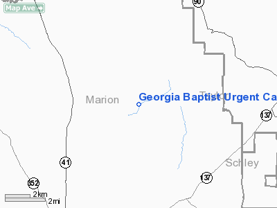
Georgia Baptist Urgent Care Heliport |
|
|
Location
& QuickFacts
|
FAA Information Effective: |
2007-01-18 |
|
Airport
Identifier: |
2GE2 |
|
Airport
Status: |
Operational |
|
Longitude/Latitude: |
084-28-47.7100W/32-26-56.5200N
-84.479919/32.449033 (Estimated) |
|
Elevation: |
860 ft / 262.13 m (Estimated) |
|
Land: |
0
acres |
|
From
nearest city: |
0 nautical miles N of Fayetteville, GA |
|
Location: |
Fayette County, GA |
|
Magnetic Variation: |
03W (1995) |
Owner
& Manager
|
Ownership: |
Privately owned |
|
Owner: |
Baptist Convention Exec Committee |
|
Address: |
300 Boulevard, Ne, P.o. Box 288
Atlanta, GA 30312 |
|
Phone
number: |
770-653-4455 |
|
Manager: |
Ralph Mc Daniel |
|
Address: |
300 Boulevard, Ne, P.o. Box 288
Atlanta, GA 30312 |
|
Phone number: |
770-653-3646 |
Airport
Operations and Facilities
|
Airport Use: |
Private |
|
Wind
indicator: |
Yes |
|
Segmented
Circle: |
No |
|
Control
Tower: |
No |
|
Lighting
Schedule: |
PHONE REQ
FOR PERIMETER LGTS CALL 770-653-3646. |
|
Sectional chart: |
Atlanta |
|
Region: |
ASO - Southern |
|
Boundary ARTCC: |
ZTL - Atlanta |
|
Tie-in FSS: |
MCN - Macon |
|
FSS Phone: |
478-784-1155 |
|
FSS Toll Free: |
1-800-WX-BRIEF |
Airport
Services
|
Runway Information
Helipad H1
|
Dimension: |
40 x 40 ft / 12.2 x 12.2 m |
|
Surface: |
CONC, Good Condition |
|
|
Runway H1 |
Runway |
|
Traffic
Pattern: |
Left |
Left |
|
Radio Navigation
Aids
|
ID |
Type |
Name |
Ch |
Freq |
Var |
Dist |
|
IZS |
NDB |
Montezuma |
|
426.00 |
04W |
24.5 nm |
|
LKG |
NDB |
Lindbergh |
|
242.00 |
03W |
25.1 nm |
|
AWS |
NDB |
Lawson |
|
335.00 |
02W |
29.1 nm |
|
PIM |
NDB |
Pine Mountain |
|
272.00 |
03W |
30.9 nm |
|
OP |
NDB |
Yates |
|
339.00 |
03W |
31.9 nm |
|
BEP |
NDB |
Bay Creek |
|
350.00 |
03W |
36.2 nm |
|
OHY |
NDB |
Coney |
|
400.00 |
02W |
41.5 nm |
|
JHH |
NDB |
Griffin |
|
412.00 |
04W |
46.0 nm |
|
EQQ |
NDB |
Coweta County |
|
234.00 |
03W |
50.0 nm |
|
LSF |
VOR/DME |
Lawson |
051X |
111.40 |
02W |
27.0 nm |
|
CSG |
VORTAC |
Columbus |
118X |
117.10 |
01E |
29.0 nm |
|
MCN |
VORTAC |
Macon |
089X |
114.20 |
01E |
44.6 nm |
|
EUF |
VORTAC |
Eufaula |
029X |
109.20 |
02E |
44.7 nm |
|
PZD |
VORTAC |
Pecan |
108X |
116.10 |
02W |
48.7 nm |
Remarks
- PRVDD
APCH/DEP OPNS CONDUCTED 330-030 AND 180-210, AREA IS MKD, WIND INDICATOR
IS MAINTAINED.
Based Aircraft
|
Aircraft
based on field: |
1 |
|
Helicopters: |
1 |
Georgia Baptist Urgent Care Heliport
Address:
Fayette County, GA
Tel:
770-653-4455,
770-653-3646
Images
and information placed above are from
http://www.airport-data.com/airport/2GE2/
We
thank them for the data!
| General
Info |
| Country |
United
States |
| State |
GEORGIA
|
| FAA ID |
2GE2
|
| Latitude |
32-26-56.520N
|
| Longitude |
084-28-47.710W
|
| Elevation |
860 feet
|
| Near City |
FAYETTEVILLE
|
We don't guarantee the information is fresh and accurate. The data may
be wrong or outdated.
For more up-to-date information please refer to other sources.
|
|


