 |
|
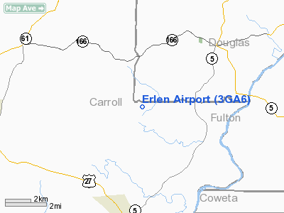
Location
& QuickFacts
|
FAA Information Effective: |
2007-01-18 |
|
Airport
Identifier: |
3GA6 |
|
Airport
Status: |
Operational |
|
Longitude/Latitude: |
084-53-54.0000W/33-34-14.0000N
-84.898333/33.570556 (Estimated) |
|
Elevation: |
1044 ft / 318.21 m (Surveyed) |
|
Land: |
0
acres |
|
From
nearest city: |
4 nautical miles NE of Whitesburg, GA |
|
Location: |
Carroll County, GA |
|
Magnetic Variation: |
02W (1985) |
Owner
& Manager
|
Ownership: |
Privately owned |
|
Owner: |
Paul Schmidt |
|
Address: |
745 Consolation Road
Whitesburg, GA 30185 |
|
Phone number: |
770-834-6132 |
|
Manager: |
Paul Schmidt |
|
Address: |
745 Consolation Road
Whitesburg, GA 30185 |
|
Phone number: |
770-834-6132 |
Airport
Operations and Facilities
|
Airport Use: |
Private |
|
Wind indicator: |
Yes |
|
Segmented Circle: |
No |
|
Control Tower: |
No |
|
Landing fee charge: |
No |
|
Sectional chart: |
Atlanta |
|
Region: |
ASO - Southern |
|
Boundary ARTCC: |
ZTL - Atlanta |
|
Tie-in FSS: |
MCN - Macon |
|
FSS on Airport: |
No |
|
FSS Phone: |
478-784-1155 |
|
FSS Toll Free: |
1-800-WX-BRIEF |
Airport
Services
|
Airframe Repair: |
NONE |
|
Power Plant Repair: |
NONE |
|
Runway Information
Runway N/S
|
Dimension: |
2300 x 75 ft / 701.0 x 22.9 m |
|
Surface: |
TURF, |
|
|
Runway N |
Runway S |
|
Traffic
Pattern: |
Left |
Left |
|
Displaced
threshold: |
500.00
ft |
500.00
ft |
|
Radio Navigation
Aids
|
ID |
Type |
Name |
Ch |
Freq |
Var |
Dist |
|
GPQ |
NDB |
Carrollton |
|
278.00 |
02W |
11.7 nm |
|
FT |
NDB |
Flanc |
|
344.00 |
02W |
17.4 nm |
|
EQQ |
NDB |
Coweta County |
|
234.00 |
03W |
21.0 nm |
|
FF |
NDB |
Pecat |
|
316.00 |
02W |
26.3 nm |
|
BR |
NDB |
Redan |
|
266.00 |
02W |
29.7 nm |
|
EVZ |
NDB |
Cartersville |
|
308.00 |
04W |
37.9 nm |
|
JHH |
NDB |
Griffin |
|
412.00 |
04W |
40.9 nm |
|
PIM |
NDB |
Pine Mountain |
|
272.00 |
03W |
43.8 nm |
|
OYD |
NDB |
Floyd |
|
388.00 |
02W |
45.7 nm |
|
DJD |
NDB |
Canton |
|
415.00 |
04W |
45.8 nm |
|
OUK |
NDB |
Calhoun |
|
323.00 |
02W |
50.0 nm |
|
DOB |
TACAN |
Dobbins |
077X |
|
01W |
28.5 nm |
|
PDK |
VOR/DME |
Peachtree |
113X |
116.60 |
02W |
35.1 nm |
|
ATL |
VORTAC |
Atlanta |
116X |
116.90 |
00W |
23.5 nm |
|
LGC |
VORTAC |
Lagrange |
103X |
115.60 |
01E |
35.0 nm |
|
RMG |
VORTAC |
Rome |
101X |
115.40 |
01E |
37.3 nm |
|
ATL |
VOT |
Atlanta Muni |
|
111.00 |
|
24.2 nm |
Remarks
- ERLEN
ARPT IS ADJ TO & W OF SMISSON FIELD.
- VFR,
PVT USE ONLY.
Erlen Airport
Address:
Carroll County, GA
Tel:
770-834-6132
Images
and information placed above are from
http://www.airport-data.com/airport/3GA6/
We
thank them for the data!
| General
Info |
| Country |
United
States |
| State |
GEORGIA
|
| FAA ID |
3GA6
|
| Latitude |
33-34-14.000N
|
| Longitude |
084-53-54.000W
|
| Elevation |
1044 feet
|
| Near City |
WHITESBURG
|
We don't guarantee the information is fresh and accurate. The data may
be wrong or outdated.
For more up-to-date information please refer to other sources.
|
|


