 |
|
|
|
Location
& QuickFacts
|
FAA Information Effective: |
2007-01-18 |
|
Airport
Identifier: |
30GA |
|
Airport
Status: |
Operational |
|
Longitude/Latitude: |
084-10-52.6970W/34-27-32.3340N
-84.181305/34.458982 (Estimated) |
|
Elevation: |
1500 ft / 457.20 m (Estimated) |
|
Land: |
0
acres |
|
From
nearest city: |
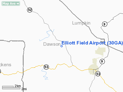
4 nautical miles NW of Dawsonville, GA |
|
Location: |
Dawson County, GA |
|
Magnetic Variation: |
02W (1985) |
Owner
& Manager
|
Ownership: |
Privately owned |
|
Owner: |
Bill Elliott |
|
Address: |
Hwy 183 P.o. Box 665
Dawsonville, GA 30534 |
|
Phone
number: |
706-265-4258 |
|
Manager: |
John P. Chagaris |
|
Address: |
Hwy 183 Po Box 665
Dawsonville, GA 30534 |
|
Phone number: |
706-265-1346 |
Airport
Operations and Facilities
|
Airport Use: |
Private |
|
Wind
indicator: |
Yes |
|
Segmented
Circle: |
No |
|
Control
Tower: |
No |
|
Lighting
Schedule: |
RDO-CTL
ACTVT LIRL RY 14/32 - 122.8. |
|
Landing fee charge: |
No |
|
Sectional chart: |
Atlanta |
|
Region: |
ASO - Southern |
|
Boundary ARTCC: |
ZTL - Atlanta |
|
Tie-in FSS: |
MCN - Macon |
|
FSS on Airport: |
No |
|
FSS Phone: |
478-784-1155 |
|
FSS Toll Free: |
1-800-WX-BRIEF |
Airport
Services
|
Runway Information
Runway 14/32
|
Dimension: |
4200 x 40 ft / 1280.2 x 12.2 m |
|
Surface: |
ASPH, |
|
Edge
Lights: |
Low |
|
|
Runway 14 |
Runway 32 |
|
Traffic
Pattern: |
Left |
Left |
|
Obstruction: |
20 ft trees, 400.0 ft from runway |
50 ft hill, 500.0 ft from runway |
|
Radio Navigation
Aids
|
ID |
Type |
Name |
Ch |
Freq |
Var |
Dist |
|
JZP |
NDB |
Pickens County |
|
285.00 |
04W |
13.8 nm |
|
DJD |
NDB |
Canton |
|
415.00 |
04W |
19.6 nm |
|
FKV |
NDB |
Flowery Branch |
|
365.00 |
03W |
20.6 nm |
|
AJR |
NDB |
Habersham |
|
347.00 |
03W |
31.4 nm |
|
EVZ |
NDB |
Cartersville |
|
308.00 |
04W |
36.4 nm |
|
OUK |
NDB |
Calhoun |
|
323.00 |
02W |
37.1 nm |
|
DDA |
NDB |
Commerce |
|
244.00 |
03W |
40.6 nm |
|
TTQ |
NDB |
Tomotla |
|
335.00 |
01W |
41.0 nm |
|
UWI |
NDB |
Whitfield |
|
400.00 |
03W |
42.7 nm |
|
BMW |
NDB |
Barrow County |
|
404.00 |
03W |
43.1 nm |
|
FT |
NDB |
Flanc |
|
344.00 |
02W |
47.7 nm |
|
JNM |
NDB |
Monroe |
|
392.00 |
03W |
48.9 nm |
|
BR |
NDB |
Redan |
|
266.00 |
02W |
49.3 nm |
|
OYD |
NDB |
Floyd |
|
388.00 |
02W |
49.7 nm |
|
DOB |
TACAN |
Dobbins |
077X |
|
01W |
36.5 nm |
|
PDK |
VOR/DME |
Peachtree |
113X |
116.60 |
02W |
35.5 nm |
|
HRS |
VORTAC |
Harris |
035X |
109.80 |
00E |
31.9 nm |
|
ODF |
VORTAC |
Foothills |
081X |
113.40 |
00E |
46.0 nm |
|
RMG |
VORTAC |
Rome |
101X |
115.40 |
01E |
49.9 nm |
|
ATL |
VOT |
Atlanta Muni |
|
111.00 |
|
49.7 nm |
Remarks
Based
Aircraft
|
Aircraft
based on field: |
6 |
|
Single
Engine Airplanes: |
3 |
|
Multi
Engine Airplanes: |
3 |
Elliott Field Airport
Address:
Dawson County, GA
Tel:
706-265-4258,
706-265-1346
Images
and information placed above are from
http://www.airport-data.com/airport/30GA/
We
thank them for the data!
| General
Info |
| Country |
United
States |
| State |
GEORGIA
|
| FAA ID |
30GA
|
| Latitude |
34-27-32.334N
|
| Longitude |
084-10-52.697W
|
| Elevation |
1500 feet
|
| Near City |
DAWSONVILLE
|
We don't guarantee the information is fresh and accurate. The data may
be wrong or outdated.
For more up-to-date information please refer to other sources.
|
|


