|
|
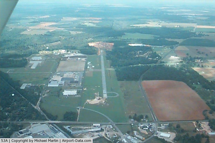
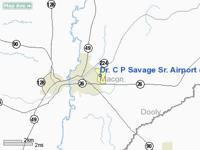
Dr. C P Savage Sr. Airport |
|
 |
(Click on the photo to enlarge) |
Location
& QuickFacts
|
FAA Information Effective: |
2007-01-18 |
|
Airport
Identifier: |
53A |
|
Airport
Status: |
Operational |
|
Longitude/Latitude: |
084-00-26.9000W/32-18-07.2000N
-84.007472/32.302000 (Estimated) |
|
Elevation: |
337 ft / 102.72 m (Surveyed) |
|
Land: |
179 acres |
|
From
nearest city: |
1 nautical miles E of Montezuma, GA |
|
Location: |
Macon County, GA |
|
Magnetic Variation: |
04W (2005) |
Owner
& Manager
|
Ownership: |
Publicly owned |
|
Owner: |
City Of Montezuma |
|
Address: |
City Hall, P.o. Box 388, 408 South Dooly
Montezuma, GA 31063 |
|
Phone
number: |
478-472-8144 |
|
Manager: |
Willie J. Larry, Mayor |
|
Address: |
City Hall, P.o. Box 388
Montezuma, GA 31063 |
|
Phone number: |
478-472-8144 |
Airport
Operations and Facilities
|
Airport Use: |
Open to public |
|
Wind
indicator: |
Yes |
|
Segmented
Circle: |
No |
|
Control
Tower: |
No |
|
Lighting
Schedule: |
DUSK-DAWN
ACTVT MIRL RY 18/36 - CTAF. |
|
Beacon
Color: |
Clear-Green (lighted land airport) |
|
Landing
fee charge: |
No |
|
Sectional
chart: |
Atlanta |
|
Region: |
ASO - Southern |
|
Boundary
ARTCC: |
ZTL - Atlanta |
|
Tie-in
FSS: |
MCN - Macon |
|
FSS
on Airport: |
No |
|
FSS
Phone: |
478-784-1155 |
|
FSS
Toll Free: |
1-800-WX-BRIEF |
|
NOTAMs
Facility: |
MCN (NOTAM-d service avaliable) |
|
Federal Agreements: |
NGY |
Airport
Communications
Airport
Services
|
Airframe Repair: |
NONE |
|
Power Plant Repair: |
NONE |
|
Bottled
Oxygen: |
NONE |
|
Bulk
Oxygen: |
NONE |
|
Runway Information
Runway 18/36
|
Dimension: |
4220 x 75 ft / 1286.3 x 22.9 m |
|
Surface: |
ASPH, Good Condition |
|
Weight
Limit: |
Single wheel: 30000 lbs. |
|
Edge
Lights: |
Medium |
|
|
Runway 18 |
Runway 36 |
|
Longitude: |
084-00-26.6996W |
084-00-27.1604W |
|
Latitude: |
32-18-28.0342N |
32-17-46.2762N |
|
Elevation: |
335.00
ft |
337.00
ft |
|
Alignment: |
127 |
1 |
|
Traffic
Pattern: |
Left |
Left |
|
Markings: |
Non-precision instrument, Fair Condition |
Non-precision instrument, Fair Condition |
|
Obstruction: |
80 ft trees, 1240.0 ft from runway, 13:1 slope
to clear
RY 18 +12 FT TREES AT THLD 125 FT RIGHT. |
52 ft tree, 1240.0 ft from runway, 100 ft left
of centerline, 20:1 slope to clear |
|
Radio Navigation
Aids
|
ID |
Type |
Name |
Ch |
Freq |
Var |
Dist |
|
IZS |
NDB |
Montezuma |
|
426.00 |
04W |
3.9 nm |
|
LKG |
NDB |
Lindbergh |
|
242.00 |
03W |
9.2 nm |
|
BEP |
NDB |
Bay Creek |
|
350.00 |
03W |
15.4 nm |
|
OHY |
NDB |
Coney |
|
400.00 |
02W |
19.7 nm |
|
OP |
NDB |
Yates |
|
339.00 |
03W |
38.2 nm |
|
EZM |
NDB |
Eastman |
|
366.00 |
04W |
44.6 nm |
|
VNA |
VORTAC |
Vienna |
112X |
116.50 |
01E |
26.5 nm |
|
MCN |
VORTAC |
Macon |
089X |
114.20 |
01E |
29.7 nm |
|
PZD |
VORTAC |
Pecan |
108X |
116.10 |
02W |
41.5 nm |
Remarks
Based
Aircraft
|
Aircraft
based on field: |
9 |
|
Single
Engine Airplanes: |
9 |
Operational Statistics
Time Period: 2005-02-01
- 2006-01-31
|
Aircraft
Operations: |
97/Week |
|
General
Aviation Local: |
70.0% |
|
General
Aviation Itinerant: |
30.0% |
Dr. C P Savage Sr. Airport
Address:
Macon County, GA
Tel:
478-472-8144
Images
and information placed above are from
http://www.airport-data.com/airport/53A/
We
thank them for the data!
| General
Info |
| Country |
United
States |
| State |
GEORGIA
|
| FAA ID |
53A
|
| Latitude |
32-18-07.200N
|
| Longitude |
084-00-26.900W
|
| Elevation |
337 feet
|
| Near City |
MONTEZUMA
|
We don't guarantee the information is fresh and accurate. The data may
be wrong or outdated.
For more up-to-date information please refer to other sources.
|
|