 |
|
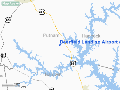
Deerfield Landing Putnam Airport |
Location
& QuickFacts
|
FAA Information Effective: |
2007-01-18 |
|
Airport
Identifier: |
9GA9 |
|
Airport
Status: |
Operational |
|
Longitude/Latitude: |
083-19-02.0000W/33-13-05.0000N
-83.317222/33.218056 (Estimated) |
|
Elevation: |
445 ft / 135.64 m (Estimated) |
|
Land: |
0
acres |
|
From
nearest city: |
8 nautical miles SE of Eatonton, GA |
|
Location: |
Putnam County, GA |
|
Magnetic Variation: |
04W (1995) |
Owner
& Manager
|
Ownership: |
Privately owned |
|
Owner: |
Bill Stancil |
|
Address: |
896 Milledgeville Road
Eatonton, GA 31024 |
|
Phone number: |
770-339-1296 |
|
Manager: |
Bill Stancil |
|
Address: |
896 Milledgeville Road
Eatonton, GA 31024 |
|
Phone number: |
770-339-1296 |
Airport
Operations and Facilities
|
Airport Use: |
Private |
|
Segmented
Circle: |
No |
|
Control
Tower: |
No |
|
Sectional
chart: |
Atlanta |
|
Region: |
ASO - Southern |
|
Boundary
ARTCC: |
ZTL - Atlanta |
|
Tie-in
FSS: |
MCN - Macon |
|
FSS
Phone: |
478-784-1155 |
|
FSS
Toll Free: |
1-800-WX-BRIEF |
|
Runway Information
Runway 16/34
|
Dimension: |
2900 x 50 ft / 883.9 x 15.2 m |
|
Surface: |
TURF, Good Condition |
|
|
Runway 16 |
Runway 34 |
|
Traffic
Pattern: |
Left |
Left |
|
Radio Navigation
Aids
|
ID |
Type |
Name |
Ch |
Freq |
Var |
Dist |
|
UMB |
NDB |
Culvr |
|
380.00 |
04W |
8.9 nm |
|
HIT |
NDB |
Kaolin |
|
360.00 |
05W |
22.5 nm |
|
VV |
NDB |
Junne |
|
353.00 |
05W |
29.7 nm |
|
VOF |
NDB |
Alcovy |
|
370.00 |
03W |
34.0 nm |
|
JNM |
NDB |
Monroe |
|
392.00 |
03W |
37.4 nm |
|
AA |
NDB |
Cedar |
|
341.00 |
04W |
40.0 nm |
|
IIY |
NDB |
Washington/wilkes County |
|
435.00 |
03W |
41.9 nm |
|
HQU |
NDB |
Thomson-mcduffie |
|
333.00 |
04W |
44.3 nm |
|
BJT |
NDB |
Bulldog |
|
221.00 |
03W |
44.4 nm |
|
BMW |
NDB |
Barrow County |
|
404.00 |
03W |
45.2 nm |
|
JHH |
NDB |
Griffin |
|
412.00 |
04W |
45.8 nm |
|
DB |
NDB |
Creke |
|
251.00 |
04W |
46.8 nm |
|
OP |
NDB |
Yates |
|
339.00 |
03W |
47.4 nm |
|
MCN |
VORTAC |
Macon |
089X |
114.20 |
01E |
35.8 nm |
|
AHN |
VORTAC |
Athens |
33 |
109.60 |
00E |
43.9 nm |
|
DBN |
VORTAC |
Dublin |
078X |
113.10 |
01W |
46.5 nm |
Remarks
- 200
FT PILE 1500 FT EAST OF & PARALLEL TO RY, 1000 FT STACK 1.5 NM SOUTHEAST
OF RY 34.
- PRVDD
VFR, PVT USE.
Deerfield Landing Putnam Airport
Address:
Putnam County, GA
Tel:
770-339-1296
Images
and information placed above are from
http://www.airport-data.com/airport/9GA9/
We
thank them for the data!
We don't guarantee the information is fresh and accurate. The data may
be wrong or outdated.
For more up-to-date information please refer to other sources.
|
|


