|
|
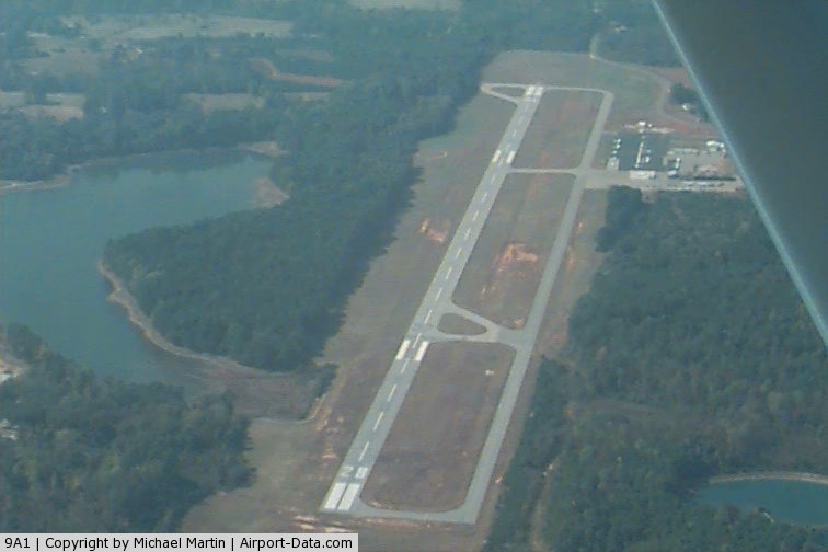
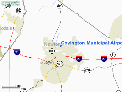
Covington Municipal Airport |
|
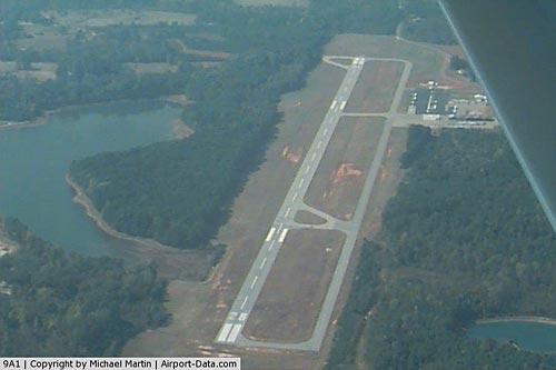 |
(Click on the photo to enlarge) |
Location
& QuickFacts
|
FAA Information Effective: |
2007-01-18 |
|
Airport
Identifier: |
9A1 |
|
Airport
Status: |
Operational |
|
Longitude/Latitude: |
083-50-58.4090W/33-37-56.9370N
-83.849558/33.632483 (Estimated) |
|
Elevation: |
795 ft / 242.32 m (Surveyed) |
|
Land: |
60 acres |
|
From
nearest city: |
3 nautical miles N of Covington, GA |
|
Location: |
Newton County, GA |
|
Magnetic
Variation: |
02W (1985) |
Owner
& Manager
|
Ownership: |
Publicly owned |
|
Owner: |
City Of Covington |
|
Address: |
City Hall, Po Box 1527
Covington, GA 30209 |
|
Phone
number: |
770-385-2000 |
|
Manager: |
Frank Turner, City Mgr. |
|
Address: |
Cityhall, Po Box 1527
Covington, GA 30209 |
|
Phone
number: |
770-385-2000
ARPT PHONE 770-787-0098. |
Airport
Operations and Facilities
|
Airport Use: |
Open to public |
|
Wind
indicator: |
Yes |
|
Segmented
Circle: |
Yes |
|
Control
Tower: |
No |
|
Lighting
Schedule: |
DUSK-DAWN |
|
Beacon
Color: |
Clear-Green (lighted land airport) |
|
Landing
fee charge: |
No |
|
Sectional
chart: |
Atlanta |
|
Region: |
ASO - Southern |
|
Boundary
ARTCC: |
ZTL - Atlanta |
|
Tie-in
FSS: |
MCN - Macon |
|
FSS
on Airport: |
No |
|
FSS
Phone: |
478-784-1155 |
|
FSS
Toll Free: |
1-800-WX-BRIEF |
|
NOTAMs
Facility: |
MCN (NOTAM-d service avaliable) |
|
Federal
Agreements: |
NGY |
Airport
Communications
|
CTAF: |
123.000 |
|
Unicom: |
123.000 |
Airport
Services
|
Fuel available: |
100LLA |
|
Airframe Repair: |
MAJOR |
|
Power Plant Repair: |
MAJOR |
|
Bottled
Oxygen: |
NONE |
|
Bulk
Oxygen: |
NONE |
|
Runway Information
Runway 10/28
|
Dimension: |
4203 x 75 ft / 1281.1 x 22.9 m |
|
Surface: |
ASPH, Fair Condition |
|
Weight
Limit: |
Single wheel: 30000 lbs. |
|
Edge
Lights: |
Medium |
|
|
Runway 10 |
Runway 28 |
|
Longitude: |
083-51-23.1510W |
083-50-33.6680W |
|
Latitude: |
33-37-58.9210N |
33-37-54.9520N |
|
Elevation: |
795.00 ft |
784.00 ft |
|
Alignment: |
95 |
127 |
|
Traffic
Pattern: |
Left |
Right |
|
Markings: |
Non-precision instrument, Poor Condition
RUNWAY END NUMBERS FADED |
Non-precision instrument, Poor Condition
RWY END NUMBERS FADED |
|
Crossing
Height: |
54.00 ft |
44.00 ft |
|
VASI: |
2-light PAPI on left side |
2-light PAPI on left side |
|
Visual
Glide Angle: |
4.00° |
3.00° |
|
Obstruction: |
55 ft trees, 805.0 ft from runway, 290 ft right
of centerline, 11:1 slope to clear |
97 ft trees, 2334.0 ft from runway, 22:1 slope
to clear |
|
Radio Navigation
Aids
|
ID |
Type |
Name |
Ch |
Freq |
Var |
Dist |
|
VOF |
NDB |
Alcovy |
|
370.00 |
03W |
3.4 nm |
|
JNM |
NDB |
Monroe |
|
392.00 |
03W |
8.8 nm |
|
BMW |
NDB |
Barrow County |
|
404.00 |
03W |
22.4 nm |
|
BR |
NDB |
Redan |
|
266.00 |
02W |
23.1 nm |
|
DDA |
NDB |
Commerce |
|
244.00 |
03W |
30.6 nm |
|
JHH |
NDB |
Griffin |
|
412.00 |
04W |
32.9 nm |
|
FKV |
NDB |
Flowery Branch |
|
365.00 |
03W |
34.4 nm |
|
BJT |
NDB |
Bulldog |
|
221.00 |
03W |
36.8 nm |
|
FF |
NDB |
Pecat |
|
316.00 |
02W |
37.7 nm |
|
FT |
NDB |
Flanc |
|
344.00 |
02W |
40.2 nm |
|
VV |
NDB |
Junne |
|
353.00 |
05W |
41.5 nm |
|
UMB |
NDB |
Culvr |
|
380.00 |
04W |
45.1 nm |
|
OP |
NDB |
Yates |
|
339.00 |
03W |
46.1 nm |
|
EQQ |
NDB |
Coweta County |
|
234.00 |
03W |
48.8 nm |
|
DJD |
NDB |
Canton |
|
415.00 |
04W |
49.0 nm |
|
DOB |
TACAN |
Dobbins |
077X |
|
01W |
37.0 nm |
|
PDK |
VOR/DME |
Peachtree |
113X |
116.60 |
02W |
26.8 nm |
|
ATL |
VORTAC |
Atlanta |
116X |
116.90 |
00W |
29.3 nm |
|
AHN |
VORTAC |
Athens |
33 |
109.60 |
00E |
32.3 nm |
|
ATL |
VOT |
Atlanta Muni |
|
111.00 |
|
28.9 nm |
Remarks
- DEER
AND MIGRATORY BIRDS ON & INVOF ARPT.
- AVOID
OVERFLYING POPULATED AREA SW OF ARPT BLO 1500 FT AGL.
- NO
180 DEGREE TURNS ON ASPH FOR ACFT OVER 12500 LBS GWT.
- EXISTED
PRIOR TO 1959.
Based
Aircraft
|
Aircraft
based on field: |
75 |
|
Single
Engine Airplanes: |
65 |
|
Multi
Engine Airplanes: |
8 |
|
Jet Engine
Airplanes: |
1 |
|
Helicopters: |
1 |
Operational Statistics
Time Period: 2004-04-22 - 2005-04-21
|
Aircraft
Operations: |
115/Day |
|
General
Aviation Local: |
52.6% |
|
General
Aviation Itinerant: |
47.4% |
Covington Municipal Airport
Address: Newton County, GA
Tel:
770-385-2000
Images
and information placed above are from
http://www.airport-data.com/airport/9A1/
We
thank them for the data!
| General
Info |
| Country |
United
States |
| State |
GEORGIA
|
| FAA ID |
9A1
|
| Latitude |
33-37-56.937N
|
| Longitude |
083-50-58.409W
|
| Elevation |
795 feet
|
| Near City |
COVINGTON
|
We don't guarantee the information is fresh and accurate. The data may
be wrong or outdated.
For more up-to-date information please refer to other sources.
|
|