 |
|
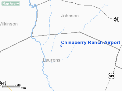
Location
& QuickFacts
|
FAA Information Effective: |
2007-01-18 |
|
Airport
Identifier: |
9GA8 |
|
Airport
Status: |
Operational |
|
Longitude/Latitude: |
082-53-56.0000W/32-41-37.0000N
-82.898889/32.693611 (Estimated) |
|
Elevation: |
295 ft / 89.92 m (Estimated) |
|
Land: |
3
acres |
|
From
nearest city: |
10 nautical miles N of East Dublin, GA |
|
Location: |
Laurens County, GA |
|
Magnetic Variation: |
04W (1995) |
Owner
& Manager
|
Ownership: |
Privately owned |
|
Owner: |
Glenn J. Bridges |
|
Address: |
2757 Buckeye Road
East Dublin, GA 31027 |
|
Phone number: |
912-277-9032 |
|
Address: |
|
Airport
Operations and Facilities
|
Airport Use: |
Private |
|
Wind
indicator: |
Yes |
|
Segmented
Circle: |
No |
|
Control
Tower: |
No |
|
Sectional
chart: |
Atlanta |
|
Region: |
ASO - Southern |
|
Boundary
ARTCC: |
ZTL - Atlanta |
|
Tie-in
FSS: |
MCN - Macon |
|
FSS
Phone: |
478-784-1155 |
|
FSS
Toll Free: |
1-800-WX-BRIEF |
|
Runway Information
Runway 12/30
|
Dimension: |
1500 x 90 ft / 457.2 x 27.4 m |
|
Surface: |
TURF, |
|
|
Runway 12 |
Runway 30 |
|
Traffic
Pattern: |
Left |
Left |
|
Radio Navigation
Aids
|
ID |
Type |
Name |
Ch |
Freq |
Var |
Dist |
|
DB |
NDB |
Creke |
|
251.00 |
04W |
13.8 nm |
|
HIT |
NDB |
Kaolin |
|
360.00 |
05W |
19.5 nm |
|
EEX |
NDB |
Emanuel County |
|
309.00 |
04W |
22.6 nm |
|
UMB |
NDB |
Culvr |
|
380.00 |
04W |
30.5 nm |
|
MQW |
NDB |
Mc Rae |
|
280.00 |
03W |
36.0 nm |
|
EZM |
NDB |
Eastman |
|
366.00 |
04W |
36.0 nm |
|
UQN |
NDB |
Onyun |
|
372.00 |
04W |
41.6 nm |
|
MHP |
NDB |
Metter |
|
432.00 |
03W |
45.6 nm |
|
BEP |
NDB |
Bay Creek |
|
350.00 |
03W |
46.1 nm |
|
LNH |
NDB |
Millen |
|
205.00 |
05W |
48.6 nm |
|
BXG |
NDB |
Burke County |
|
356.00 |
04W |
49.8 nm |
|
DBN |
VORTAC |
Dublin |
078X |
113.10 |
01W |
8.7 nm |
|
MCN |
VORTAC |
Macon |
089X |
114.20 |
01E |
37.9 nm |
|
VNA |
VORTAC |
Vienna |
112X |
116.50 |
01E |
41.9 nm |
Remarks
Based Aircraft
|
Aircraft
based on field: |
1 |
|
Single
Engine Airplanes: |
1 |
Chinaberry Ranch Airport
Address:
Laurens County, GA
Tel:
912-277-9032
Images
and information placed above are from
http://www.airport-data.com/airport/9GA8/
We
thank them for the data!
| General
Info |
| Country |
United
States |
| State |
GEORGIA
|
| FAA ID |
9GA8
|
| Latitude |
32-41-37.000N
|
| Longitude |
082-53-56.000W
|
| Elevation |
295 feet
|
| Near City |
EAST DUBLIN
|
We don't guarantee the information is fresh and accurate. The data may
be wrong or outdated.
For more up-to-date information please refer to other sources.
|
|


