 |
|
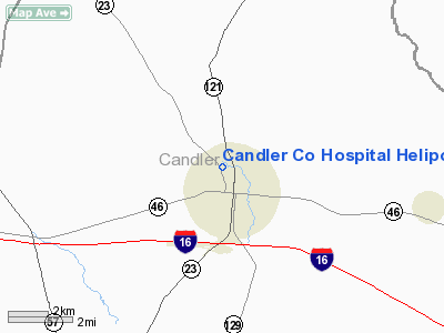
Candler Company Hospital Heliport |
Location
& QuickFacts
|
FAA Information Effective: |
2007-01-18 |
|
Airport
Identifier: |
GA32 |
|
Airport
Status: |
Operational |
|
Longitude/Latitude: |
082-03-57.4310W/32-24-30.6210N
-82.065953/32.408506 (Estimated) |
|
Elevation: |
95
ft / 28.96 m (Estimated) |
|
Land: |
0
acres |
|
From
nearest city: |
1 nautical miles NW of Metter, GA |
|
Location: |
Candler County, GA |
|
Magnetic Variation: |
03W (1985) |
Owner
& Manager
|
Ownership: |
Privately owned |
|
Address: |
|
|
Manager: |
J C Rivenbark |
|
Address: |
Candler Co Hosp, Cedar Rd
Metter, GA 30439 |
Airport
Operations and Facilities
|
Airport Use: |
Private
MEDICAL. |
|
Wind indicator: |
No |
|
Segmented Circle: |
No |
|
Control Tower: |
No |
|
Landing fee charge: |
No |
|
Sectional chart: |
Atlanta |
|
Region: |
ASO - Southern |
|
Boundary ARTCC: |
ZJX - Jacksonville |
|
Tie-in FSS: |
MCN - Macon |
|
FSS on Airport: |
No |
|
FSS Phone: |
478-784-1155 |
|
FSS Toll Free: |
1-800-WX-BRIEF |
|
NOTAMs Facility: |
MCN |
Airport
Services
|
Airframe Repair: |
NONE |
|
Power Plant Repair: |
NONE |
|
Runway Information
Helipad H1
|
Dimension: |
40 x 40 ft / 12.2 x 12.2 m |
|
Surface: |
CONC, |
|
|
Runway H1 |
Runway |
|
Traffic
Pattern: |
Left |
Left |
|
Radio Navigation
Aids
|
ID |
Type |
Name |
Ch |
Freq |
Var |
Dist |
|
MHP |
NDB |
Metter |
|
432.00 |
03W |
2.4 nm |
|
CWV |
NDB |
Claxton |
|
395.50 |
04W |
15.8 nm |
|
UQN |
NDB |
Onyun |
|
372.00 |
04W |
16.2 nm |
|
BZ |
NDB |
Bullo |
|
407.00 |
05W |
20.4 nm |
|
RVJ |
NDB |
Prison |
|
424.00 |
03W |
21.5 nm |
|
EEX |
NDB |
Emanuel County |
|
309.00 |
04W |
25.0 nm |
|
JYL |
NDB |
Sylvania |
|
245.00 |
04W |
27.9 nm |
|
LNH |
NDB |
Millen |
|
205.00 |
05W |
29.6 nm |
|
BXG |
NDB |
Burke County |
|
356.00 |
04W |
38.2 nm |
|
AZE |
NDB |
Hazlehurst |
|
414.00 |
03W |
43.4 nm |
|
MOQ |
NDB |
Mc Intosh |
|
263.00 |
04W |
44.8 nm |
|
BHC |
NDB |
Baxley |
|
376.00 |
04W |
45.0 nm |
|
MQW |
NDB |
Mc Rae |
|
280.00 |
03W |
45.7 nm |
|
DB |
NDB |
Creke |
|
251.00 |
04W |
48.1 nm |
|
DBN |
VORTAC |
Dublin |
078X |
113.10 |
01W |
40.0 nm |
|
SAV |
VORTAC |
Savannah |
106Y |
115.95 |
06W |
46.8 nm |
|
SAV |
VOT |
Savannah Travis Fld |
|
111.00 |
|
47.1 nm |
Remarks
Candler Company Hospital Heliport
Address:
Candler County, GA
Tel:
Images
and information placed above are from
http://www.airport-data.com/airport/GA32/
We
thank them for the data!
| General
Info |
| Country |
United
States |
| State |
GEORGIA
|
| FAA ID |
GA32
|
| Latitude |
32-24-30.621N
|
| Longitude |
082-03-57.431W
|
| Elevation |
95 feet
|
| Near City |
METTER
|
We don't guarantee the information is fresh and accurate. The data may
be wrong or outdated.
For more up-to-date information please refer to other sources.
|
|


