 |
|
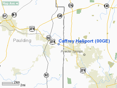
Location
& QuickFacts
|
FAA Information Effective: |
2007-01-18 |
|
Airport
Identifier: |
00GE |
|
Airport
Status: |
Operational |
|
Longitude/Latitude: |
084-44-02.0000W/33-53-03.0000N
-84.733889/33.884167 (Estimated) |
|
Elevation: |
957 ft / 291.69 m (Estimated) |
|
Land: |
7
acres |
|
From
nearest city: |
2 nautical miles NE of Hiram, GA |
|
Location: |
Paulding County, GA |
|
Magnetic Variation: |
() |
Owner
& Manager
|
Ownership: |
Privately owned |
|
Owner: |
Mark & Leigh Caffrey |
|
Address: |
204 Greenfield Road
Hiram, GA 30141 |
|
Phone number: |
770-943-4769 |
|
Manager: |
Mark & Leigh Caffrey |
|
Address: |
204 Greenfield Road
Hiram, GA 30141 |
|
Phone number: |
770-943-4769 |
Airport
Operations and Facilities
|
Airport Use: |
Private |
|
Wind
indicator: |
Yes |
|
Segmented
Circle: |
No |
|
Control
Tower: |
No |
|
Lighting
Schedule: |
DUSK-DAWN |
|
Beacon
Color: |
Clear-Green-Yellow (heliport) |
|
Region: |
ASO - Southern |
|
Boundary
ARTCC: |
ZTL - Atlanta |
|
Responsible
ARTCC: |
ZTL - Atlanta |
|
Tie-in
FSS: |
MCN - Macon |
|
FSS
Phone: |
478-784-1155 |
|
FSS
Toll Free: |
1-800-WX-BRIEF |
|
Runway Information
Helipad H1
|
Dimension: |
125 x 95 ft / 38.1 x 29.0 m |
|
Surface: |
ASPH, |
|
|
Runway H1 |
Runway |
|
Traffic
Pattern: |
Left |
Left |
|
Radio Navigation
Aids
|
ID |
Type |
Name |
Ch |
Freq |
Var |
Dist |
|
FT |
NDB |
Flanc |
|
344.00 |
02W |
8.7 nm |
|
EVZ |
NDB |
Cartersville |
|
308.00 |
04W |
19.7 nm |
|
DJD |
NDB |
Canton |
|
415.00 |
04W |
25.3 nm |
|
BR |
NDB |
Redan |
|
266.00 |
02W |
25.5 nm |
|
GPQ |
NDB |
Carrollton |
|
278.00 |
02W |
27.6 nm |
|
OUK |
NDB |
Calhoun |
|
323.00 |
02W |
32.5 nm |
|
OYD |
NDB |
Floyd |
|
388.00 |
02W |
32.9 nm |
|
JZP |
NDB |
Pickens County |
|
285.00 |
04W |
37.0 nm |
|
FF |
NDB |
Pecat |
|
316.00 |
02W |
37.2 nm |
|
EQQ |
NDB |
Coweta County |
|
234.00 |
03W |
37.7 nm |
|
FKV |
NDB |
Flowery Branch |
|
365.00 |
03W |
45.5 nm |
|
JHH |
NDB |
Griffin |
|
412.00 |
04W |
49.1 nm |
|
VOF |
NDB |
Alcovy |
|
370.00 |
03W |
50.0 nm |
|
DOB |
TACAN |
Dobbins |
077X |
|
01W |
11.5 nm |
|
PDK |
VOR/DME |
Peachtree |
113X |
116.60 |
02W |
21.7 nm |
|
ATL |
VORTAC |
Atlanta |
116X |
116.90 |
00W |
21.4 nm |
|
RMG |
VORTAC |
Rome |
101X |
115.40 |
01E |
25.5 nm |
|
ATL |
VOT |
Atlanta Muni |
|
111.00 |
|
20.5 nm |
Remarks
- PRVDD
VFR, PRVT, TKOF/LANDING AREA IS APPROPRIATELY MARKED.
Based
Aircraft
|
Aircraft
based on field: |
1 |
|
Helicopters: |
1 |
Caffrey Heliport
Address:
Paulding County, GA
Tel:
770-943-4769
Images
and information placed above are from
http://www.airport-data.com/airport/00GE/
We
thank them for the data!
We don't guarantee the information is fresh and accurate. The data may
be wrong or outdated.
For more up-to-date information please refer to other sources.
|
|


