 |
|
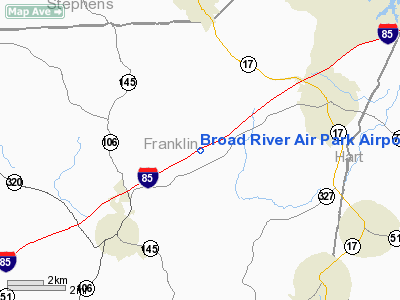
Broad River Air Park Airport |
Location
& QuickFacts
|
FAA Information Effective: |
2007-01-18 |
|
Airport
Identifier: |
3GE3 |
|
Airport
Status: |
Operational |
|
Longitude/Latitude: |
083-11-03.0000W/34-24-43.0000N
-83.184167/34.411944 (Estimated) |
|
Elevation: |
690 ft / 210.31 m (Estimated) |
|
Land: |
20 acres |
|
From
nearest city: |
4 nautical miles NE of Carnesville, GA |
|
Location: |
Franklin County, GA |
|
Magnetic Variation: |
04W (1995) |
Owner
& Manager
|
Ownership: |
Privately owned |
|
Owner: |
James E. Hatcher |
|
Address: |
711 Chattahoochee Place
Gainesville, GA 30506 |
|
Phone number: |
706-878-0758 |
|
Manager: |
James E. Hatcher |
|
Address: |
711 Chattahoochee Place
Gainesville, GA 30506 |
|
Phone number: |
706-878-0758 |
Airport
Operations and Facilities
|
Airport Use: |
Private |
|
Wind
indicator: |
Yes |
|
Segmented
Circle: |
No |
|
Control
Tower: |
No |
|
Sectional
chart: |
Atlanta |
|
Region: |
ASO - Southern |
|
Boundary
ARTCC: |
ZTL - Atlanta |
|
Tie-in
FSS: |
MCN - Macon |
|
FSS
Phone: |
478-784-1155 |
|
FSS
Toll Free: |
1-800-WX-BRIEF |
|
Runway Information
Runway 07/25
|
Dimension: |
3000 x 40 ft / 914.4 x 12.2 m |
|
Surface: |
ASPH, |
|
|
Runway 07 |
Runway 25 |
|
Traffic
Pattern: |
Left |
Left |
|
Radio Navigation
Aids
|
ID |
Type |
Name |
Ch |
Freq |
Var |
Dist |
|
AJR |
NDB |
Habersham |
|
347.00 |
03W |
18.9 nm |
|
CEU |
NDB |
Clemson |
|
257.00 |
05W |
21.6 nm |
|
AND |
NDB |
Anderson County |
|
230.00 |
04W |
24.1 nm |
|
DDA |
NDB |
Commerce |
|
244.00 |
03W |
26.9 nm |
|
BJT |
NDB |
Bulldog |
|
221.00 |
03W |
27.7 nm |
|
LQK |
NDB |
Lake Keowee |
|
408.00 |
04W |
33.8 nm |
|
BMW |
NDB |
Barrow County |
|
404.00 |
03W |
35.0 nm |
|
FKV |
NDB |
Flowery Branch |
|
365.00 |
03W |
38.0 nm |
|
GY |
NDB |
Dyana |
|
338.00 |
03W |
40.3 nm |
|
IIY |
NDB |
Washington/wilkes County |
|
435.00 |
03W |
42.5 nm |
|
VV |
NDB |
Junne |
|
353.00 |
05W |
46.7 nm |
|
JNM |
NDB |
Monroe |
|
392.00 |
03W |
48.7 nm |
|
ODF |
VORTAC |
Foothills |
081X |
113.40 |
00E |
18.0 nm |
|
ELW |
VORTAC |
Electric City |
023X |
108.60 |
00E |
19.8 nm |
|
AHN |
VORTAC |
Athens |
33 |
109.60 |
00E |
28.8 nm |
|
HRS |
VORTAC |
Harris |
035X |
109.80 |
00E |
48.2 nm |
Remarks
- 263
FT TOWER 1 NM EAST-NORTHEAST OF ARPT.
- PRVDD
VFR, PVT USE, AWARE OF HEAVY MILITARY TRAINING IN AREA.
Based
Aircraft
|
Aircraft
based on field: |
2 |
|
Single
Engine Airplanes: |
2 |
Broad River Air Park Airport
Address:
Franklin County, GA
Tel:
706-878-0758
Images
and information placed above are from
http://www.airport-data.com/airport/3GE3/
We
thank them for the data!
| General
Info |
| Country |
United
States |
| State |
GEORGIA
|
| FAA ID |
3GE3
|
| Latitude |
34.411944
34° 24' 43.00" N |
| Longitude |
-83.184167
083° 11' 03.00" W |
| Elevation |
690 feet
210 meters |
| Magnetic
Variation |
005° W
(01/06) |
| Operating
Agency |
PRIVATE
|
We don't guarantee the information is fresh and accurate. The data may
be wrong or outdated.
For more up-to-date information please refer to other sources.
|
|


