 |
|
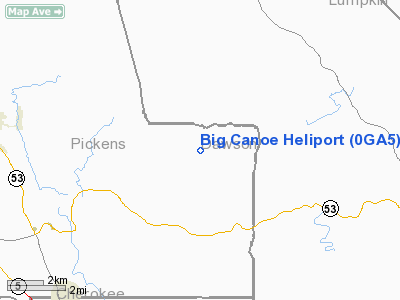
Location
& QuickFacts
|
FAA Information Effective: |
2007-01-18 |
|
Airport
Identifier: |
0GA5 |
|
Airport
Status: |
Operational |
|
Longitude/Latitude: |
084-17-20.7110W/34-27-17.3300N
-84.289086/34.454814 (Estimated) |
|
Elevation: |
1475 ft / 449.58 m (Estimated) |
|
Land: |
0
acres |
|
From
nearest city: |
10 nautical miles E of Jasper, GA |
|
Location: |
Pickens County, GA |
|
Magnetic Variation: |
02W (1985) |
Owner
& Manager
|
Ownership: |
Privately owned |
|
Owner: |
Big Canoe Company |
|
Address: |
Big Canoe, GA 30143 |
|
Manager: |
Big Canoe Company |
|
Address: |
Big Canoe, GA 30143 |
|
Phone number: |
404-522-8437 |
Airport
Operations and Facilities
|
Airport Use: |
Private |
|
Wind indicator: |
No |
|
Segmented Circle: |
No |
|
Control Tower: |
No |
|
Landing fee charge: |
No |
|
Sectional chart: |
Atlanta |
|
Region: |
ASO - Southern |
|
Boundary ARTCC: |
ZTL - Atlanta |
|
Tie-in FSS: |
MCN - Macon |
|
FSS on Airport: |
No |
|
FSS Phone: |
478-784-1155 |
|
FSS Toll Free: |
1-800-WX-BRIEF |
Airport
Communications
|
Unicom: |
122.800
ADDITIONAL UNICOM FREQUENCY: 123.050. |
|
Runway Information
Helipad H1
|
Dimension: |
100 x 100 ft / 30.5 x 30.5 m |
|
Surface: |
TURF, |
|
|
Runway H1 |
Runway |
|
Traffic
Pattern: |
Left |
Left |
|
Radio Navigation
Aids
|
ID |
Type |
Name |
Ch |
Freq |
Var |
Dist |
|
JZP |
NDB |
Pickens County |
|
285.00 |
04W |
8.5 nm |
|
DJD |
NDB |
Canton |
|
415.00 |
04W |
15.7 nm |
|
FKV |
NDB |
Flowery Branch |
|
365.00 |
03W |
24.3 nm |
|
EVZ |
NDB |
Cartersville |
|
308.00 |
04W |
31.5 nm |
|
OUK |
NDB |
Calhoun |
|
323.00 |
02W |
31.8 nm |
|
AJR |
NDB |
Habersham |
|
347.00 |
03W |
36.7 nm |
|
UWI |
NDB |
Whitfield |
|
400.00 |
03W |
38.2 nm |
|
TTQ |
NDB |
Tomotla |
|
335.00 |
01W |
43.0 nm |
|
OYD |
NDB |
Floyd |
|
388.00 |
02W |
44.4 nm |
|
DDA |
NDB |
Commerce |
|
244.00 |
03W |
44.9 nm |
|
FT |
NDB |
Flanc |
|
344.00 |
02W |
45.1 nm |
|
BMW |
NDB |
Barrow County |
|
404.00 |
03W |
46.7 nm |
|
BR |
NDB |
Redan |
|
266.00 |
02W |
48.7 nm |
|
DOB |
TACAN |
Dobbins |
077X |
|
01W |
34.2 nm |
|
PDK |
VOR/DME |
Peachtree |
113X |
116.60 |
02W |
34.8 nm |
|
HRS |
VORTAC |
Harris |
035X |
109.80 |
00E |
34.7 nm |
|
RMG |
VORTAC |
Rome |
101X |
115.40 |
01E |
44.8 nm |
|
ATL |
VOT |
Atlanta Muni |
|
111.00 |
|
48.4 nm |
Remarks
- LIMITED
TO PVT USE; VFR ONLY; PROPONENT COORDINATES USE WITH ATL GADO.
Big Canoe Heliport
Address:
Pickens County, GA
Tel:
404-522-8437
Images
and information placed above are from
http://www.airport-data.com/airport/0GA5/
We
thank them for the data!
| General
Info |
| Country |
United
States |
| State |
GEORGIA
|
| FAA ID |
0GA5
|
| Latitude |
34-27-17.330N
|
| Longitude |
084-17-20.711W
|
| Elevation |
1475 feet
|
| Near City |
JASPER
|
We don't guarantee the information is fresh and accurate. The data may
be wrong or outdated.
For more up-to-date information please refer to other sources.
|
|


