 |
|
Barwick Lafayette Airport |
| Barwick-LaFayette Airport |
| IATA: none â ICAO: none â FAA LID: 9A5 |
| Summary |
| Airport type |
Public |
| Owner |
City of LaFayette |
| Serves |
LaFayette, Georgia |
| Elevation AMSL |
777 ft / 237 m |
| Coordinates |
34°41â²19â³N 085°17â²26â³W / 34.68861°N 85.29056°W / 34.68861; -85.29056 |
| Website |
CityOfLaFayetteGA.org/... |
| Runways |
| Direction |
Length |
Surface |
| ft |
m |
| 2/20 |
5,412 |
1,650 |
Asphalt |
| Statistics (2007) |
| Aircraft operations |
6,925 |
| Source: Federal Aviation Administration |
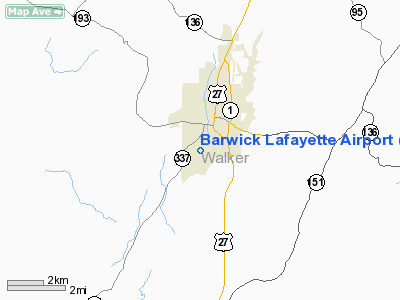
Barwick-LaFayette Airport (FAA LID: 9A5) is a public airport located one mile (2 km) south of the central business district of LaFayette, a city in Walker County, Georgia, United States. It is owned by the City of LaFayette.
Facilities and aircraft
Barwick-LaFayette Airport covers an area of 20 acres (8 ha) which contains one asphalt paved runway (2/20) measuring 5,412 x 50 ft (1,650 x 15 m). For the 12-month period ending March 28, 2007, the airport had 6,925 aircraft operations: 99% general aviation and 1% military.
The above content comes from Wikipedia and is published under free licenses – click here to read more.
Location
& QuickFacts
|
FAA Information Effective: |
2007-01-18 |
|
Airport
Identifier: |
9A5 |
|
Airport
Status: |
Operational |
|
Longitude/Latitude: |
085-17-25.6100W/34-41-18.8270N
-85.290447/34.688563 (Estimated) |
|
Elevation: |
777 ft / 236.83 m (Surveyed) |
|
Land: |
20
acres |
|
From
nearest city: |
1 nautical miles S of Lafayette, GA |
|
Location: |
Walker County, GA |
|
Magnetic Variation: |
02W (1985) |
Owner
& Manager
|
Ownership: |
Publicly owned |
|
Owner: |
City Of Lafayette |
|
Address: |
P.o. Box 89
Lafayette, GA 30728 |
|
Phone number: |
706-638-1272 |
|
Manager: |
Larry Stanfield |
|
Address: |
141 Gasque Dr
Lafayette, GA 30728 |
|
Phone number: |
706-638-7071 |
Airport
Operations and Facilities
|
Airport Use: |
Open to public |
|
Wind
indicator: |
Yes |
|
Segmented
Circle: |
No |
|
Control
Tower: |
No |
|
Lighting
Schedule: |
DUSK-DAWN
MIRL RY 02/20 PRESET MED INTST DUSK-2200; AFTER 2200 ACTVT
- CTAF; ACTVT PAPI RY 02 & 20 - CTAF. |
|
Beacon
Color: |
Clear-Green (lighted land airport) |
|
Landing
fee charge: |
No |
|
Sectional
chart: |
Atlanta |
|
Region: |
ASO - Southern |
|
Boundary
ARTCC: |
ZTL - Atlanta |
|
Tie-in
FSS: |
MCN - Macon |
|
FSS
on Airport: |
No |
|
FSS
Phone: |
478-784-1155 |
|
FSS
Toll Free: |
1-800-WX-BRIEF |
|
NOTAMs
Facility: |
MCN (NOTAM-d service avaliable) |
|
Federal Agreements: |
N |
Airport
Communications
|
CTAF: |
122.800 |
|
Unicom: |
122.800 |
Airport
Services
|
Fuel available: |
100LLA1+ |
|
Airframe Repair: |
MAJOR |
|
Power Plant Repair: |
MAJOR |
|
Bottled
Oxygen: |
NONE |
|
Bulk
Oxygen: |
NONE |
|
Runway Information
Runway 02/20
|
Dimension: |
5412 x 50 ft / 1649.6 x 15.2 m |
|
Surface: |
ASPH, Good Condition |
|
Weight
Limit: |
Single wheel: 20000 lbs. |
|
Edge
Lights: |
Medium |
|
|
Runway 02 |
Runway 20 |
|
Longitude: |
085-17-37.1000W |
085-17-14.1190W |
|
Latitude: |
34-40-53.8000N |
34-41-43.8530N |
|
Elevation: |
769.00
ft |
774.00
ft |
|
Alignment: |
21 |
127 |
|
Traffic
Pattern: |
Left |
Left |
|
Markings: |
Non-precision instrument, Poor Condition
RY MARKING BADLY FADED. |
Non-precision instrument, Poor Condition
RY MARKING BADLY FADED. |
|
Crossing
Height: |
39.00
ft |
38.00
ft |
|
Displaced
threshold: |
0.00 ft |
450.00
ft |
|
VASI: |
2-light PAPI on left side |
2-light PAPI on left side |
|
Visual
Glide Angle: |
3.50° |
3.50° |
|
Obstruction: |
30 ft trees, 200.0 ft from runway, 150 ft right
of centerline
+15' TREES & BRUSH 60 FT OUT & 150 FT RIGHT. |
23 ft rr, 200.0 ft from runway, 165 ft right
of centerline
RY 20 RR TRACKS AT THR 165' R & +20 FT TREES AND BRUSH
90 FT LEFT AT THLD. |
|
Radio Navigation
Aids
|
ID |
Type |
Name |
Ch |
Freq |
Var |
Dist |
|
UWI |
NDB |
Whitfield |
|
400.00 |
03W |
18.1 nm |
|
FTP |
NDB |
Fort Payne |
|
426.00 |
01W |
21.5 nm |
|
OYD |
NDB |
Floyd |
|
388.00 |
02W |
24.3 nm |
|
OUK |
NDB |
Calhoun |
|
323.00 |
02W |
24.9 nm |
|
APT |
NDB |
Jasper |
|
382.00 |
02W |
26.6 nm |
|
CQN |
NDB |
Daisy |
|
341.00 |
02W |
29.5 nm |
|
HDI |
NDB |
Hardwick |
|
369.00 |
01W |
33.8 nm |
|
EVZ |
NDB |
Cartersville |
|
308.00 |
04W |
36.8 nm |
|
UOS |
NDB |
Sewanee |
|
275.00 |
02E |
43.0 nm |
|
JZP |
NDB |
Pickens County |
|
285.00 |
04W |
43.4 nm |
|
DJD |
NDB |
Canton |
|
415.00 |
04W |
47.6 nm |
|
BGF |
NDB |
Boiling Fork |
|
263.00 |
02W |
48.3 nm |
|
GQO |
VORTAC |
Choo Choo |
105X |
115.80 |
01E |
17.7 nm |
|
RMG |
VORTAC |
Rome |
101X |
115.40 |
01E |
32.7 nm |
Remarks
- RR
TRACKS PARALLEL W SIDE OF RWY 115' FROM CNTRLN.
- DEER
ON & INVOF RY & ARPT.
- EXISTED
PRIOR TO 1959.
Based
Aircraft
|
Aircraft
based on field: |
63 |
|
Single
Engine Airplanes: |
59 |
|
Multi
Engine Airplanes: |
4 |
Operational Statistics
Time Period: 2004-08-20
- 2005-08-19
|
Aircraft
Operations: |
125/Week |
|
General
Aviation Local: |
46.2% |
|
General
Aviation Itinerant: |
53.8% |
Barwick Lafayette Airport
Address:
Walker County, GA
Tel:
706-638-1272, 706-638-7071
Images
and information placed above are from
http://www.airport-data.com/airport/9A5/
We
thank them for the data!
| General
Info |
| Country |
United
States |
| State |
GEORGIA
|
| FAA ID |
9A5
|
| Latitude |
34-41-18.827N
|
| Longitude |
085-17-25.610W
|
| Elevation |
777 feet
|
| Near City |
LAFAYETTE
|
We don't guarantee the information is fresh and accurate. The data may
be wrong or outdated.
For more up-to-date information please refer to other sources.
|
|


