 |
|
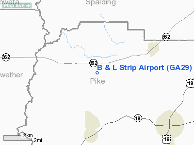
Location
& QuickFacts
|
FAA Information Effective: |
2007-01-18 |
|
Airport
Identifier: |
GA29 |
|
Airport
Status: |
Operational |
|
Longitude/Latitude: |
084-25-51.7260W/33-09-22.4400N
-84.431035/33.156233 (Estimated) |
|
Elevation: |
843 ft / 256.95 m (Estimated) |
|
Land: |
0
acres |
|
From
nearest city: |
2 nautical miles SE of Hollonville, GA |
|
Location: |
Pike County, GA |
|
Magnetic Variation: |
02W (1985) |
Owner
& Manager
|
Ownership: |
Privately owned |
|
Owner: |
Loyd J. Cox |
|
Address: |
685 Turner Rd
Williamson, GA 30292 |
|
Phone number: |
770-228-9367 |
|
Manager: |
Loyd J. Cox |
|
Address: |
685 Turner Rd
Williamson, GA 30292 |
|
Phone number: |
770-228-9367 |
Airport
Operations and Facilities
|
Airport Use: |
Private |
|
Segmented Circle: |
No |
|
Control Tower: |
No |
|
Landing fee charge: |
No |
|
Sectional chart: |
Atlanta |
|
Region: |
ASO - Southern |
|
Boundary ARTCC: |
ZTL - Atlanta |
|
Tie-in FSS: |
MCN - Macon |
|
FSS Phone: |
478-784-1155 |
|
FSS Toll Free: |
1-800-WX-BRIEF |
Airport
Services
|
Airframe Repair: |
NONE |
|
Power Plant Repair: |
NONE |
|
Bottled
Oxygen: |
NONE |
|
Bulk
Oxygen: |
NONE |
|
Runway Information
Runway 07/25
|
Dimension: |
1650 x 100 ft / 502.9 x 30.5 m |
|
Surface: |
TURF, |
|
|
Runway 07 |
Runway 25 |
|
Traffic
Pattern: |
Left |
Left |
|
Runway
End Identifier: |
No |
No |
|
Centerline
Lights: |
No |
No |
|
Touchdown
Lights: |
No |
No |
|
Radio Navigation
Aids
|
ID |
Type |
Name |
Ch |
Freq |
Var |
Dist |
|
FF |
NDB |
Pecat |
|
316.00 |
02W |
9.1 nm |
|
JHH |
NDB |
Griffin |
|
412.00 |
04W |
10.4 nm |
|
EQQ |
NDB |
Coweta County |
|
234.00 |
03W |
15.4 nm |
|
OP |
NDB |
Yates |
|
339.00 |
03W |
18.8 nm |
|
PIM |
NDB |
Pine Mountain |
|
272.00 |
03W |
29.2 nm |
|
BR |
NDB |
Redan |
|
266.00 |
02W |
30.0 nm |
|
FT |
NDB |
Flanc |
|
344.00 |
02W |
37.9 nm |
|
GPQ |
NDB |
Carrollton |
|
278.00 |
02W |
42.9 nm |
|
VOF |
NDB |
Alcovy |
|
370.00 |
03W |
43.3 nm |
|
JNM |
NDB |
Monroe |
|
392.00 |
03W |
49.7 nm |
|
DOB |
TACAN |
Dobbins |
077X |
|
01W |
45.7 nm |
|
PDK |
VOR/DME |
Peachtree |
113X |
116.60 |
02W |
43.7 nm |
|
ATL |
VORTAC |
Atlanta |
116X |
116.90 |
00W |
28.4 nm |
|
LGC |
VORTAC |
Lagrange |
103X |
115.60 |
01E |
39.6 nm |
|
CSG |
VORTAC |
Columbus |
118X |
117.10 |
01E |
44.0 nm |
|
MCN |
VORTAC |
Macon |
089X |
114.20 |
01E |
48.4 nm |
|
ATL |
VOT |
Atlanta Muni |
|
111.00 |
|
30.2 nm |
Remarks
- PVT
USE VFR ONLY; OPNS AGRMT MAINTD WITH SHADE TREE ARPT.
B And L Strip Airport
Address:
Pike County, GA
Tel:
770-228-9367
Images
and information placed above are from
http://www.airport-data.com/airport/GA29/
We
thank them for the data!
| General
Info |
| Country |
United
States |
| State |
GEORGIA
|
| FAA ID |
GA29
|
| Latitude |
33-09-22.440N
|
| Longitude |
084-25-51.726W
|
| Elevation |
843 feet
|
| Near City |
HOLLONVILLE
|
We don't guarantee the information is fresh and accurate. The data may
be wrong or outdated.
For more up-to-date information please refer to other sources.
|
|


