 |
|
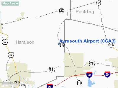
Location
& QuickFacts
|
FAA Information Effective: |
2007-01-18 |
|
Airport
Identifier: |
0GA3 |
|
Airport
Status: |
Operational |
|
Longitude/Latitude: |
085-03-38.8050W/33-46-12.3810N
-85.060779/33.770106 (Estimated) |
|
Elevation: |
1287 ft / 392.28 m (Estimated) |
|
Land: |
0
acres |
|
From
nearest city: |
3 nautical miles NW of Temple, GA |
|
Location: |
Haralson County, GA |
|
Magnetic Variation: |
01W (1985) |
Owner
& Manager
|
Ownership: |
Privately owned |
|
Owner: |
Steven D. Ayres |
|
Address: |
3132 Bankhead Hwy
Lithia Springs, GA 30057 |
|
Phone
number: |
404-819-1035 |
|
Manager: |
Steven D. Ayres |
|
Address: |
3600 Bankhead Hwy
Lithia Sprins, GA 30057 |
|
Phone number: |
404-920-2281 |
Airport
Operations and Facilities
|
Airport Use: |
Private |
|
Wind
indicator: |
Yes |
|
Segmented
Circle: |
No |
|
Control
Tower: |
No |
|
Sectional
chart: |
Atlanta |
|
Region: |
ASO - Southern |
|
Boundary
ARTCC: |
ZTL - Atlanta |
|
Tie-in
FSS: |
MCN - Macon |
|
FSS
Phone: |
478-784-1155 |
|
FSS
Toll Free: |
1-800-WX-BRIEF |
|
Runway Information
Runway 18/36
|
Dimension: |
2000 x 100 ft / 609.6 x 30.5 m |
|
Surface: |
TURF, |
|
|
Runway 18 |
Runway 36 |
|
Traffic
Pattern: |
Left |
Left |
|
Radio Navigation
Aids
|
ID |
Type |
Name |
Ch |
Freq |
Var |
Dist |
|
GPQ |
NDB |
Carrollton |
|
278.00 |
02W |
12.8 nm |
|
FT |
NDB |
Flanc |
|
344.00 |
02W |
21.1 nm |
|
EVZ |
NDB |
Cartersville |
|
308.00 |
04W |
28.0 nm |
|
OYD |
NDB |
Floyd |
|
388.00 |
02W |
32.2 nm |
|
EQQ |
NDB |
Coweta County |
|
234.00 |
03W |
35.4 nm |
|
BR |
NDB |
Redan |
|
266.00 |
02W |
38.2 nm |
|
OUK |
NDB |
Calhoun |
|
323.00 |
02W |
38.5 nm |
|
FF |
NDB |
Pecat |
|
316.00 |
02W |
40.3 nm |
|
DJD |
NDB |
Canton |
|
415.00 |
04W |
40.7 nm |
|
DOB |
TACAN |
Dobbins |
077X |
|
01W |
29.0 nm |
|
PDK |
VOR/DME |
Peachtree |
113X |
116.60 |
02W |
38.6 nm |
|
RMG |
VORTAC |
Rome |
101X |
115.40 |
01E |
23.8 nm |
|
ATL |
VORTAC |
Atlanta |
116X |
116.90 |
00W |
32.4 nm |
|
LGC |
VORTAC |
Lagrange |
103X |
115.60 |
01E |
43.9 nm |
|
ATL |
VOT |
Atlanta Muni |
|
111.00 |
|
32.5 nm |
Remarks
Ayresouth Airport
Address:
Haralson County, GA
Tel:
404-819-1035,
404-920-2281
Images
and information placed above are from
http://www.airport-data.com/airport/0GA3/
We
thank them for the data!
| General
Info |
| Country |
United
States |
| State |
GEORGIA
|
| FAA ID |
0GA3
|
| Latitude |
33-46-12.381N
|
| Longitude |
085-03-38.805W
|
| Elevation |
1287 feet
|
| Near City |
TEMPLE
|
We don't guarantee the information is fresh and accurate. The data may
be wrong or outdated.
For more up-to-date information please refer to other sources.
|
|


