 |
|
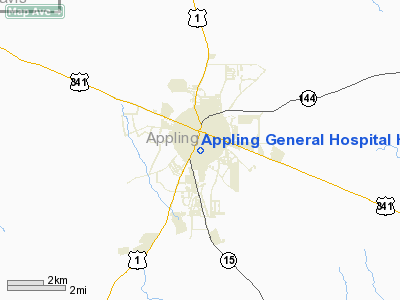
Appling General Hospital Heliport |
Location
& QuickFacts
|
FAA Information Effective: |
2007-01-18 |
|
Airport
Identifier: |
GA78 |
|
Airport
Status: |
Operational |
|
Longitude/Latitude: |
082-20-54.4630W/31-46-07.7050N
-82.348462/31.768807 (Estimated) |
|
Elevation: |
250 ft / 76.20 m (Estimated) |
|
Land: |
0
acres |
|
From
nearest city: |
1 nautical miles SE of Baxley, GA |
|
Location: |
Appling County, GA |
|
Magnetic Variation: |
03W (1990) |
Owner
& Manager
|
Ownership: |
Publicly owned |
|
Owner: |
Appling General Hospital |
|
Address: |
163 E. Tollison Street
Baxley, GA 31513 |
|
Phone
number: |
912-367-9841 |
|
Manager: |
Appling General Hospital |
|
Address: |
163 E. Tollison Street
Baxley, GA 31513 |
|
Phone number: |
912-367-9841 |
Airport
Operations and Facilities
|
Airport Use: |
Private
MEDICAL USE. |
|
Wind
indicator: |
Yes |
|
Segmented
Circle: |
No |
|
Control
Tower: |
No |
|
Sectional
chart: |
Jacksonville |
|
Region: |
ASO - Southern |
|
Boundary
ARTCC: |
ZJX - Jacksonville |
|
Tie-in
FSS: |
MCN - Macon |
|
FSS
on Airport: |
No |
|
FSS
Phone: |
478-784-1155 |
|
FSS
Toll Free: |
1-800-WX-BRIEF |
|
Runway Information
Helipad H1
|
Dimension: |
40 x 40 ft / 12.2 x 12.2 m |
|
Surface: |
CONC, |
|
|
Runway H1 |
Runway |
|
Traffic
Pattern: |
Left |
Left |
|
Radio Navigation
Aids
|
ID |
Type |
Name |
Ch |
Freq |
Var |
Dist |
|
BHC |
NDB |
Baxley |
|
376.00 |
04W |
4.0 nm |
|
AZE |
NDB |
Hazlehurst |
|
414.00 |
03W |
16.7 nm |
|
RVJ |
NDB |
Prison |
|
424.00 |
03W |
20.0 nm |
|
JES |
NDB |
Slover |
|
340.00 |
04W |
26.9 nm |
|
UQN |
NDB |
Onyun |
|
372.00 |
04W |
27.4 nm |
|
MQW |
NDB |
Mc Rae |
|
280.00 |
03W |
33.6 nm |
|
CWV |
NDB |
Claxton |
|
395.50 |
04W |
35.1 nm |
|
OWC |
NDB |
Coffee County |
|
390.00 |
03W |
36.7 nm |
|
MHP |
NDB |
Metter |
|
432.00 |
03W |
38.7 nm |
|
MOQ |
NDB |
Mc Intosh |
|
263.00 |
04W |
43.0 nm |
|
EZM |
NDB |
Eastman |
|
366.00 |
04W |
46.6 nm |
|
HOE |
NDB |
Homerville |
|
209.00 |
03W |
48.1 nm |
|
SUR |
NDB |
Fitzgerald |
|
362.00 |
03W |
49.1 nm |
|
AMG |
VORTAC |
Alma |
098X |
115.10 |
00E |
16.2 nm |
|
AYS |
VORTAC |
Waycross |
039X |
110.20 |
00E |
31.9 nm |
Remarks
- PRVDD
VFR/PR USE; APCH/DEP RTES OPS FROM 40-80 DEGS; FROM 180-230 DEGS; &
FROM 280-320 DEGS; TKOF/LNDG ARE MKD; WIND INDICATOR MNTND.
Based
Aircraft
|
Aircraft
based on field: |
3 |
|
Helicopters: |
3 |
Appling General Hospital Heliport
Address:
Appling County, GA
Tel:
912-367-9841
Images
and information placed above are from
http://www.airport-data.com/airport/GA78/
We
thank them for the data!
| General
Info |
| Country |
United
States |
| State |
GEORGIA
|
| FAA ID |
GA78
|
| Latitude |
31-46-07.705N
|
| Longitude |
082-20-54.463W
|
| Elevation |
250 feet
|
| Near City |
BAXLEY
|
We don't guarantee the information is fresh and accurate. The data may
be wrong or outdated.
For more up-to-date information please refer to other sources.
|
|


