 |
|
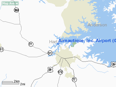
Airnautique Incorporated Airport |
Location
& QuickFacts
|
FAA Information Effective: |
2007-01-18 |
|
Airport
Identifier: |
0GA2 |
|
Airport
Status: |
Operational |
|
Longitude/Latitude: |
082-56-44.5160W/34-22-40.3750N
-82.945699/34.377882 (Estimated) |
|
Elevation: |
720 ft / 219.46 m (Estimated) |
|
Land: |
0
acres |
|
From
nearest city: |
2 nautical miles N of Hartwell, GA |
|
Location: |
Hart County, GA |
|
Magnetic Variation: |
03W (1985) |
Owner
& Manager
|
Ownership: |
Privately owned |
|
Owner: |
Jane Holmes |
|
Address: |
222 West Howell St
Hartwell, GA 30643 |
|
Phone number: |
706-376-9385
ADDL PHONE 706-376-8433. |
|
Address: |
|
Airport
Operations and Facilities
|
Airport Use: |
Private |
|
Wind indicator: |
Yes |
|
Segmented Circle: |
No |
|
Control Tower: |
No |
|
Landing fee charge: |
Yes |
|
Sectional chart: |
Atlanta |
|
Region: |
ASO - Southern |
|
Boundary ARTCC: |
ZTL - Atlanta |
|
Tie-in FSS: |
MCN - Macon |
|
FSS on Airport: |
No |
|
FSS Phone: |
478-784-1155 |
|
FSS Toll Free: |
1-800-WX-BRIEF |
Airport
Services
|
Airframe Repair: |
NONE |
|
Power Plant Repair: |
NONE |
|
Runway Information
Runway 08/26
|
Dimension: |
2600 x 60 ft / 792.5 x 18.3 m |
|
Surface: |
TURF, |
|
Edge
Lights: |
Low |
|
|
Runway 08 |
Runway 26 |
|
Traffic
Pattern: |
Left |
Left |
|
Radio Navigation
Aids
|
ID |
Type |
Name |
Ch |
Freq |
Var |
Dist |
|
AND |
NDB |
Anderson County |
|
230.00 |
04W |
13.8 nm |
|
CEU |
NDB |
Clemson |
|
257.00 |
05W |
18.0 nm |
|
LQK |
NDB |
Lake Keowee |
|
408.00 |
04W |
28.7 nm |
|
BJT |
NDB |
Bulldog |
|
221.00 |
03W |
29.0 nm |
|
AJR |
NDB |
Habersham |
|
347.00 |
03W |
30.9 nm |
|
GY |
NDB |
Dyana |
|
338.00 |
03W |
31.2 nm |
|
DDA |
NDB |
Commerce |
|
244.00 |
03W |
34.3 nm |
|
IIY |
NDB |
Washington/wilkes County |
|
435.00 |
03W |
36.8 nm |
|
BMW |
NDB |
Barrow County |
|
404.00 |
03W |
41.6 nm |
|
GIW |
NDB |
Coronaca |
|
239.00 |
04W |
43.3 nm |
|
VV |
NDB |
Junne |
|
353.00 |
05W |
44.1 nm |
|
FKV |
NDB |
Flowery Branch |
|
365.00 |
03W |
48.8 nm |
|
LUX |
NDB |
Laurens |
|
307.00 |
04W |
50.0 nm |
|
ELW |
VORTAC |
Electric City |
023X |
108.60 |
00E |
8.4 nm |
|
ODF |
VORTAC |
Foothills |
081X |
113.40 |
00E |
25.9 nm |
|
AHN |
VORTAC |
Athens |
33 |
109.60 |
00E |
32.0 nm |
|
GRD |
VORTAC |
Greenwood |
102X |
115.50 |
01W |
40.0 nm |
Remarks
Based
Aircraft
|
Aircraft
based on field: |
3 |
|
Single
Engine Airplanes: |
3 |
Airnautique Incorporated Airport
Address:
Hart County, GA
Tel:
706-376-9385
Images
and information placed above are from
http://www.airport-data.com/airport/0GA2/
We
thank them for the data!
| General
Info |
| Country |
United
States |
| State |
GEORGIA
|
| FAA ID |
0GA2
|
| Latitude |
34-22-40.375N
|
| Longitude |
082-56-44.516W
|
| Elevation |
720 feet
|
| Near City |
HARTWELL
|
We don't guarantee the information is fresh and accurate. The data may
be wrong or outdated.
For more up-to-date information please refer to other sources.
|
|


