 |
|
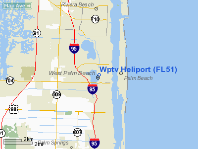
Location
& QuickFacts
|
FAA Information Effective: |
2007-01-18 |
|
Airport
Identifier: |
FL51 |
|
Airport
Status: |
Operational |
|
Longitude/Latitude: |
080-03-51.0000W/26-42-50.0000N
-80.064167/26.713889 (Estimated) |
|
Elevation: |
33
ft / 10.06 m (Estimated) |
|
Land: |
0
acres |
|
From
nearest city: |
0 nautical miles S of West Palm Beach, FL |
|
Location: |
Palm Beach County, FL |
|
Magnetic Variation: |
05W (2000) |
Owner
& Manager
|
Ownership: |
Privately owned |
|
Owner: |
Wptv |
|
Address: |
1100 Banyan Blvd
West Palm Beach, FL 33401 |
|
Phone
number: |
561-655-5455 |
|
Manager: |
David Mc Kinley |
|
Address: |
1100 Banyan Blvd
West Palm Beach, FL 33401 |
|
Phone number: |
561-653-5650 |
Airport
Operations and Facilities
|
Airport Use: |
Private |
|
Wind
indicator: |
Yes |
|
Segmented
Circle: |
No |
|
Control
Tower: |
No |
|
Sectional
chart: |
Miami |
|
Region: |
ASO - Southern |
|
Boundary
ARTCC: |
ZMA - Miami |
|
Tie-in
FSS: |
MIA - Miami |
|
FSS
Phone: |
305-233-2600 |
|
FSS
Toll Free: |
1-800-WX-BRIEF |
|
Runway Information
Helipad H1
|
Dimension: |
40 x 40 ft / 12.2 x 12.2 m |
|
Surface: |
ASPH, |
|
|
Runway H1 |
Runway |
|
Traffic
Pattern: |
Left |
Left |
|
Radio Navigation
Aids
|
ID |
Type |
Name |
Ch |
Freq |
Var |
Dist |
|
PB |
NDB |
Rubin |
|
356.00 |
03W |
8.0 nm |
|
UTX |
NDB |
United |
|
405.00 |
03W |
18.7 nm |
|
FX |
NDB |
Praiz |
|
221.00 |
02W |
34.2 nm |
|
PJN |
NDB |
Plantation |
|
242.00 |
03W |
35.9 nm |
|
FPR |
NDB |
Fort Pierce |
|
275.00 |
04W |
49.3 nm |
|
FLL |
VOR/DME |
Fort Lauderdale |
091X |
114.40 |
00E |
38.7 nm |
|
PBI |
VORTAC |
Palm Beach |
104X |
115.70 |
03W |
2.4 nm |
|
PHK |
VORTAC |
Pahokee |
101X |
115.40 |
00E |
33.9 nm |
|
PBI |
VOT |
Palm Beach |
|
109.00 |
|
2.7 nm |
Remarks
- PRVDD
VFR OPNS, PVT USE, ALL APCH/DEP FROM 250-330 DEGS, AREA MKD, WIND INDICATOR
MAINTAINED, EXECUTE LOA WITH GOOD SAMARITAN MEDICAL CENTER, PALM BEACH
JUDICIAL CENTER, WEST PALM BEACH POLICE & PALM BEACH INTL ATCT.
Wptv Heliport
Address:
Palm Beach County, FL
Tel:
561-655-5455,
561-653-5650
Images
and information placed above are from
http://www.airport-data.com/airport/FL51/
We
thank them for the data!
| General
Info |
| Country |
United
States |
| State |
FLORIDA
|
| FAA ID |
FL51
|
| Latitude |
26-42-50.000N
|
| Longitude |
080-03-51.000W
|
| Elevation |
33 feet
|
| Near City |
WEST PALM
BEACH |
We don't guarantee the information is fresh and accurate. The data may
be wrong or outdated.
For more up-to-date information please refer to other sources.
|
|


