 |
|
|
|
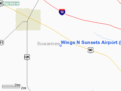
Location
& QuickFacts
|
FAA Information Effective: |
2007-01-18 |
|
Airport
Identifier: |
FL07 |
|
Airport
Status: |
Operational |
|
Longitude/Latitude: |
082-55-26.4650W/30-15-00.8120N
-82.924018/30.250226 (Estimated) |
|
Elevation: |
130 ft / 39.62 m (Estimated) |
|
Land: |
17
acres |
|
From
nearest city: |
4 nautical miles SE of Live Oak, FL |
|
Location: |
Suwannee County, FL |
|
Magnetic Variation: |
02W (1985) |
Owner
& Manager
|
Ownership: |
Privately owned |
|
Owner: |
Roger Johnston |
|
Address: |
11020 89th Road
Live Oak, FL 32060 |
|
Phone
number: |
904-330-2007 |
|
Manager: |
Roger Johnston |
|
Address: |
11020 89th Road
Live Oak, FL 32060 |
|
Phone number: |
904-330-2007 |
Airport
Operations and Facilities
|
Airport Use: |
Private |
|
Wind indicator: |
Yes |
|
Segmented Circle: |
No |
|
Control Tower: |
No |
|
Landing fee charge: |
No |
|
Sectional chart: |
Jacksonville |
|
Region: |
ASO - Southern |
|
Boundary ARTCC: |
ZJX - Jacksonville |
|
Tie-in FSS: |
GNV - Gainesville |
|
FSS on Airport: |
No |
|
FSS Phone: |
850-377-3291 |
|
FSS Toll Free: |
1-800-WX-BRIEF |
Airport
Services
|
Airframe Repair: |
NONE |
|
Power Plant Repair: |
NONE |
|
Runway Information
Runway 10/28
|
Dimension: |
2163 x 100 ft / 659.3 x 30.5 m |
|
Surface: |
TURF, |
|
|
Runway 10 |
Runway 28 |
|
Traffic
Pattern: |
Left |
Left |
|
Obstruction: |
4
ft fence |
40 ft trees, 200.0 ft from runway |
|
Radio Navigation
Aids
|
ID |
Type |
Name |
Ch |
Freq |
Var |
Dist |
|
LCQ |
NDB |
Lake City |
|
204.00 |
03W |
18.4 nm |
|
FPY |
NDB |
Foley |
|
254.00 |
03W |
37.7 nm |
|
HOE |
NDB |
Homerville |
|
209.00 |
03W |
49.0 nm |
|
OTK |
VOR/DME |
Valdosta |
095X |
114.80 |
02W |
36.8 nm |
|
TAY |
VORTAC |
Taylor |
076X |
112.90 |
03W |
24.6 nm |
|
CTY |
VORTAC |
Cross City |
057X |
112.00 |
02W |
39.7 nm |
|
VAD |
VORTAC |
Moody |
080X |
113.30 |
03W |
44.9 nm |
|
GNV |
VORTAC |
Gators |
109X |
116.20 |
04W |
47.7 nm |
|
GEF |
VORTAC |
Greenville |
027X |
109.00 |
01E |
48.1 nm |
Remarks
Based
Aircraft
|
Aircraft
based on field: |
1 |
|
Single
Engine Airplanes: |
1 |
Wings N Sunsets Airport
Address:
Suwannee County, FL
Tel:
904-330-2007
Images
and information placed above are from
http://www.airport-data.com/airport/FL07/
We
thank them for the data!
| General
Info |
| Country |
United
States |
| State |
FLORIDA
|
| FAA ID |
FL07
|
| Latitude |
30-15-00.812N
|
| Longitude |
082-55-26.465W
|
| Elevation |
130 feet
|
| Near City |
LIVE OAK
|
We don't guarantee the information is fresh and accurate. The data may
be wrong or outdated.
For more up-to-date information please refer to other sources.
|
|


