 |
|
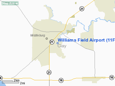
Location
& QuickFacts
|
FAA Information Effective: |
2007-01-18 |
|
Airport
Identifier: |
11FL |
|
Airport
Status: |
Closed Indefinitely |
|
Longitude/Latitude: |
081-52-51.3610W/30-02-34.8640N
-81.880934/30.043018 (Estimated) |
|
Elevation: |
88
ft / 26.82 m (Surveyed) |
|
Land: |
10
acres |
|
From
nearest city: |
2 nautical miles S of Middleburg, FL |
|
Location: |
Clay County, FL |
|
Magnetic Variation: |
03W (1985) |
Owner
& Manager
|
Ownership: |
Privately owned |
|
Owner: |
Walter Williams & Son, Inc |
|
Address: |
4273 Blueberry Street
Middleburg, FL 32068 |
|
Phone number: |
904-282-5552 |
|
Manager: |
Walter Williams |
|
Address: |
4273 Blueberry Street
Middleburg, FL 32068 |
|
Phone number: |
904-282-5552 |
Airport
Operations and Facilities
|
Airport Use: |
Private |
|
Wind
indicator: |
Yes |
|
Segmented
Circle: |
No |
|
Control
Tower: |
No |
|
Landing
fee charge: |
No |
|
Sectional
chart: |
Jacksonville |
|
Region: |
ASO - Southern |
|
Boundary
ARTCC: |
ZJX - Jacksonville |
|
Tie-in
FSS: |
GNV - Gainesville |
|
FSS
on Airport: |
No |
|
FSS
Phone: |
850-377-3291 |
|
FSS
Toll Free: |
1-800-WX-BRIEF |
|
Runway Information
Runway 18/36
|
Dimension: |
3000 x 200 ft / 914.4 x 61.0 m |
|
Surface: |
TURF, |
|
|
Runway 18 |
Runway 36 |
|
Traffic
Pattern: |
Left |
Left |
|
Displaced
threshold: |
1000.00
ft |
0.00 ft |
|
Obstruction: |
60
ft trees |
|
|
Radio Navigation
Aids
|
ID |
Type |
Name |
Ch |
Freq |
Var |
Dist |
|
HEG |
NDB |
Herlong |
|
332.00 |
02W |
14.5 nm |
|
IAK |
NDB |
Palatka |
|
243.00 |
05W |
23.7 nm |
|
JA |
NDB |
Dinns |
|
344.00 |
03W |
25.7 nm |
|
EYA |
NDB |
Eastport |
|
357.00 |
03W |
26.9 nm |
|
GN |
NDB |
Wynds |
|
269.00 |
04W |
27.1 nm |
|
LCQ |
NDB |
Lake City |
|
204.00 |
03W |
37.3 nm |
|
NZC |
TACAN |
Cecil/dcmsnd |
088X |
|
04W |
10.7 nm |
|
NIP |
TACAN |
Jacksonville |
19X |
|
04W |
15.7 nm |
|
NRB |
TACAN |
Mayport |
051X |
|
03W |
31.6 nm |
|
VQQ |
VOR |
Cecil |
|
117.90 |
03W |
10.2 nm |
|
SGJ |
VOR/DME |
St Augustine |
031X |
109.40 |
06W |
29.1 nm |
|
CRG |
VORTAC |
Craig |
092X |
114.50 |
03W |
26.2 nm |
|
GNV |
VORTAC |
Gators |
109X |
116.20 |
04W |
29.4 nm |
|
TAY |
VORTAC |
Taylor |
076X |
112.90 |
03W |
44.6 nm |
|
JAX |
VOT |
Jacksonville Intl |
|
111.00 |
|
28.8 nm |
Remarks
- (ARPT
STATUS) ARPT CLSD INDEFLY.
- VFR,
PVT USE; INGRESS/EGRESS TO/FROM THIS ARPT BE LMTD TO SOUTHERN SEMICIRCLE
AS MUCH AS PSBL DUE TO NAVY ACFT IBND TO NAS CECIL FLD.
Based
Aircraft
|
Aircraft
based on field: |
10 |
|
Single
Engine Airplanes: |
10 |
Williams Field Airport
Address:
Clay County, FL
Tel:
904-282-5552
Images
and information placed above are from
http://www.airport-data.com/airport/11FL/
We
thank them for the data!
| General
Info |
| Country |
United
States |
| State |
FLORIDA
|
| FAA ID |
11FL
|
| Latitude |
30-02-34.864N
|
| Longitude |
081-52-51.361W
|
| Elevation |
50 feet
|
| Near City |
MIDDLEBURG
|
We don't guarantee the information is fresh and accurate. The data may
be wrong or outdated.
For more up-to-date information please refer to other sources.
|
|


