 |
|
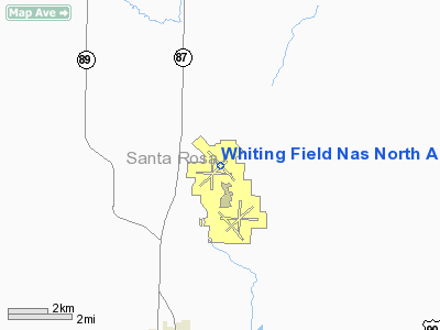
Whiting Field Naval Air Station North Airport |
Coordinates: 30°43′27″N 087°01′19″W / 30.72417°N 87.02194°W / 30.72417; -87.02194
| NAS Whiting Field - North |
| IATA: NSE – ICAO: KNSE – FAA LID: NSE |
| Summary |
| Airport type |
Military: Naval Air Station |
| Operator |
United States Navy |
| Location |
Santa Rosa County, near Milton, Florida |
| Elevation AMSL |
199 ft / 61 m |
| Website |
wwwcfs.cnet.navy.mil/... |
| Runways |
| Direction |
Length |
Surface |
| ft |
m |
| 5/23 |
6,000 |
1,829 |
Asphalt |
| 14/32 |
6,000 |
1,829 |
Asphalt |
| Sources: FAA master record, diagram |
NAS Whiting Field - North (IATA: NSE, ICAO: KNSE), also known as North Whiting Field, is located four miles (6 km) north of the central business district of Milton, a city in Santa Rosa County, Florida, United States. It is one of two airfields located at Naval Air Station Whiting Field, the other airfield being NAS Whiting Field - South. Facilities
Whiting Field NAS North has two asphalt paved runways:
- Runway 5/23: 6,000 x 200 ft (1,829 x 61 m)
- Runway 14/32: 6,000 x 200 ft (1,829 x 61 m)
The above content comes from Wikipedia and is published under free licenses – click here to read more.
Location
& QuickFacts
|
FAA Information Effective: |
2007-01-18 |
|
Airport
Identifier: |
NSE |
|
Airport
Status: |
Operational |
|
Longitude/Latitude: |
087-01-19.0000W/30-43-27.0000N
-87.021944/30.724167 (Estimated) |
|
Elevation: |
199 ft / 60.66 m (Estimated) |
|
Land: |
0
acres |
|
From
nearest city: |
4 nautical miles N of Milton, FL |
|
Location: |
Santa Rosa County, FL |
|
Magnetic Variation: |
01E (1985) |
Owner
& Manager
|
Ownership: |
Navy owned |
|
Owner: |
Us Navy |
|
Address: |
Oceanographic Ofc-code 3142
Washington, DC 20373 |
|
Manager: |
Commanding Officer |
|
Address: |
Naval Air Station Whiting Fld
Milton, FL 32570 |
Airport
Operations and Facilities
|
Airport Use: |
Private |
|
Segmented
Circle: |
No |
|
Control
Tower: |
Yes |
|
Lighting
Schedule: |
DUSK-DAWN |
|
Beacon
Color: |
Split-Clear-Green (lighted military airport) |
|
Sectional
chart: |
New Orleans |
|
Region: |
ASO - Southern |
|
Boundary
ARTCC: |
ZJX - Jacksonville |
|
Tie-in
FSS: |
GNV - Gainesville
FSS-GAINESVILLE GNV-DL-NOTAM PNS |
|
FSS
on Airport: |
No |
|
FSS
Phone: |
850-377-3291 |
|
FSS
Toll Free: |
1-800-WX-BRIEF |
|
NOTAMs
Facility: |
NSE (NOTAM-d service avaliable) |
Airport
Services
|
Fuel available: |
100LL |
|
Airframe Repair: |
NONE |
|
Power Plant Repair: |
NONE |
|
Bottled
Oxygen: |
NONE |
|
Bulk
Oxygen: |
NONE |
|
Runway Information
Runway 05/23
|
Dimension: |
6000 x 200 ft / 1828.8 x 61.0 m |
|
Surface: |
ASPH, |
|
Pavement
Class: |
31 /F/A/W/T |
|
Edge
Lights: |
High |
|
|
Runway 05 |
Runway 23 |
|
Traffic
Pattern: |
Left |
Left |
|
VASI: |
4-light PAPI on left side |
4-light PAPI on left side |
|
Runway 09/27
|
Dimension: |
6000 x 200 ft / 1828.8 x 61.0 m |
|
Surface: |
ASPH, |
|
|
Runway 09 |
Runway 27 |
|
Traffic
Pattern: |
Left |
Left |
|
Runway 14/32
|
Dimension: |
6000 x 200 ft / 1828.8 x 61.0 m |
|
Surface: |
ASPH, |
|
Pavement
Class: |
23 /F/A/W/T |
|
Edge
Lights: |
High |
|
|
Runway 14 |
Runway 32 |
|
Traffic
Pattern: |
Left |
Left |
|
VASI: |
4-light PAPI on left side |
4-light PAPI on left side |
|
Approach
lights: |
ALSF1 |
|
|
Runway 18/36
|
Dimension: |
6000 x 200 ft / 1828.8 x 61.0 m |
|
Surface: |
ASPH, |
|
|
Runway 18 |
Runway 36 |
|
Traffic
Pattern: |
Left |
Left |
|
Radio Navigation
Aids
|
ID |
Type |
Name |
Ch |
Freq |
Var |
Dist |
|
PKZ |
NDB |
Pickens |
|
326.00 |
01E |
19.1 nm |
|
DTS |
NDB |
Destin |
|
254.00 |
01W |
34.2 nm |
|
ESU |
NDB |
Summerdale |
|
204.00 |
01E |
38.8 nm |
|
JUY |
NDB |
Judd |
|
264.00 |
02W |
47.7 nm |
|
NSE |
TACAN |
Whiting |
070X |
|
01E |
0.2 nm |
|
NGS |
TACAN |
Santa Rosa |
063X |
|
01E |
7.9 nm |
|
HRT |
TACAN |
Hurlburt |
045X |
|
00E |
24.7 nm |
|
NPA |
TACAN |
Pensacola |
119X |
|
01E |
26.8 nm |
|
DWG |
TACAN |
Warrington |
002X |
|
00E |
29.8 nm |
|
NUN |
VOR |
Saufley |
|
108.80 |
01E |
22.2 nm |
|
UIA |
VOR |
Andalusia |
|
110.20 |
00E |
47.9 nm |
|
CEW |
VORTAC |
Crestview |
106X |
115.90 |
03E |
18.7 nm |
|
MVC |
VORTAC |
Monroeville |
115X |
116.80 |
04E |
47.4 nm |
Remarks
- RSTD:
PPR FOR PRACTICE INST APCH BY TRAN ACFT. ALL TRAN ACFT LDG WHITING FLD
S UNLESS OTHERWISE ARNG WITH OPS OFFICER. (SEE
WHITING FLD NAS-S) 24 HR NTC FOR PPR.
- CAUTION:
EXTREMELY HVY PRIM TRNG OPR ALL TIMES. PONDING OCCURS AFTER MODERATE
TO HVY RAIN - BA POOR.
- MISC
CLASS C AIRSPACE EFFECTIVE 1300-0500Z++ MON-THU, 1300-2300Z++ FRI, 2030-0230++
SUN, CLSD SAT AND HOL, OT CLASS E ABV 700' AGL
Whiting Field Naval Air Station North
Airport
Address:
Santa Rosa County, FL
Tel:
Images
and information placed above are from
http://www.airport-data.com/airport/NSE/
We
thank them for the data!
| General
Info |
| Country |
United
States |
| State |
FLORIDA
|
| FAA ID |
NSE
|
| Latitude |
30-43-26.684N
|
| Longitude |
087-01-18.875W
|
| Elevation |
200 feet
|
| Near City |
MILTON
|
We don't guarantee the information is fresh and accurate. The data may
be wrong or outdated.
For more up-to-date information please refer to other sources.
|
|


