 |
|
|
|
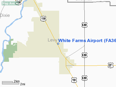
Location
& QuickFacts
|
FAA Information Effective: |
2007-01-18 |
|
Airport
Identifier: |
FA36 |
|
Airport
Status: |
Operational |
|
Longitude/Latitude: |
082-52-29.4350W/29-30-45.8590N
-82.874843/29.512739 (Estimated) |
|
Elevation: |
46
ft / 14.02 m (Estimated) |
|
Land: |
0
acres |
|
From
nearest city: |
3 nautical miles N of Chiefland, FL |
|
Location: |
Levy County, FL |
|
Magnetic Variation: |
02W (1985) |
Owner
& Manager
|
Ownership: |
Privately owned |
|
Owner: |
White Construction Co |
|
Address: |
Po Box 790
Chiefland, FL 32626 |
|
Phone number: |
352-493-4400 |
|
Manager: |
Gene Pollock |
|
Address: |
Po Drawer 790
Chiefland, FL 32644 |
|
Phone number: |
352-493-1444 |
Airport
Operations and Facilities
|
Airport Use: |
Private |
|
Wind indicator: |
Yes |
|
Segmented Circle: |
No |
|
Control Tower: |
No |
|
Landing fee charge: |
No |
|
Sectional chart: |
Jacksonville |
|
Region: |
ASO - Southern |
|
Boundary ARTCC: |
ZJX - Jacksonville |
|
Tie-in FSS: |
GNV - Gainesville |
|
FSS on Airport: |
No |
|
FSS Phone: |
850-377-3291 |
|
FSS Toll Free: |
1-800-WX-BRIEF |
Airport
Services
|
Airframe Repair: |
NONE |
|
Power Plant Repair: |
NONE |
|
Runway Information
Runway 18/36
|
Dimension: |
3900 x 75 ft / 1188.7 x 22.9 m |
|
Surface: |
ASPH, |
|
|
Runway 18 |
Runway 36 |
|
Traffic
Pattern: |
Left |
Left |
|
Radio Navigation
Aids
|
ID |
Type |
Name |
Ch |
Freq |
Var |
Dist |
|
GN |
NDB |
Wynds |
|
269.00 |
04W |
37.9 nm |
|
LCQ |
NDB |
Lake City |
|
204.00 |
03W |
43.3 nm |
|
FPY |
NDB |
Foley |
|
254.00 |
03W |
47.1 nm |
|
CTY |
VORTAC |
Cross City |
057X |
112.00 |
02W |
10.5 nm |
|
GNV |
VORTAC |
Gators |
109X |
116.20 |
04W |
33.3 nm |
|
OCF |
VORTAC |
Ocala |
084X |
113.70 |
00E |
39.5 nm |
Remarks
Based
Aircraft
|
Aircraft
based on field: |
2 |
|
Single
Engine Airplanes: |
1 |
|
Multi
Engine Airplanes: |
1 |
White Farms Airport
Address:
Levy County, FL
Tel:
352-493-4400, 352-493-1444
Images
and information placed above are from
http://www.airport-data.com/airport/FA36/
We
thank them for the data!
| General
Info |
| Country |
United
States |
| State |
FLORIDA
|
| FAA ID |
FA36
|
| Latitude |
29-30-45.859N
|
| Longitude |
082-52-29.435W
|
| Elevation |
46 feet
|
| Near City |
CHIEFLAND
|
We don't guarantee the information is fresh and accurate. The data may
be wrong or outdated.
For more up-to-date information please refer to other sources.
|
|


