 |
|
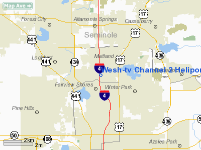
Wesh-TV Channel 2 Heliport |
Location
& QuickFacts
|
FAA Information Effective: |
2007-01-18 |
|
Airport
Identifier: |
9FD8 |
|
Airport
Status: |
Operational |
|
Longitude/Latitude: |
081-23-08.2500W/28-36-44.9980N
-81.385625/28.612499 (Estimated) |
|
Elevation: |
105 ft / 32.00 m (Estimated) |
|
Land: |
0
acres |
|
From
nearest city: |
1 nautical miles SW of Eatonville, FL |
|
Location: |
Orange County, FL |
|
Magnetic Variation: |
03W (1985) |
Owner
& Manager
|
Ownership: |
Privately owned |
|
Owner: |
Wesh-tv Broadcasting Co |
|
Address: |
1021 N Wymore Rd
Winter Park, FL 32789 |
|
Phone
number: |
407-645-2222 |
|
Manager: |
Jeff Lee |
|
Address: |
1021 N Wymore Rd
Winter Park, FL 32789 |
|
Phone number: |
407-645-2222 |
Airport
Operations and Facilities
|
Airport Use: |
Private |
|
Wind
indicator: |
Yes |
|
Segmented
Circle: |
No |
|
Control
Tower: |
No |
|
Sectional
chart: |
Jacksonville |
|
Region: |
ASO - Southern |
|
Boundary
ARTCC: |
ZJX - Jacksonville |
|
Tie-in
FSS: |
PIE - Saint Petersburg |
|
FSS
on Airport: |
No |
|
FSS
Toll Free: |
1-800-WX-BRIEF |
|
Runway Information
Helipad H1
|
Dimension: |
50 x 50 ft / 15.2 x 15.2 m |
|
Surface: |
CONC, |
|
|
Runway H1 |
Runway |
|
Traffic
Pattern: |
Left |
Left |
|
Radio Navigation
Aids
|
ID |
Type |
Name |
Ch |
Freq |
Var |
Dist |
|
SFB |
NDB |
Sanford |
|
408.00 |
05W |
12.8 nm |
|
ISM |
NDB |
Kissimmee |
|
329.00 |
05W |
19.6 nm |
|
LEE |
NDB |
Leesburg |
|
335.00 |
04W |
25.4 nm |
|
DED |
NDB |
Deland/dcmsnd |
|
201.00 |
05W |
28.0 nm |
|
GGL |
NDB |
Geiger Lake |
|
375.00 |
05W |
30.1 nm |
|
EVB |
NDB |
New Smyrna Beach |
|
417.00 |
04W |
35.4 nm |
|
COI |
NDB |
Merritt Island |
|
247.00 |
05W |
40.3 nm |
|
RHZ |
NDB |
Zephyrhills |
|
253.00 |
03W |
46.9 nm |
|
SQT |
NDB |
Satellite |
|
257.00 |
03W |
47.6 nm |
|
TTS |
TACAN |
Kennedy Space Center |
059Y |
|
00E |
36.4 nm |
|
COF |
TACAN |
Patrick |
097X |
|
04W |
46.7 nm |
|
ORL |
VORTAC |
Orlando |
059X |
112.20 |
00E |
5.0 nm |
|
OMN |
VORTAC |
Ormond Beach |
073X |
112.60 |
00E |
43.9 nm |
|
DAB |
VOT |
Daytona Beach |
|
111.00 |
|
38.3 nm |
Remarks
- VFR,
PRIVATE USE ONLY; OPERATIONS ARE CONDUCTED FROM 190 DEG TO 230 DEG;
AREA IS MARKED; WIND INDICATOR IS MAINTAINED; PLINE NW TO SE BE REMOVED
AND/OR RELOCATED BEFORE OPERATIONS BEGIN.
Wesh-tv Channel 2 Heliport
Address:
Orange County, FL
Tel:
407-645-2222
Images
and information placed above are from
http://www.airport-data.com/airport/9FD8/
We
thank them for the data!
| General
Info |
| Country |
United
States |
| State |
FLORIDA
|
| FAA ID |
9FD8
|
| Latitude |
28-36-44.998N
|
| Longitude |
081-23-08.250W
|
| Elevation |
105 feet
|
| Near City |
EATONVILLE
|
We don't guarantee the information is fresh and accurate. The data may
be wrong or outdated.
For more up-to-date information please refer to other sources.
|
|


