Wellington Medical Center Heliport |
Location
& QuickFacts
|
FAA Information Effective: |
2007-01-18 |
|
Airport
Identifier: |
FL39 |
|
Airport
Status: |
Operational |
|
Longitude/Latitude: |
080-12-16.1640W/26-38-15.2430N
-80.204490/26.637567 (Estimated) |
|
Elevation: |
60
ft / 18.29 m (Estimated) |
|
Land: |
0
acres |
|
From
nearest city: |
1 nautical miles N of West Palm Beach, FL |
|
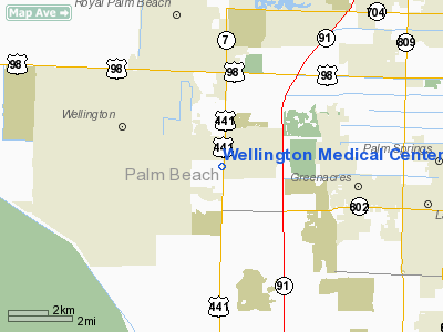
Location: |
Palm Beach County, FL |
|
Magnetic Variation: |
04W (1990) |
Owner
& Manager
|
Ownership: |
Privately owned |
|
Owner: |
Wellington Regional Medical C |
|
Address: |
10101 Forrest Hill Blvd.
West Palm Beach, FL 33414 |
|
Phone number: |
407-798-8500 |
|
Address: |
|
Airport
Operations and Facilities
|
Airport Use: |
Private
MEDICAL USE. |
|
Wind
indicator: |
Yes |
|
Segmented
Circle: |
No |
|
Control
Tower: |
No |
|
Sectional
chart: |
Miami |
|
Region: |
ASO - Southern |
|
Boundary
ARTCC: |
ZMA - Miami |
|
Tie-in
FSS: |
MIA - Miami |
|
FSS
Phone: |
305-233-2600 |
|
FSS
Toll Free: |
1-800-WX-BRIEF |
|
Runway Information
Helipad H1
|
Dimension: |
100 x 100 ft / 30.5 x 30.5 m |
|
Surface: |
CONC, Good Condition |
|
|
Runway H1 |
Runway |
|
Traffic
Pattern: |
Left |
Left |
|
Radio Navigation
Aids
|
ID |
Type |
Name |
Ch |
Freq |
Var |
Dist |
|
PB |
NDB |
Rubin |
|
356.00 |
03W |
3.0 nm |
|
UTX |
NDB |
United |
|
405.00 |
03W |
17.8 nm |
|
FX |
NDB |
Praiz |
|
221.00 |
02W |
27.6 nm |
|
PJN |
NDB |
Plantation |
|
242.00 |
03W |
30.4 nm |
|
FLL |
VOR/DME |
Fort Lauderdale |
091X |
114.40 |
00E |
33.9 nm |
|
PBI |
VORTAC |
Palm Beach |
104X |
115.70 |
03W |
6.8 nm |
|
PHK |
VORTAC |
Pahokee |
101X |
115.40 |
00E |
27.6 nm |
|
PBI |
VOT |
Palm Beach |
|
109.00 |
|
6.2 nm |
Remarks
- PRVDD
VFR; PVT USE; INGRESS/EGRESS FM 030 THRU 090 & FM 210 THRU 330;
& LDG AREA MKD & INSTALLATION OF A SECURITY FENCE.
Wellington Medical Center Heliport
Address:
Palm Beach County, FL
Tel:
407-798-8500
Images
and information placed above are from
http://www.airport-data.com/airport/FL39/
We
thank them for the data!
| General
Info |
| Country |
United
States |
| State |
FLORIDA
|
| FAA ID |
FL39
|
| Latitude |
26-38-15.243N
|
| Longitude |
080-12-16.164W
|
| Elevation |
60 feet
|
| Near City |
WEST PALM
BEACH |
We don't guarantee the information is fresh and accurate. The data may
be wrong or outdated.
For more up-to-date information please refer to other sources.
|


