 |
|
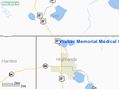
Walker Memorial Medical Center Heliport |
Location
& QuickFacts
|
FAA Information Effective: |
2007-01-18 |
|
Airport
Identifier: |
FA67 |
|
Airport
Status: |
Operational |
|
Longitude/Latitude: |
081-31-06.2710W/27-37-57.1170N
-81.518409/27.632532 (Estimated) |
|
Elevation: |
120 ft / 36.58 m (Estimated) |
|
Land: |
0
acres |
|
From
nearest city: |
3 nautical miles N of Avon Park, FL |
|
Location: |
Highlands County, FL |
|
Magnetic Variation: |
02W (1985) |
Owner
& Manager
|
Ownership: |
Privately owned |
|
Owner: |
Walker Memorial Med Center |
|
Address: |
P O Box 1200
Avon Park, FL 33825-1200 |
|
Phone
number: |
813-453-7511 |
|
Manager: |
Samuel Leonor |
|
Address: |
2501 Us27 N.
Avon Park, FL 33825-1200 |
|
Phone number: |
813-453-7511 |
Airport
Operations and Facilities
|
Airport Use: |
Private
MEDICAL. |
|
Wind
indicator: |
Yes |
|
Segmented
Circle: |
No |
|
Control
Tower: |
No |
|
Landing
fee charge: |
No |
|
Sectional
chart: |
Miami |
|
Region: |
ASO - Southern |
|
Boundary
ARTCC: |
ZMA - Miami |
|
Tie-in
FSS: |
PIE - Saint Petersburg |
|
FSS
on Airport: |
No |
|
FSS
Toll Free: |
1-800-WX-BRIEF |
|
Runway Information
Helipad H1
|
Dimension: |
40 x 40 ft / 12.2 x 12.2 m |
|
Surface: |
CONC, |
|
|
Runway H1 |
Runway |
|
Traffic
Pattern: |
Left |
Left |
|
Radio Navigation
Aids
|
ID |
Type |
Name |
Ch |
Freq |
Var |
Dist |
|
CHN |
NDB |
Wauchula |
|
261.00 |
04W |
20.8 nm |
|
ISM |
NDB |
Kissimmee |
|
329.00 |
05W |
39.7 nm |
|
PCM |
NDB |
Plant City |
|
346.00 |
02W |
40.6 nm |
|
RHZ |
NDB |
Zephyrhills |
|
253.00 |
03W |
49.3 nm |
|
PGD |
VOR |
Punta Gorda |
|
110.20 |
03W |
49.9 nm |
|
LAL |
VORTAC |
Lakeland |
107X |
116.00 |
01E |
33.8 nm |
|
LBV |
VORTAC |
La Belle |
041X |
110.40 |
01E |
48.8 nm |
Remarks
- PVT
USE; VFR WEATHER CONDITIONS; COORDINATE WITH GADO 8-ST PETERSBURG.
Walker Memorial Medical Center Heliport
Address:
Highlands County, FL
Tel:
813-453-7511
Images
and information placed above are from
http://www.airport-data.com/airport/FA67/
We
thank them for the data!
| General
Info |
| Country |
United
States |
| State |
FLORIDA
|
| FAA ID |
FA67
|
| Latitude |
27-37-57.117N
|
| Longitude |
081-31-06.271W
|
| Elevation |
120 feet
|
| Near City |
AVON PARK
|
We don't guarantee the information is fresh and accurate. The data may
be wrong or outdated.
For more up-to-date information please refer to other sources.
|
|


