 |
|
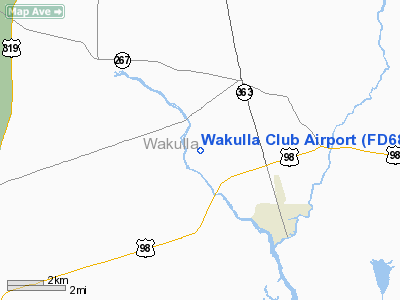
Location
& QuickFacts
|
FAA Information Effective: |
2007-01-18 |
|
Airport
Identifier: |
FD68 |
|
Airport
Status: |
Operational |
|
Longitude/Latitude: |
084-15-12.6250W/30-11-52.7320N
-84.253507/30.197981 (Estimated) |
|
Elevation: |
15
ft / 4.57 m (Estimated) |
|
Land: |
0
acres |
|
From
nearest city: |
4 nautical miles NW of St Marks, FL |
|
Location: |
Wakulla County, FL |
|
Magnetic Variation: |
02W (1990) |
Owner
& Manager
|
Ownership: |
Privately owned |
|
Owner: |
Wakulla River Club |
|
Address: |
Rt 4 Box 6150
Crawfordville, FL 32327 |
|
Phone
number: |
214-739-2025 |
|
Manager: |
W.r. Goddard Vice President |
|
Address: |
P.o. Box 25166
Dallas, TX 75225 |
|
Phone number: |
214-739-2025 |
Airport
Operations and Facilities
|
Airport Use: |
Private |
|
Segmented
Circle: |
No |
|
Control
Tower: |
No |
|
Sectional
chart: |
New Orleans |
|
Region: |
ASO - Southern |
|
Boundary
ARTCC: |
ZJX - Jacksonville |
|
Tie-in
FSS: |
GNV - Gainesville |
|
FSS
Phone: |
850-377-3291 |
|
FSS
Toll Free: |
1-800-WX-BRIEF |
|
Runway Information
Runway 01/19
|
Dimension: |
3424 x 50 ft / 1043.6 x 15.2 m |
|
Surface: |
TURF, |
|
|
Runway 01 |
Runway 19 |
|
Traffic
Pattern: |
Left |
Left |
|
Obstruction: |
20 ft trees, 100.0 ft from runway |
20 ft trees, 100.0 ft from runway |
|
Radio Navigation
Aids
|
ID |
Type |
Name |
Ch |
Freq |
Var |
Dist |
|
TL |
NDB |
Wakul |
|
379.00 |
01W |
9.4 nm |
|
FPY |
NDB |
Foley |
|
254.00 |
03W |
36.8 nm |
|
CYR |
NDB |
Caidy |
|
338.00 |
01W |
41.8 nm |
|
LYZ |
NDB |
Willis |
|
359.00 |
01W |
48.7 nm |
|
AAF |
NDB |
Apalachicola |
|
349.00 |
02W |
49.4 nm |
|
SZW |
VORTAC |
Seminole |
122X |
117.50 |
02E |
22.4 nm |
|
GEF |
VORTAC |
Greenville |
027X |
109.00 |
01E |
32.3 nm |
|
TLH |
VOT |
Tallahassee Muni |
|
111.00 |
|
13.2 nm |
Remarks
- PRVDD
VFR; PR USE; & MILITARY TRAINING RTE VR-1002 IS SITUATED ABOVE THE
APT.
Wakulla Club Airport
Address:
Wakulla County, FL
Tel:
214-739-2025
Images
and information placed above are from
http://www.airport-data.com/airport/FD68/
We
thank them for the data!
| General
Info |
| Country |
United
States |
| State |
FLORIDA
|
| FAA ID |
FD68
|
| Latitude |
30-11-52.732N
|
| Longitude |
084-15-12.625W
|
| Elevation |
15 feet
|
| Near City |
ST MARKS
|
We don't guarantee the information is fresh and accurate. The data may
be wrong or outdated.
For more up-to-date information please refer to other sources.
|
|


