 |
|
Veterans Administration Medical Center Heliport |
|
|
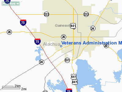
Location
& QuickFacts
|
FAA Information Effective: |
2007-01-18 |
|
Airport
Identifier: |
FA39 |
|
Airport
Status: |
Operational |
|
Longitude/Latitude: |
082-21-43.3770W/29-38-13.8830N
-82.362049/29.637190 (Estimated) |
|
Elevation: |
102 ft / 31.09 m (Estimated) |
|
Land: |
0
acres |
|
From
nearest city: |
2 nautical miles SW of Gainesville, FL |
|
Location: |
Alachua County, FL |
|
Magnetic Variation: |
02W (1985) |
Owner
& Manager
|
Ownership: |
Publicly owned |
|
Owner: |
United States Government |
|
Address: |
Veterans Admin Med Center
Gainesville, FL 32608-1197 |
|
Phone
number: |
352-376-1611 |
|
Manager: |
Elwood J. Headley, M.d. |
|
Address: |
Veterans Admin Med Center
Gainesville, FL 32608-1197 |
|
Phone number: |
352-376-1611 |
Airport
Operations and Facilities
|
Airport Use: |
Private
MEDICAL. |
|
Wind
indicator: |
Yes |
|
Segmented
Circle: |
No |
|
Control
Tower: |
No |
|
Lighting
Schedule: |
PHONE REQ
FOR PERIMETER LGTS CALL 352-376-1611. |
|
Landing
fee charge: |
No |
|
Sectional
chart: |
Jacksonville |
|
Region: |
ASO - Southern |
|
Boundary
ARTCC: |
ZJX - Jacksonville |
|
Tie-in
FSS: |
GNV - Gainesville |
|
FSS
on Airport: |
No |
|
FSS
Phone: |
850-377-3291 |
|
FSS
Toll Free: |
1-800-WX-BRIEF |
|
Runway Information
Helipad H1
|
Dimension: |
110 x 110 ft / 33.5 x 33.5 m |
|
Surface: |
CONC, |
|
|
Runway H1 |
Runway |
|
Traffic
Pattern: |
Left |
Left |
|
Radio Navigation
Aids
|
ID |
Type |
Name |
Ch |
Freq |
Var |
Dist |
|
GN |
NDB |
Wynds |
|
269.00 |
04W |
10.1 nm |
|
IAK |
NDB |
Palatka |
|
243.00 |
05W |
28.8 nm |
|
LCQ |
NDB |
Lake City |
|
204.00 |
03W |
34.8 nm |
|
HEG |
NDB |
Herlong |
|
332.00 |
02W |
48.0 nm |
|
NZC |
TACAN |
Cecil/dcmsnd |
088X |
|
04W |
43.4 nm |
|
VQQ |
VOR |
Cecil |
|
117.90 |
03W |
42.4 nm |
|
GNV |
VORTAC |
Gators |
109X |
116.20 |
04W |
5.7 nm |
|
OCF |
VORTAC |
Ocala |
084X |
113.70 |
00E |
28.5 nm |
|
CTY |
VORTAC |
Cross City |
057X |
112.00 |
02W |
36.0 nm |
Remarks
Veterans Administration Medical Center
Heliport
Address:
Alachua County, FL
Tel:
352-376-1611
Images
and information placed above are from
http://www.airport-data.com/airport/FA39/
We
thank them for the data!
| General
Info |
| Country |
United
States |
| State |
FLORIDA
|
| FAA ID |
FA39
|
| Latitude |
29-38-13.883N
|
| Longitude |
082-21-43.377W
|
| Elevation |
102 feet
|
| Near City |
GAINESVILLE
|
We don't guarantee the information is fresh and accurate. The data may
be wrong or outdated.
For more up-to-date information please refer to other sources.
|
|


