 |
|
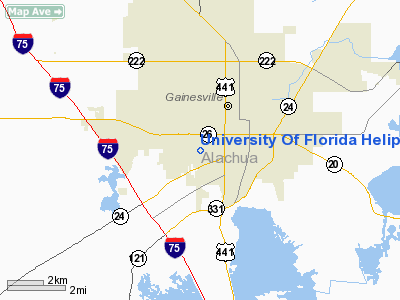
University Of Florida Heliport |
Location
& QuickFacts
|
FAA Information Effective: |
2007-01-18 |
|
Airport
Identifier: |
53FL |
|
Airport
Status: |
Operational |
|
Longitude/Latitude: |
082-21-11.3770W/29-38-38.8830N
-82.353160/29.644134 (Estimated) |
|
Elevation: |
125 ft / 38.10 m (Estimated) |
|
Land: |
6
acres |
|
From
nearest city: |
0 nautical miles N of Gainesville, FL |
|
Location: |
Alachua County, FL |
|
Magnetic Variation: |
02W (1985) |
Owner
& Manager
|
Ownership: |
Privately owned |
|
Owner: |
University Of Florida |
|
Address: |
226 Tigert Hall
Gainesville, FL 32604 |
|
Phone number: |
904-373-0517 |
|
Manager: |
Dewey G. Oliver |
|
Address: |
Po Box 14485
Gainesville, FL 32604 |
|
Phone number: |
904-373-0517 |
Airport
Operations and Facilities
|
Airport Use: |
Private |
|
Wind
indicator: |
Yes |
|
Segmented
Circle: |
No |
|
Control
Tower: |
No |
|
Sectional
chart: |
Jacksonville |
|
Region: |
ASO - Southern |
|
Boundary
ARTCC: |
ZJX - Jacksonville |
|
Tie-in
FSS: |
GNV - Gainesville |
|
FSS
Phone: |
850-377-3291 |
|
FSS
Toll Free: |
1-800-WX-BRIEF |
|
Runway Information
Helipad H1
|
Dimension: |
30
x 30 ft / 9.1 x 9.1 m |
|
Surface: |
TURF, |
|
|
Runway H1 |
Runway |
|
Traffic
Pattern: |
Left |
Left |
|
Radio Navigation
Aids
|
ID |
Type |
Name |
Ch |
Freq |
Var |
Dist |
|
GN |
NDB |
Wynds |
|
269.00 |
04W |
9.6 nm |
|
IAK |
NDB |
Palatka |
|
243.00 |
05W |
28.3 nm |
|
LCQ |
NDB |
Lake City |
|
204.00 |
03W |
34.6 nm |
|
HEG |
NDB |
Herlong |
|
332.00 |
02W |
47.4 nm |
|
NZC |
TACAN |
Cecil/dcmsnd |
088X |
|
04W |
42.8 nm |
|
VQQ |
VOR |
Cecil |
|
117.90 |
03W |
41.8 nm |
|
GNV |
VORTAC |
Gators |
109X |
116.20 |
04W |
5.1 nm |
|
OCF |
VORTAC |
Ocala |
084X |
113.70 |
00E |
28.8 nm |
|
CTY |
VORTAC |
Cross City |
057X |
112.00 |
02W |
36.4 nm |
Remarks
- PRVDD
VFR/PVT USE ONLY; OPNS ARE CONDUCTED FROM 260-300 DEGS & FROM 045-065
DEGS; AREA IS MARKED; WIND INDICATOR IS MAINTAINED.
University Of Florida Heliport
Address:
Alachua County, FL
Tel:
904-373-0517
Images
and information placed above are from
http://www.airport-data.com/airport/53FL/
We
thank them for the data!
| General
Info |
| Country |
United
States |
| State |
FLORIDA
|
| FAA ID |
53FL
|
| Latitude |
29-38-38.883N
|
| Longitude |
082-21-11.377W
|
| Elevation |
125 feet
|
| Near City |
GAINESVILLE
|
We don't guarantee the information is fresh and accurate. The data may
be wrong or outdated.
For more up-to-date information please refer to other sources.
|
|


