 |
|
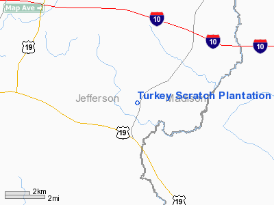
Turkey Scratch Plantation Airport |
Location
& QuickFacts
|
FAA Information Effective: |
2007-01-18 |
|
Airport
Identifier: |
4FL0 |
|
Airport
Status: |
Operational |
|
Longitude/Latitude: |
083-48-36.0000W/30-24-13.0000N
-83.810000/30.403611 (Estimated) |
|
Elevation: |
115 ft / 35.05 m (Estimated) |
|
Land: |
0
acres |
|
From
nearest city: |
2 nautical miles S of Lamont, FL |
|
Location: |
Jefferson County, FL |
|
Magnetic Variation: |
03W (1995) |
Owner
& Manager
|
Ownership: |
Privately owned |
|
Owner: |
Red Hills Land Company |
|
Address: |
4200 Piney Grove Road
Glyndon, MD 21071 |
|
Phone
number: |
410-429-4000 |
|
Manager: |
Franklin Foster |
|
Address: |
4200 Piney Grove Road
Glyndon, MD 21071 |
|
Phone number: |
410-429-4000 |
Airport
Operations and Facilities
|
Airport Use: |
Private |
|
Segmented
Circle: |
No |
|
Control
Tower: |
No |
|
Sectional
chart: |
Jacksonville |
|
Region: |
ASO - Southern |
|
Boundary
ARTCC: |
ZJX - Jacksonville |
|
Tie-in
FSS: |
GNV - Gainesville |
|
FSS
Phone: |
850-377-3291 |
|
FSS
Toll Free: |
1-800-WX-BRIEF |
|
Runway Information
Runway 18/36
|
Dimension: |
2800 x 50 ft / 853.4 x 15.2 m |
|
Surface: |
TURF, |
|
|
Runway 18 |
Runway 36 |
|
Traffic
Pattern: |
Left |
Left |
|
Obstruction: |
50 ft trees, 4000.0 ft from runway |
45 ft trees, 2000.0 ft from runway |
|
Radio Navigation
Aids
|
ID |
Type |
Name |
Ch |
Freq |
Var |
Dist |
|
FPY |
NDB |
Foley |
|
254.00 |
03W |
27.1 nm |
|
TL |
NDB |
Wakul |
|
379.00 |
01W |
28.8 nm |
|
GTP |
NDB |
Patten |
|
245.00 |
02W |
33.3 nm |
|
CYR |
NDB |
Caidy |
|
338.00 |
01W |
34.3 nm |
|
OTK |
VOR/DME |
Valdosta |
095X |
114.80 |
02W |
35.6 nm |
|
MGR |
VOR/DME |
Moultrie |
025X |
108.80 |
02W |
40.8 nm |
|
GEF |
VORTAC |
Greenville |
027X |
109.00 |
01E |
9.0 nm |
|
SZW |
VORTAC |
Seminole |
122X |
117.50 |
02E |
30.6 nm |
|
VAD |
VORTAC |
Moody |
080X |
113.30 |
03W |
46.2 nm |
|
TLH |
VOT |
Tallahassee Muni |
|
111.00 |
|
28.3 nm |
Remarks
Turkey Scratch Plantation Airport
Address:
Jefferson County, FL
Tel:
410-429-4000
Images
and information placed above are from
http://www.airport-data.com/airport/4FL0/
We
thank them for the data!
| General
Info |
| Country |
United
States |
| State |
FLORIDA
|
| FAA ID |
4FL0
|
| Latitude |
30-24-13.000N
|
| Longitude |
083-48-36.000W
|
| Elevation |
115 feet
|
| Near City |
LAMONT
|
We don't guarantee the information is fresh and accurate. The data may
be wrong or outdated.
For more up-to-date information please refer to other sources.
|
|


