 |
|
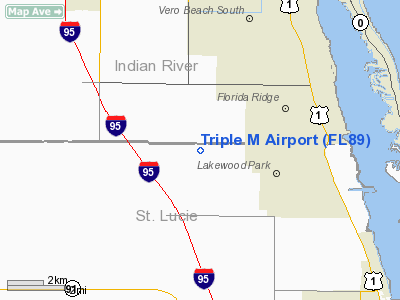
Location
& QuickFacts
|
FAA Information Effective: |
2007-01-18 |
|
Airport
Identifier: |
FL89 |
|
Airport
Status: |
Operational |
|
Longitude/Latitude: |
080-26-23.1900W/27-33-15.1260N
-80.439775/27.554202 (Estimated) |
|
Elevation: |
20
ft / 6.10 m (Estimated) |
|
Land: |
0
acres |
|
From
nearest city: |
4 nautical miles SW of Vero Beach, FL |
|
Location: |
St Lucie County, FL |
|
Magnetic Variation: |
03W (1985) |
Owner
& Manager
|
Ownership: |
Privately owned |
|
Owner: |
Triple M Groves |
|
Address: |
P O Box 670
Ft Pierce, FL 33450 |
|
Phone number: |
305-464-3502 |
|
Address: |
|
Airport
Operations and Facilities
|
Airport Use: |
Private |
|
Wind indicator: |
No |
|
Segmented Circle: |
No |
|
Control Tower: |
No |
|
Landing fee charge: |
No |
|
Sectional chart: |
Miami |
|
Region: |
ASO - Southern |
|
Boundary ARTCC: |
ZMA - Miami |
|
Tie-in FSS: |
PIE - Saint Petersburg |
|
FSS on Airport: |
No |
|
FSS Toll Free: |
1-800-WX-BRIEF |
Airport
Services
|
Airframe Repair: |
NONE |
|
Power Plant Repair: |
NONE |
|
Runway Information
Runway 18/36
|
Dimension: |
2500 x 100 ft / 762.0 x 30.5 m |
|
Surface: |
TURF, |
|
|
Runway 18 |
Runway 36 |
|
Traffic
Pattern: |
Left |
Left |
|
Obstruction: |
45 ft trees, 50.0 ft from runway |
10
ft trees |
|
Radio Navigation
Aids
|
ID |
Type |
Name |
Ch |
Freq |
Var |
Dist |
|
FPR |
NDB |
Fort Pierce |
|
275.00 |
04W |
5.4 nm |
|
VEP |
NDB |
Vero Beach |
|
392.00 |
04W |
6.7 nm |
|
SQT |
NDB |
Satellite |
|
257.00 |
03W |
35.6 nm |
|
UTX |
NDB |
United |
|
405.00 |
03W |
39.2 nm |
|
COI |
NDB |
Merritt Island |
|
247.00 |
05W |
49.1 nm |
|
COF |
TACAN |
Patrick |
097X |
|
04W |
42.1 nm |
|
MLB |
VOR/DME |
Melbourne |
037X |
110.00 |
02W |
34.7 nm |
|
VRB |
VORTAC |
Vero Beach |
120X |
117.30 |
04W |
7.9 nm |
|
PHK |
VORTAC |
Pahokee |
101X |
115.40 |
00E |
48.3 nm |
|
VRB |
VOT |
Vero Beach |
|
111.00 |
|
6.1 nm |
Remarks
Based
Aircraft
|
Aircraft
based on field: |
1 |
|
Single
Engine Airplanes: |
1 |
Triple M Airport
Address:
St Lucie County, FL
Tel:
305-464-3502
Images
and information placed above are from
http://www.airport-data.com/airport/FL89/
We
thank them for the data!
| General
Info |
| Country |
United
States |
| State |
FLORIDA
|
| FAA ID |
FL89
|
| Latitude |
27-33-15.126N
|
| Longitude |
080-26-23.190W
|
| Elevation |
20 feet
|
| Near City |
VERO BEACH
|
We don't guarantee the information is fresh and accurate. The data may
be wrong or outdated.
For more up-to-date information please refer to other sources.
|
|


