 |
|
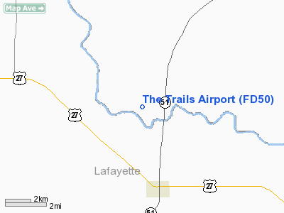
Location
& QuickFacts
|
FAA Information Effective: |
2007-01-18 |
|
Airport
Identifier: |
FD50 |
|
Airport
Status: |
Operational |
|
Longitude/Latitude: |
083-11-19.4910W/30-06-32.8010N
-83.188747/30.109111 (Estimated) |
|
Elevation: |
45
ft / 13.72 m (Estimated) |
|
Land: |
7
acres |
|
From
nearest city: |
5 nautical miles S of Mayo, FL |
|
Location: |
Suwannee County, FL |
|
Magnetic Variation: |
02W (1985) |
Owner
& Manager
|
Ownership: |
Privately owned |
|
Owner: |
Art Gyles |
|
Address: |
18400 211th Road
Live Oak, FL 32060 |
|
Phone
number: |
386-776-2653 |
|
Manager: |
Art Gyles |
|
Address: |
18400 211th Road
Live Oak, FL 32060 |
|
Phone number: |
386-776-2653 |
Airport
Operations and Facilities
|
Airport Use: |
Private |
|
Wind
indicator: |
Yes |
|
Segmented
Circle: |
No |
|
Control
Tower: |
No |
|
Landing
fee charge: |
No |
|
Sectional
chart: |
Jacksonville |
|
Region: |
ASO - Southern |
|
Boundary
ARTCC: |
ZJX - Jacksonville |
|
Tie-in
FSS: |
GNV - Gainesville |
|
FSS
on Airport: |
No |
|
FSS
Phone: |
850-377-3291 |
|
FSS
Toll Free: |
1-800-WX-BRIEF |
|
Runway Information
Runway 18/36
|
Dimension: |
3400 x 75 ft / 1036.3 x 22.9 m |
|
Surface: |
TURF, |
|
|
Runway 18 |
Runway 36 |
|
Traffic
Pattern: |
Left |
Left |
|
Obstruction: |
60 ft trees, 100.0 ft from runway |
60 ft trees, 100.0 ft from runway |
|
Radio Navigation
Aids
|
ID |
Type |
Name |
Ch |
Freq |
Var |
Dist |
|
FPY |
NDB |
Foley |
|
254.00 |
03W |
21.8 nm |
|
LCQ |
NDB |
Lake City |
|
204.00 |
03W |
32.0 nm |
|
OTK |
VOR/DME |
Valdosta |
095X |
114.80 |
02W |
40.6 nm |
|
CTY |
VORTAC |
Cross City |
057X |
112.00 |
02W |
31.5 nm |
|
TAY |
VORTAC |
Taylor |
076X |
112.90 |
03W |
40.7 nm |
|
GEF |
VORTAC |
Greenville |
027X |
109.00 |
01E |
40.7 nm |
Remarks
- VFR,
PVT USE ONLY, ALL TFC PATTERNS FLOW SOUTH OF RWY CNTRLN.
Based
Aircraft
|
Aircraft
based on field: |
3 |
|
Single
Engine Airplanes: |
2 |
|
Multi
Engine Airplanes: |
1 |
The Trails Airport
Address:
Suwannee County, FL
Tel:
386-776-2653
Images
and information placed above are from
http://www.airport-data.com/airport/FD50/
We
thank them for the data!
| General
Info |
| Country |
United
States |
| State |
FLORIDA
|
| FAA ID |
FD50
|
| Latitude |
30-06-32.801N
|
| Longitude |
083-11-19.491W
|
| Elevation |
45 feet
|
| Near City |
MAYO
|
We don't guarantee the information is fresh and accurate. The data may
be wrong or outdated.
For more up-to-date information please refer to other sources.
|
|


