 |
|
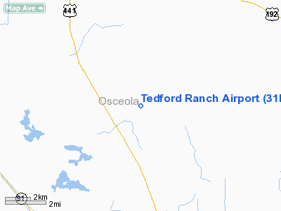
Location
& QuickFacts
|
FAA Information Effective: |
2007-01-18 |
|
Airport
Identifier: |
31FL |
|
Airport
Status: |
Operational |
|
Longitude/Latitude: |
081-01-09.2270W/28-02-36.0690N
-81.019230/28.043353 (Estimated) |
|
Elevation: |
54
ft / 16.46 m (Estimated) |
|
Land: |
0
acres |
|
From
nearest city: |
22 nautical miles W of Melbourne, FL |
|
Location: |
Osceola County, FL |
|
Magnetic Variation: |
03W (1985) |
Owner
& Manager
|
Ownership: |
Privately owned |
|
Owner: |
Allen Brousard Conservancy Inc |
|
Address: |
502 E New Haven Ave
Melbourne, FL 32901 |
|
Manager: |
William Brousard |
|
Address: |
Allen Broussard Conservancy Inc, 502 E New
Haven Ave
Melbourne, FL 32901 |
Airport
Operations and Facilities
|
Airport Use: |
Private |
|
Wind
indicator: |
Yes |
|
Segmented
Circle: |
No |
|
Control
Tower: |
No |
|
Landing
fee charge: |
No |
|
Sectional
chart: |
Jacksonville |
|
Region: |
ASO - Southern |
|
Boundary
ARTCC: |
ZMA - Miami |
|
Tie-in
FSS: |
PIE - Saint Petersburg |
|
FSS
on Airport: |
No |
|
FSS
Toll Free: |
1-800-WX-BRIEF |
|
Runway Information
Runway 09/27
|
Dimension: |
3000 x 150 ft / 914.4 x 45.7 m |
|
Surface: |
TURF, |
|
|
Runway 09 |
Runway 27 |
|
Traffic
Pattern: |
Left |
Left |
|
Radio Navigation
Aids
|
ID |
Type |
Name |
Ch |
Freq |
Var |
Dist |
|
SQT |
NDB |
Satellite |
|
257.00 |
03W |
17.2 nm |
|
COI |
NDB |
Merritt Island |
|
247.00 |
05W |
25.0 nm |
|
ISM |
NDB |
Kissimmee |
|
329.00 |
05W |
26.5 nm |
|
GGL |
NDB |
Geiger Lake |
|
375.00 |
05W |
34.7 nm |
|
VEP |
NDB |
Vero Beach |
|
392.00 |
04W |
39.2 nm |
|
SFB |
NDB |
Sanford |
|
408.00 |
05W |
46.1 nm |
|
FPR |
NDB |
Fort Pierce |
|
275.00 |
04W |
48.0 nm |
|
COF |
TACAN |
Patrick |
097X |
|
04W |
24.6 nm |
|
TTS |
TACAN |
Kennedy Space Center |
059Y |
|
00E |
39.0 nm |
|
MLB |
VOR/DME |
Melbourne |
037X |
110.00 |
02W |
20.7 nm |
|
ORL |
VORTAC |
Orlando |
059X |
112.20 |
00E |
34.4 nm |
|
VRB |
VORTAC |
Vero Beach |
120X |
117.30 |
04W |
35.7 nm |
|
VRB |
VOT |
Vero Beach |
|
111.00 |
|
39.7 nm |
Remarks
Based
Aircraft
|
Aircraft
based on field: |
1 |
|
Single
Engine Airplanes: |
1 |
Tedford Ranch Airport
Address:
Osceola County, FL
Tel:
Images
and information placed above are from
http://www.airport-data.com/airport/31FL/
We
thank them for the data!
| General
Info |
| Country |
United
States |
| State |
FLORIDA
|
| FAA ID |
31FL
|
| Latitude |
28-02-36.069N
|
| Longitude |
081-01-09.227W
|
| Elevation |
54 feet
|
| Near City |
MELBOURNE
|
We don't guarantee the information is fresh and accurate. The data may
be wrong or outdated.
For more up-to-date information please refer to other sources.
|
|


