 |
|
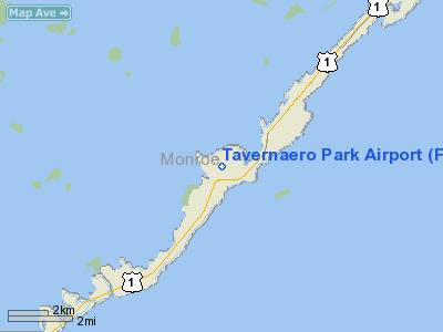
Location
& QuickFacts
|
FAA Information Effective: |
2007-01-18 |
|
Airport
Identifier: |
FA81 |
|
Airport
Status: |
Operational |
|
Longitude/Latitude: |
080-31-59.2200W/25-00-31.4670N
-80.533117/25.008741 (Estimated) |
|
Elevation: |
10
ft / 3.05 m (Estimated) |
|
Land: |
7
acres |
|
From
nearest city: |
1 nautical miles W of Tavernier, FL |
|
Location: |
Monroe County, FL |
|
Magnetic Variation: |
02W (1985) |
Owner
& Manager
|
Ownership: |
Privately owned |
|
Owner: |
Tavernaero Arpt Park Inc |
|
Address: |
P O Box 806
Long Key, FL 33001 |
|
Manager: |
Jay Frins |
|
Address: |
135 N Airport Rd
Tavernier, FL 33070 |
|
Phone number: |
305-852-7210 |
Airport
Operations and Facilities
|
Airport Use: |
Private |
|
Wind indicator: |
Yes |
|
Segmented Circle: |
No |
|
Control Tower: |
No |
|
Landing fee charge: |
No |
|
Sectional chart: |
Miami |
|
Region: |
ASO - Southern |
|
Boundary ARTCC: |
ZMA - Miami |
|
Tie-in FSS: |
MIA - Miami |
|
FSS on Airport: |
No |
|
FSS Phone: |
305-233-2600 |
|
FSS Toll Free: |
1-800-WX-BRIEF |
Airport
Services
|
Airframe Repair: |
NONE |
|
Power Plant Repair: |
NONE |
|
Runway Information
Runway 08/26
|
Dimension: |
2175 x 95 ft / 662.9 x 29.0 m |
|
Surface: |
TURF, |
|
|
Runway 08 |
Runway 26 |
|
Traffic
Pattern: |
Left |
Left |
|
Obstruction: |
|
203 ft tower, 2500.0 ft from runway |
|
Radio Navigation
Aids
|
ID |
Type |
Name |
Ch |
Freq |
Var |
Dist |
|
MTH |
NDB |
Marathon |
|
260.00 |
04W |
35.5 nm |
|
HST |
TACAN |
Homestead |
019X |
|
03W |
30.1 nm |
|
VKZ |
VOR/DME |
Virginia Key |
118X |
117.10 |
04W |
49.2 nm |
|
DHP |
VORTAC |
Dolphin |
086X |
113.90 |
04W |
48.6 nm |
|
MIA |
VOT |
Miami Intl |
|
112.00 |
|
49.2 nm |
Remarks
Based
Aircraft
|
Aircraft
based on field: |
14 |
|
Single
Engine Airplanes: |
11 |
|
Multi
Engine Airplanes: |
3 |
Tavernaero Park Airport
Address:
Monroe County, FL
Tel:
305-852-7210
Images
and information placed above are from
http://www.airport-data.com/airport/FA81/
We
thank them for the data!
| General
Info |
| Country |
United
States |
| State |
FLORIDA
|
| FAA ID |
FA81
|
| Latitude |
25-00-31.467N
|
| Longitude |
080-31-59.220W
|
| Elevation |
10 feet
|
| Near City |
TAVERNIER
|
We don't guarantee the information is fresh and accurate. The data may
be wrong or outdated.
For more up-to-date information please refer to other sources.
|
|


