 |
|
Suwannee Hospital Emergency Heliport |
|
|
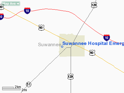
Location
& QuickFacts
|
FAA Information Effective: |
2007-01-18 |
|
Airport
Identifier: |
9FL9 |
|
Airport
Status: |
Operational |
|
Longitude/Latitude: |
083-00-14.4730W/30-17-28.8040N
-83.004020/30.291334 (Estimated) |
|
Elevation: |
94
ft / 28.65 m (Estimated) |
|
Land: |
2
acres |
|
From
nearest city: |
5 nautical miles SW of Live Oak, FL |
|
Location: |
Suwannee County, FL |
|
Magnetic Variation: |
02W (1985) |
Owner
& Manager
|
Ownership: |
Privately owned |
|
Owner: |
Shands Teaching Hospital & Clinic |
|
Address: |
1600 Sw Archer Road
Gainesville, FL 32610 |
|
Phone
number: |
904-392-9146 |
|
Manager: |
Skipper Mimbs
HOSPITAL ADDRESS IS PO BOX X, LIVE OAK, FL 32060, PHONE
352-392-9289. |
|
Address: |
1100 Sw 11th Street
Live Oak, FL 32060 |
|
Phone number: |
904-362-1413 |
Airport
Operations and Facilities
|
Airport Use: |
Private
MEDICAL |
|
Wind
indicator: |
Yes |
|
Segmented
Circle: |
No |
|
Control
Tower: |
No |
|
Lighting
Schedule: |
PHONE REQ
FOR PERIMETER LGTS CALL 904-755-3200 EXT. 180. |
|
Sectional
chart: |
Jacksonville |
|
Region: |
ASO - Southern |
|
Boundary
ARTCC: |
ZJX - Jacksonville |
|
Tie-in
FSS: |
GNV - Gainesville |
|
FSS
Phone: |
850-377-3291 |
|
FSS
Toll Free: |
1-800-WX-BRIEF |
|
Runway Information
Helipad H1
|
Dimension: |
30
x 30 ft / 9.1 x 9.1 m |
|
Surface: |
CONC, Good Condition |
|
|
Runway H1 |
Runway |
|
Traffic
Pattern: |
Left |
Left |
|
Radio Navigation
Aids
|
ID |
Type |
Name |
Ch |
Freq |
Var |
Dist |
|
LCQ |
NDB |
Lake City |
|
204.00 |
03W |
23.0 nm |
|
FPY |
NDB |
Foley |
|
254.00 |
03W |
35.1 nm |
|
HOE |
NDB |
Homerville |
|
209.00 |
03W |
47.5 nm |
|
OTK |
VOR/DME |
Valdosta |
095X |
114.80 |
02W |
32.7 nm |
|
TAY |
VORTAC |
Taylor |
076X |
112.90 |
03W |
26.7 nm |
|
VAD |
VORTAC |
Moody |
080X |
113.30 |
03W |
41.4 nm |
|
CTY |
VORTAC |
Cross City |
057X |
112.00 |
02W |
41.7 nm |
|
GEF |
VORTAC |
Greenville |
027X |
109.00 |
01E |
43.3 nm |
Remarks
- PRVDD
VFR/PR USE; ALL APCH/DEP OPS 055-105 DEG & 165-190 DEG; TKOF/LNDG
AREA APPROPRIATELY MKD; NON OBSTRUCTING WIND INDICATOR MNTND.
Suwannee Hospital Emergency Heliport
Address:
Suwannee County, FL
Tel:
904-392-9146,
904-362-1413
Images
and information placed above are from
http://www.airport-data.com/airport/9FL9/
We
thank them for the data!
| General
Info |
| Country |
United
States |
| State |
FLORIDA
|
| FAA ID |
9FL9
|
| Latitude |
30-17-28.804N
|
| Longitude |
083-00-14.473W
|
| Elevation |
94 feet
|
| Near City |
LIVE OAK
|
We don't guarantee the information is fresh and accurate. The data may
be wrong or outdated.
For more up-to-date information please refer to other sources.
|
|


