 |
|
Sugar Loaf Shores Airport |
|
|
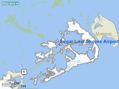
Location
& QuickFacts
|
FAA Information Effective: |
2007-01-18 |
|
Airport
Identifier: |
7FA1 |
|
Airport
Status: |
Operational |
|
Longitude/Latitude: |
081-34-47.3100W/24-38-55.5160N
-81.579808/24.648754 (Estimated) |
|
Elevation: |
4
ft / 1.22 m (Estimated) |
|
Land: |
12
acres |
|
From
nearest city: |
11 nautical miles NE of Key West, FL |
|
Location: |
Monroe County, FL |
|
Magnetic Variation: |
02W (1985) |
Owner
& Manager
|
Ownership: |
Privately owned |
|
Owner: |
Sugar Loaf Lodge |
|
Address: |
Po Box 148
Sugar Loaf Shores, FL 33044 |
|
Phone
number: |
305-745-2217 |
|
Manager: |
Daniel Haggerty |
|
Address: |
Po Box 265
Sugar Loaf Shores, FL 33044 |
|
Phone number: |
305-745-2217 |
Airport Operations and Facilities
|
Airport Use: |
Private |
|
Wind indicator: |
Yes |
|
Segmented Circle: |
No |
|
Control Tower: |
No |
|
Landing fee charge: |
No |
|
Sectional chart: |
Miami |
|
Region: |
ASO - Southern |
|
Boundary ARTCC: |
ZMA - Miami |
|
Tie-in FSS: |
MIA - Miami |
|
FSS on Airport: |
No |
|
FSS Phone: |
305-233-2600 |
|
FSS Toll Free: |
1-800-WX-BRIEF |
Airport
Communications
Airport
Services
|
Airframe Repair: |
NONE |
|
Power Plant Repair: |
NONE |
|
Runway Information
Runway 10/28
|
Dimension: |
2700 x 100 ft / 823.0 x 30.5 m |
|
Surface: |
ASPH-GRVL,
MIDDLE 20' ASPH FULL LENGTH OF RWY 10/28. |
|
|
Runway 10 |
Runway 28 |
|
Traffic
Pattern: |
Left |
Left |
|
Radio Navigation
Aids
|
ID |
Type |
Name |
Ch |
Freq |
Var |
Dist |
|
FIS |
NDB |
Fish Hook |
|
332.00 |
04W |
12.8 nm |
|
MTH |
NDB |
Marathon |
|
260.00 |
04W |
26.7 nm |
|
NQX |
TACAN |
Key West |
078X |
|
02W |
7.0 nm |
|
EYW |
VORTAC |
Key West |
082X |
113.50 |
01E |
12.6 nm |
Remarks
Based
Aircraft
|
Aircraft
based on field: |
13 |
|
Single
Engine Airplanes: |
10 |
|
Multi
Engine Airplanes: |
2 |
|
Gliders: |
1 |
Sugar Loaf Shores Airport
Address:
Monroe County, FL
Tel:
305-745-2217
Images
and information placed above are from
http://www.airport-data.com/airport/7FA1/
We
thank them for the data!
| General
Info |
| Country |
United
States |
| State |
FLORIDA
|
| FAA ID |
7FA1
|
| Latitude |
24-38-55.516N
|
| Longitude |
081-34-47.310W
|
| Elevation |
4 feet
|
| Near City |
KEY WEST
|
We don't guarantee the information is fresh and accurate. The data may
be wrong or outdated.
For more up-to-date information please refer to other sources.
|
|


