 |
|
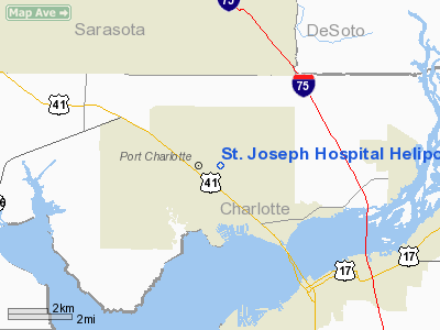
St. Joseph Hospital Heliport |
Location & QuickFacts
|
FAA Information Effective: |
2007-01-18 |
|
Airport Identifier: |
FA01 |
|
Airport Status: |
Operational |
|
Longitude/Latitude: |
082-05-42.3210W/26-59-27.2120N
-82.095089/26.990892 (Estimated) |
|
Elevation: |
13
ft / 3.96 m (Estimated) |
|
Land: |
0
acres |
|
From nearest city: |
1 nautical miles N of Port Charlotte, FL |
|
Location: |
Charlotte County, FL |
|
Magnetic Variation: |
02W (1990) |
Owner & Manager
|
Ownership: |
Privately owned |
|
Owner: |
St. Joseph Hospital |
|
Address: |
2500 Harbor Blvd.
Charlotte, FL 33952 |
|
Phone number: |
813-627-2522 |
|
Manager: |
Dennis S. Walker |
|
Address: |
2500 Harbor Blvd.
Charlotte, FL 33952 |
|
Phone number: |
813-627-2522 |
Airport Operations and Facilities
|
Airport Use: |
Private
MEDICAL USE |
|
Segmented Circle: |
No |
|
Control Tower: |
No |
|
Lighting Schedule: |
PHONE REQ
FOR PERIMETER LGTS CALL 813-627-2522. |
|
Sectional chart: |
Miami |
|
Region: |
ASO - Southern |
|
Boundary ARTCC: |
ZMA - Miami |
|
Tie-in FSS: |
PIE - Saint Petersburg |
|
FSS Toll Free: |
1-800-WX-BRIEF |
|
Runway Information
Helipad H1
|
Dimension: |
40 x 40
ft / 12.2 x 12.2
m |
|
Surface: |
CONC, |
|
|
Runway H1 |
Runway |
|
Traffic
Pattern: |
Left |
Left |
|
Radio Navigation Aids
|
ID |
Type |
Name |
Ch |
Freq |
Var |
Dist |
|
VNC |
NDB |
Venice |
|
206.00 |
02W |
18.5 nm |
|
CHN |
NDB |
Wauchula |
|
261.00 |
04W |
33.2 nm |
|
PGD |
VOR |
Punta Gorda |
|
110.20 |
03W |
7.1 nm |
|
RSW |
VORTAC |
Lee County |
055X |
111.80 |
02W |
32.6 nm |
|
SRQ |
VORTAC |
Sarasota |
099X |
115.20 |
02W |
34.7 nm |
|
LBV |
VORTAC |
La Belle |
041X |
110.40 |
01E |
39.0 nm |
Remarks
- PRVDD
VFR; PR USE; APCH/DEP RTE OPS FM 220 TO 150; TKOF/LDG AREA MKD; &
WIND INDICATOR IS MAINTAINED.
St. Joseph Hospital Heliport
Address:
Marion County, FL
Tel:
Images
and information placed above are from
http://www.airport-data.com/airport/FA01/
We
thank them for the data!
| General Info |
| Country |
United States |
| State |
FLORIDA |
| FAA ID |
FA01 |
| Latitude |
26-59-27.212N |
| Longitude |
082-05-42.321W |
| Elevation |
13 feet |
| Near City |
PORT CHARLOTTE |
We don't guarantee the information is fresh and accurate. The data may
be wrong or outdated.
For more up-to-date information please refer to other sources.
|
|


