|
 |
|
||||
|
Coordinates: 29°57′33″N 081°20′23″W / 29.95917°N 81.33972°W
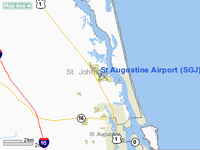
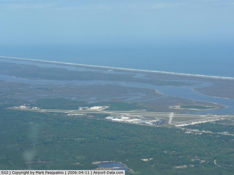
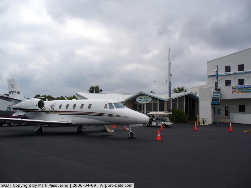
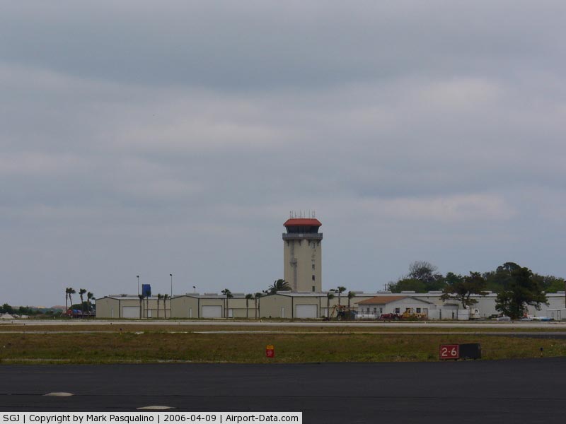
Northeast Florida Regional Airport (IATA: UST, ICAO: KSGJ, FAA LID: SGJ), formerly St. Augustine Airport, is a public airport located four miles (6 km) north of the central business district of St. Augustine, in St. Johns County, Florida, United States. It is publicly owned by St. Augustine - St. Johns County Airport Authority. The airport was left without commercial service after Skybus announced it would cease operations effective April 4, 2008. Although most U.S. airports use the same three-letter location identifier for the FAA and IATA, Northeast Florida Regional Airport is assigned SGJ by the FAA and UST by the IATA (which assigned SGJ to Sagarai, Papua New Guinea). The airport's ICAO identifier is KSGJ. HistoryOn December 27, 1933, the St. Augustine City Commission voted to purchase 276 acres in Araquay Park, north of the city, for $8,000 for conversion to a public airport. U.S. Government grants throughout the decade made possible additional improvements to the airfield. Following the outbreak of World War II in 1939, vast new sums were provided to upgrade the St. Augustine Airport with an eye toward its possible military use. After the 1941 attack on Pearl Harbor, civil aviation was cancelled and the U.S. Navy took over the airport, renaming it Naval Auxiliary Air Station St. Augustine. Used as a satellite gunnery base in connection with training operations at nearby Naval Air Station Jacksonville, significant improvements were made to NAAS St. Augustine, to include additional runway and hangar construction, support facilities and an operational control tower. Following the end of hostilities, the Navy began scaling back operations and in May 1946, St. Augustine Airport was returned to the city. In the postwar period, government subsidies made possible the establishment of "feeder airlines" providing air service to a host of smaller cities, with St. Augustine Airport becoming a scheduled stop for two passenger airlines. But with subsequnet cutbacks in government subsidies, the feeder airlines went out of business, and by 1950 the St. Augustine Airport, with weeds growing through the cracks in the runway, was seen as a "white elephant" the city could ill afford to operate. It was closed down and leased to the local Moose Lodge for $1.00 a year. However, it was not long, before the white elephant became a bonanza - a major factor in the industrial development of St. Augustine and St. Johns County. In June 1954, the Fairchild Engine and Airplane Corporation announced it would construct a large aircraft modification plant at the airport, opening the facility was the following year. Soon, military aircraft such as USAF and USMC C-119 Flying Boxcars and USAF and USCG C-123 Providers were arriving at Fairchild's St. Augustine facility for modification work. During the 1960s, C-119s would also be modified at the facility as AC-119 gunships and C-123s into aerial spraying aircraft for use in combat with U.S. Air Force units in Vietnam. Given the nature of the company’s work, airport facilities were expanded several times to meet the demand of Fairchild's requirements – the airport’s lengthening of Runway 13/31 to nearly 8,000 feet to accommodate military jet aircraft was a direct result of such needs. Fairchild also operated a Non-Federal Air Traffic Control Tower in the former Navy control tower on a periodic basis in support of military aircraft flight operations. In 1966, a terminal building and additional hangars were constructed to meet the needs of other users of the airport, while fixed base operations were established and additional land acquisitions executed. The economic impact of aviation on the St. Augustine community continued to remain significant until 1976, when Fairchild Industries announced that it would close down its St. Augustine operations. An industrial park was subsequently created at the former Fairchild facilities, and in 1980, the industrial park was sold to the Grumman Corporation for an aircraft modification plant that would ultimately service numerous front-line U.S. Navy and U.S. Marine Corps aircraft, to include the A-6 Intruder, EA-6B Prowler, C-1 Trader, C-2 Greyhound, E-2 Hawkeye and F-14 Tomcat. Grumman assumed responsibility for operating the air traffic control tower as required, maintaining emergency runway arresting gear systems for naval aircraft, and providing aircraft rescue and fire fighting capability for the airport. The Naval Air Systems Command also established Naval Plant Representative Office (NAVPRO) St. Augustine on site. In 1986 the airport was awarded Federal Aviation Regulations (FAR) Part 139 certification by the Federal Aviation Administration (FAA), enabling the airport to operate scheduled and charter airline aircraft carrying in excess of 35 passengers. This certification process increased airport safety and made the airport eligible to receive Federal grant money under the FAA's Airport Improvement Program (AIP). The airport was also designated as a "Reliever Airport" for general aviation overflow from Jacksonville International Airport. In the mid-1980s, Grumman St. Augustine was tasked with a major military contract for "re-winging" nearly all A-6 Intruder carrier-based medium attack bombers for the U.S. Navy and U.S. Marine Corps. In 1989, Grumman undertook large construction projects at the airport, to include construction of their "North 40" facility in support of a Federal Express Boeing 727 modification contract. Grumman, along with the Airport Authority, also built a facility to house the U.S. Coast Guard's E-2C Hawkeyes, which was named Coast Guard Air Station St. Augustine. At this point, the airport technically became a joint civil-military facility, while CGAS St. Augustine operated for two years with E-2C aircraft on loan from the Navy, patrolling along the eastern U.S. coast line, the Gulf of Mexico and throughout the Caribbean as part of drug interdiction operations. However, following a fatal aircraft mishap involving a Coast Guard E-2C at Naval Station Roosevelt Roads, Puerto Rico, the USCG E-2 program was terminated, CGAS St. Augustine disestablished and the military facility returned to the control of Grumman. Airport improvements continued and escalated in the 1990s. 1994 saw the completion of remodeling and expansion of the airport's Terminal Building, adding additional office space, a pilot briefing area, pilot lounge with shower facilities, ticket counters with nearby waiting and baggage areas for eventual commuter/regional airline service, conference facilities and a second-story facility for a restaurant. The Fly-By Cafe opened its doors in 1997 offering a second-story view of the airfield, a menu of aviation-themed dishes, and colorful murals of airplane and airshow memorabilia. The late 1990s also saw numerous mergers among U.S. defense contractors, with the Grumman Corporation being acquired by the Northrop Corporation in 1994 to become Northrop Grumman, the name it continues to use today as the airport's major aviation and industrial activity and largest single employer. Today, the Northrop Grumman facility is best known as the manufacturing and production site for the U.S. Navy's E-2D Advanced Hawkeye carrier-based airborne early warning aircraft. Throughout the 1980s and 1990s, the airport has added over 100 hangars for single and twin-engine airplanes and currently has over 200 based aircraft. Although the airport technically ceased to be a joint civil-military airport with the departure of the Coast Guard, military flight operations continue to be a major fixture under the cognizance of Northrop Grumman and the Department of Defense's (DoD's) Defense Contract Management Agency (DCMA). In addition, the U.S. Army's Operational Support Aircraft Command (OSACOM) Detachment 8 is permanently based at the airport, providing airlift support with C-12 Huron aircraft to Headquarters, Florida National Guard, to include colocated headquarters activities of both the Florida Army National Guard and Florida Air National Guard. The airport was renamed, "The Northeast Florida Regional Airport" in April 2010. The Airport Authority staff currently numbers to 11 employees tasked with administration and maintaenance of the airport, while the airport's control tower was passed from a periodic operation by Northrop Grumman to a full time-operation as a Level I Air Traffic Control Tower under the auspices of the FAA's Contract Tower Program. Facilities and aircraftNortheast Florida Regional Airport covers an area of 668 acres (270 ha) which contains three runways and two seaplane lanes:
For 12-month period ending June 30, 2005, the airport had 126,587 aircraft operations, an average of 346 per day: 90% general aviation, 6% military, 4% air taxi and less than 1% scheduled commercial. There are 323 aircraft based at this airport: 63% single engine, 22% military, 8% multi-engine, 4% jet aircraft, 3% helicopters and less than 1% ultralights. The above content comes from Wikipedia and is published under free licenses – click here to read more.
Runway InformationRunway 02/20
Runway 06/24
Runway 12W/30W
Runway 13/31
Runway 17W/35W
Runway 18W/36W
Radio Navigation Aids
Remarks
Based Aircraft
Operational StatisticsTime Period: 2004-07-01 - 2005-06-30
St Augustine Airport Address: St Johns County, FL Tel: 904-825-6860, 904-209-0090 Images
and information placed above are from We thank them for the data!
We don't guarantee the information is fresh and accurate. The data may
be wrong or outdated.
|
||||||||||||||||||||||||||||||||||||||||||||||||||||||||||||||||||||||||||||||||||||||||||||||||||||||||||||||||||||||||||||||||||||||||||||||||||||||||||||||||||||||||||||||||||||||||||||||||||||||||||||||||||||||||||||||||||||||||||||||||||||||||||||||||||||||||||||||||||||||||||||||||||||||||||||||||||||||||||||||||||||||||||||||||||||||||||||||||||||||||||||||||||||||||||||||||||||||||||||||||||||||||||||||||||||||||||||||||||||||||||||||||||||||||||||||||||||||||||||||||||||||||||||||||||||||

 |
|
Copyright 2004-2026 © by Airports-Worldwide.com, Vyshenskoho st. 36, Lviv 79010, Ukraine Legal Disclaimer |