 |
|
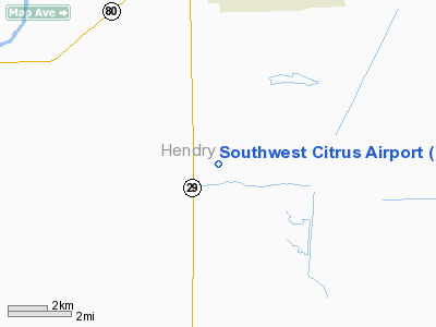
Location
& QuickFacts
|
FAA Information Effective: |
2007-01-18 |
|
Airport
Identifier: |
8FL9 |
|
Airport
Status: |
Operational |
|
Longitude/Latitude: |
081-25-24.2730W/26-39-46.2490N
-81.423409/26.662847 (Estimated) |
|
Elevation: |
28
ft / 8.53 m (Estimated) |
|
Land: |
45
acres |
|
From
nearest city: |
6 nautical miles S of La Belle, FL |
|
Location: |
Hendry County, FL |
|
Magnetic Variation: |
02W (1985) |
Owner
& Manager
|
Ownership: |
Privately owned |
|
Owner: |
Southwest Citrus Co. |
|
Address: |
Po Box 5100
Immokalee, FL 33934 |
|
Phone number: |
813-675-4005 |
|
Manager: |
Ken Rutter |
|
Address: |
Po Box 5100
Immokalee, FL 33934 |
|
Phone number: |
813-657-3217 |
Airport
Operations and Facilities
|
Airport Use: |
Private |
|
Segmented
Circle: |
No |
|
Control
Tower: |
No |
|
Sectional
chart: |
Miami |
|
Region: |
ASO - Southern |
|
Boundary
ARTCC: |
ZMA - Miami |
|
Tie-in
FSS: |
MIA - Miami |
|
FSS
on Airport: |
No |
|
FSS
Phone: |
305-233-2600 |
|
FSS
Toll Free: |
1-800-WX-BRIEF |
|
Runway Information
Runway 09/27
|
Dimension: |
2655 x 75 ft / 809.2 x 22.9 m |
|
Surface: |
TURF, |
|
|
Runway 09 |
Runway 27 |
|
Traffic
Pattern: |
Left |
Left |
|
Obstruction: |
|
30 ft trees, 0.0 ft from runway |
|
Radio Navigation
Aids
|
ID |
Type |
Name |
Ch |
Freq |
Var |
Dist |
|
APF |
NDB |
Naples |
|
201.00 |
03W |
35.9 nm |
|
PGD |
VOR |
Punta Gorda |
|
110.20 |
03W |
34.1 nm |
|
CYY |
VOR/DME |
Cypress |
023X |
108.60 |
03W |
36.1 nm |
|
LBV |
VORTAC |
La Belle |
041X |
110.40 |
01E |
10.1 nm |
|
RSW |
VORTAC |
Lee County |
055X |
111.80 |
02W |
20.6 nm |
|
PHK |
VORTAC |
Pahokee |
101X |
115.40 |
00E |
40.0 nm |
Remarks
Based
Aircraft
|
Aircraft
based on field: |
4 |
|
Single
Engine Airplanes: |
3 |
|
Helicopters: |
1 |
Southwest Citrus Airport
Address:
Hendry County, FL
Tel:
813-675-4005, 813-657-3217
Images
and information placed above are from
http://www.airport-data.com/airport/8FL9/
We
thank them for the data!
| General
Info |
| Country |
United
States |
| State |
FLORIDA
|
| FAA ID |
8FL9
|
| Latitude |
26-39-46.249N
|
| Longitude |
081-25-24.273W
|
| Elevation |
28 feet
|
| Near City |
LA BELLE
|
We don't guarantee the information is fresh and accurate. The data may
be wrong or outdated.
For more up-to-date information please refer to other sources.
|
|


