 |
|
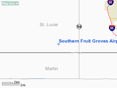
Southern Fruit Groves Airport |
Location
& QuickFacts
|
FAA Information Effective: |
2007-01-18 |
|
Airport
Identifier: |
FD24 |
|
Airport
Status: |
Operational |
|
Longitude/Latitude: |
080-31-14.1950W/27-13-16.1680N
-80.520610/27.221158 (Estimated) |
|
Elevation: |
26
ft / 7.92 m (Estimated) |
|
Land: |
0
acres |
|
From
nearest city: |
17 nautical miles NE of Port St. Lucie, FL |
|
Location: |
St Lucie County, FL |
|
Magnetic Variation: |
04W (1990) |
Owner
& Manager
|
Ownership: |
Privately owned |
|
Owner: |
Southern Fruit Groves Ltd. |
|
Address: |
P.o. Box 568367
Orlando, FL 34987 |
|
Phone
number: |
407-465-5046 |
|
Manager: |
Florida Aggregates Intergroup |
|
Address: |
14171 Rangeline Rd.
Port St. Lucie, FL 34987 |
|
Phone number: |
407-465-5046 |
Airport
Operations and Facilities
|
Airport Use: |
Private |
|
Segmented
Circle: |
No |
|
Control
Tower: |
No |
|
Sectional
chart: |
Miami |
|
Region: |
ASO - Southern |
|
Boundary
ARTCC: |
ZMA - Miami |
|
Tie-in
FSS: |
MIA - Miami |
|
FSS
Phone: |
305-233-2600 |
|
FSS
Toll Free: |
1-800-WX-BRIEF |
|
Runway
Information
Runway E/W
|
Dimension: |
2873 x 100 ft / 875.7 x 30.5 m |
|
Surface: |
TURF, |
|
|
Runway E |
Runway W |
|
Traffic
Pattern: |
Left |
Left |
|
Radio Navigation
Aids
|
ID |
Type |
Name |
Ch |
Freq |
Var |
Dist |
|
FPR |
NDB |
Fort Pierce |
|
275.00 |
04W |
17.8 nm |
|
UTX |
NDB |
United |
|
405.00 |
03W |
21.2 nm |
|
VEP |
NDB |
Vero Beach |
|
392.00 |
04W |
27.2 nm |
|
PB |
NDB |
Rubin |
|
356.00 |
03W |
36.1 nm |
|
VRB |
VORTAC |
Vero Beach |
120X |
117.30 |
04W |
27.5 nm |
|
PHK |
VORTAC |
Pahokee |
101X |
115.40 |
00E |
27.9 nm |
|
PBI |
VORTAC |
Palm Beach |
104X |
115.70 |
03W |
40.0 nm |
|
VRB |
VOT |
Vero Beach |
|
111.00 |
|
26.6 nm |
|
PBI |
VOT |
Palm Beach |
|
109.00 |
|
39.1 nm |
Remarks
- PRVDD
PVT USE/VFR & LOA WITH TREASURE COAST AIRPORT APT.
Southern Fruit Groves Airport
Address:
St Lucie County, FL
Tel:
407-465-5046
Images
and information placed above are from
http://www.airport-data.com/airport/FD24/
We
thank them for the data!
| General
Info |
| Country |
United
States |
| State |
FLORIDA
|
| FAA ID |
FD24
|
| Latitude |
27-13-16.168N
|
| Longitude |
080-31-14.195W
|
| Elevation |
26 feet
|
| Near City |
PORT ST.
LUCIE |
We don't guarantee the information is fresh and accurate. The data may
be wrong or outdated.
For more up-to-date information please refer to other sources.
|
|


