 |
|
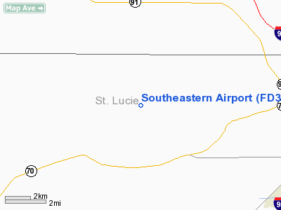
Location
& QuickFacts
|
FAA Information Effective: |
2007-01-18 |
|
Airport
Identifier: |
FD30 |
|
Airport
Status: |
Operational |
|
Longitude/Latitude: |
080-31-34.1970W/27-24-41.1440N
-80.526166/27.411429 (Estimated) |
|
Elevation: |
23
ft / 7.01 m (Estimated) |
|
Land: |
10
acres |
|
From
nearest city: |
11 nautical miles W of Fort Pierce, FL |
|
Location: |
St Lucie County, FL |
|
Magnetic Variation: |
03W (1985) |
Owner
& Manager
|
Ownership: |
Privately owned |
|
Owner: |
Charles Stone |
|
Address: |
2720 Sneed Road
Fort Pierce, FL 34945 |
|
Phone
number: |
407-461-8924 |
|
Manager: |
Charles Stone |
|
Address: |
2720 Sneed Road
Fort Pierce, FL 34945 |
|
Phone number: |
407-461-8924 |
Airport
Operations and Facilities
|
Airport Use: |
Private |
|
Wind
indicator: |
No |
|
Segmented
Circle: |
No |
|
Control
Tower: |
No |
|
Landing
fee charge: |
No |
|
Sectional
chart: |
Miami |
|
Region: |
ASO - Southern |
|
Boundary
ARTCC: |
ZMA - Miami |
|
Tie-in
FSS: |
MIA - Miami |
|
FSS
on Airport: |
No |
|
FSS
Phone: |
305-233-2600 |
|
FSS
Toll Free: |
1-800-WX-BRIEF |
|
Runway Information
Runway 09/27
|
Dimension: |
2600
x 100 ft / 792.5 x 30.5 m
RY 09/27 14' WIDE ASPH STRIP CENTERED ON TURF RY. |
|
Surface: |
ASPH-TURF, |
|
|
Runway 09 |
Runway 27 |
|
Traffic
Pattern: |
Left |
Left |
|
Radio Navigation
Aids
|
ID |
Type |
Name |
Ch |
Freq |
Var |
Dist |
|
FPR |
NDB |
Fort Pierce |
|
275.00 |
04W |
9.3 nm |
|
VEP |
NDB |
Vero Beach |
|
392.00 |
04W |
16.2 nm |
|
UTX |
NDB |
United |
|
405.00 |
03W |
31.9 nm |
|
SQT |
NDB |
Satellite |
|
257.00 |
03W |
42.4 nm |
|
PB |
NDB |
Rubin |
|
356.00 |
03W |
46.7 nm |
|
COF |
TACAN |
Patrick |
097X |
|
04W |
49.9 nm |
|
MLB |
VOR/DME |
Melbourne |
037X |
110.00 |
02W |
42.1 nm |
|
VRB |
VORTAC |
Vero Beach |
120X |
117.30 |
04W |
16.2 nm |
|
PHK |
VORTAC |
Pahokee |
101X |
115.40 |
00E |
38.8 nm |
|
PBI |
VORTAC |
Palm Beach |
104X |
115.70 |
03W |
49.9 nm |
|
VRB |
VOT |
Vero Beach |
|
111.00 |
|
15.7 nm |
|
PBI |
VOT |
Palm Beach |
|
109.00 |
|
49.1 nm |
Remarks
Southeastern Airport
Address:
St Lucie County, FL
Tel:
407-461-8924
Images
and information placed above are from
http://www.airport-data.com/airport/FD30/
We
thank them for the data!
| General
Info |
| Country |
United
States |
| State |
FLORIDA
|
| FAA ID |
FD30
|
| Latitude |
27-24-41.144N
|
| Longitude |
080-31-34.197W
|
| Elevation |
23 feet
|
| Near City |
FORT PIERCE
|
We don't guarantee the information is fresh and accurate. The data may
be wrong or outdated.
For more up-to-date information please refer to other sources.
|
|


