 |
|
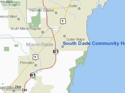
South Dade Community Health Center Heliport |
Location
& QuickFacts
|
FAA Information Effective: |
2007-01-18 |
|
Airport
Identifier: |
FA47 |
|
Airport
Status: |
Operational |
|
Longitude/Latitude: |
080-21-02.1920W/25-33-57.3850N
-80.350609/25.565940 (Estimated) |
|
Elevation: |
7
ft / 2.13 m (Estimated) |
|
Land: |
0
acres |
|
From
nearest city: |
8 nautical miles NE of Homestead, FL |
|
Location: |
Dade County, FL |
|
Magnetic Variation: |
03W (1985) |
Owner
& Manager
|
Ownership: |
Publicly owned |
|
Owner: |
Metropolitan Dade County |
|
Address: |
111 Nw 1st Street
Miami, FL 33128 |
|
Manager: |
Brodes H. Hartley, Jr. |
|
Address: |
10300 Sw 216th Street
Miami, FL 33170 |
|
Phone number: |
305-253-5100 |
Airport
Operations and Facilities
|
Airport Use: |
Private
MEDICAL. |
|
Wind
indicator: |
Yes |
|
Segmented
Circle: |
No |
|
Control
Tower: |
No |
|
Lighting
Schedule: |
DUSK-DAWN |
|
Beacon
Color: |
Clear-Green (lighted land airport) |
|
Sectional
chart: |
Miami |
|
Region: |
ASO - Southern |
|
Boundary
ARTCC: |
ZMA - Miami |
|
Tie-in
FSS: |
MIA - Miami |
|
FSS
on Airport: |
No |
|
FSS
Phone: |
305-233-2600 |
|
FSS
Toll Free: |
1-800-WX-BRIEF |
|
Runway Information
Helipad H1
|
Dimension: |
114 x 86 ft / 34.7 x 26.2 m |
|
Surface: |
ASPH-GRVL, |
|
|
Runway H1 |
Runway |
|
Traffic
Pattern: |
Left |
Left |
|
Radio Navigation
Aids
|
ID |
Type |
Name |
Ch |
Freq |
Var |
Dist |
|
PJN |
NDB |
Plantation |
|
242.00 |
03W |
34.8 nm |
|
FX |
NDB |
Praiz |
|
221.00 |
02W |
37.4 nm |
|
HST |
TACAN |
Homestead |
019X |
|
03W |
4.9 nm |
|
VKZ |
VOR/DME |
Virginia Key |
118X |
117.10 |
04W |
15.4 nm |
|
FLL |
VOR/DME |
Fort Lauderdale |
091X |
114.40 |
00E |
32.4 nm |
|
DHP |
VORTAC |
Dolphin |
086X |
113.90 |
04W |
14.1 nm |
|
MIA |
VOT |
Miami Intl |
|
112.00 |
|
14.3 nm |
Remarks
- VFR
ONLY; PVT USE. COORD USE WITH GADO 5.
South Dade Community Health Center Heliport
Address:
Dade County, FL
Tel:
305-253-5100
Images
and information placed above are from
http://www.airport-data.com/airport/FA47/
We
thank them for the data!
| General
Info |
| Country |
United
States |
| State |
FLORIDA
|
| FAA ID |
FA47
|
| Latitude |
25-33-57.385N
|
| Longitude |
080-21-02.192W
|
| Elevation |
7 feet
|
| Near City |
HOMESTEAD
|
We don't guarantee the information is fresh and accurate. The data may
be wrong or outdated.
For more up-to-date information please refer to other sources.
|
|


