 |
|
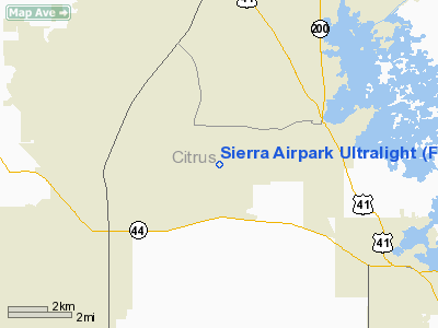
Sierra Airpark Ultralight |
Location
& QuickFacts
|
FAA Information Effective: |
2007-01-18 |
|
Airport
Identifier: |
FL48 |
|
Airport
Status: |
Operational |
|
Longitude/Latitude: |
082-25-47.0000W/28-52-56.0000N
-82.429722/28.882222 (Estimated) |
|
Elevation: |
115 ft / 35.05 m (Estimated) |
|
Land: |
97
acres |
|
From
nearest city: |
3 nautical miles SW of Worthington Springs,
FL |
|
Location: |
Union County, FL |
|
Magnetic Variation: |
04W (2000) |
Owner
& Manager
|
Ownership: |
Privately owned |
|
Owner: |
John D. Rimes, Iii |
|
Address: |
P.o. Box 188
Worthington Springs, FL 32697 |
|
Phone
number: |
904-496-2777 |
|
Manager: |
John D. Rimes, Iii |
|
Address: |
P.o. Box 188
Worthington Springs, FL 32697 |
|
Phone number: |
904-496-2777 |
Airport
Operations and Facilities
|
Airport Use: |
Private |
|
Wind
indicator: |
Yes |
|
Segmented
Circle: |
No |
|
Control
Tower: |
No |
|
Sectional
chart: |
Jacksonville |
|
Region: |
ASO - Southern |
|
Boundary
ARTCC: |
ZJX - Jacksonville |
|
Tie-in
FSS: |
GNV - Gainesville |
|
FSS
Phone: |
850-377-3291 |
|
FSS
Toll Free: |
1-800-WX-BRIEF |
|
Runway
Information
Runway 09U/27U
|
Dimension: |
1300 x 150 ft / 396.2 x 45.7 m |
|
Surface: |
TURF, |
|
|
Runway 09U |
Runway 27U |
|
Traffic
Pattern: |
Left |
Left |
|
Radio Navigation
Aids
|
ID |
Type |
Name |
Ch |
Freq |
Var |
Dist |
|
LEE |
NDB |
Leesburg |
|
335.00 |
04W |
33.0 nm |
|
RHZ |
NDB |
Zephyrhills |
|
253.00 |
03W |
41.9 nm |
|
GN |
NDB |
Wynds |
|
269.00 |
04W |
49.2 nm |
|
OCF |
VORTAC |
Ocala |
084X |
113.70 |
00E |
20.7 nm |
|
GNV |
VORTAC |
Gators |
109X |
116.20 |
04W |
49.4 nm |
Remarks
- 451
FT LGTD TWR LCTD 3 NM NORTH OF RY.
- PRVDD
VFR OPNS, PVT USE.
Based Aircraft
|
Aircraft
based on field: |
1 |
|
Ultralights: |
1 |
Sierra Airpark Ultralight
Address:
Union County, FL
Tel:
904-496-2777
Images
and information placed above are from
http://www.airport-data.com/airport/FL48/
We
thank them for the data!
| General
Info |
| Country |
United
States |
| State |
FLORIDA
|
| FAA ID |
FL48
|
| Latitude |
28-52-56.000N
|
| Longitude |
082-25-47.000W
|
| Elevation |
115 feet
|
| Near City |
WORTHINGTON
SPRINGS |
We don't guarantee the information is fresh and accurate. The data may
be wrong or outdated.
For more up-to-date information please refer to other sources.
|
|


