 |
|
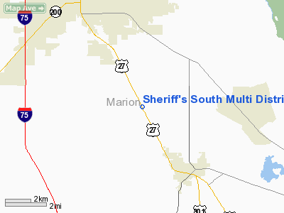
Sheriff's South Multi District Office Heliport |
Location
& QuickFacts
|
FAA Information Effective: |
2007-01-18 |
|
Airport
Identifier: |
FL68 |
|
Airport
Status: |
Operational |
|
Longitude/Latitude: |
082-05-27.3200W/29-06-20.9200N
-82.090922/29.105811 (Estimated) |
|
Elevation: |
71
ft / 21.64 m (Estimated) |
|
Land: |
0
acres |
|
From
nearest city: |
6 nautical miles SE of Ocala, FL |
|
Location: |
Marion County, FL |
|
Magnetic Variation: |
04W (2000) |
Owner
& Manager
|
Ownership: |
Privately owned |
|
Owner: |
Marion County Sheriff's Office |
|
Address: |
P.o. Box 1987
Ocala, FL 34478 |
|
Phone
number: |
352-620-7810 |
|
Manager: |
Capt. Donald R. Chapman |
|
Address: |
Marion County Sheriff's Office, Po Box 1987
Ocala, FL 34478 |
|
Phone number: |
352-873-7900 |
Airport
Operations and Facilities
|
Airport Use: |
Private |
|
Wind
indicator: |
Yes |
|
Segmented
Circle: |
No |
|
Control
Tower: |
No |
|
Lighting
Schedule: |
DUSK-DAWN |
|
Sectional
chart: |
Jacksonville |
|
Region: |
ASO - Southern |
|
Boundary
ARTCC: |
ZJX - Jacksonville |
|
Tie-in
FSS: |
GNV - Gainesville |
|
FSS
Phone: |
850-377-3291 |
|
FSS
Toll Free: |
1-800-WX-BRIEF |
|
Runway Information
Helipad H1
|
Dimension: |
65 x 65 ft / 19.8 x 19.8 m |
|
Surface: |
CONC, |
|
|
Runway H1 |
Runway |
|
Traffic
Pattern: |
Left |
Left |
|
Radio Navigation
Aids
|
ID |
Type |
Name |
Ch |
Freq |
Var |
Dist |
|
LEE |
NDB |
Leesburg |
|
335.00 |
04W |
22.8 nm |
|
GN |
NDB |
Wynds |
|
269.00 |
04W |
34.2 nm |
|
IAK |
NDB |
Palatka |
|
243.00 |
05W |
36.0 nm |
|
DED |
NDB |
Deland/dcmsnd |
|
201.00 |
05W |
43.0 nm |
|
SFB |
NDB |
Sanford |
|
408.00 |
05W |
48.6 nm |
|
OCF |
VORTAC |
Ocala |
084X |
113.70 |
00E |
8.3 nm |
|
GNV |
VORTAC |
Gators |
109X |
116.20 |
04W |
36.5 nm |
Remarks
- 50
FT POWER LINE 180 FT NORTH, 50 FT POWER LINE 130 FT EAST, 60 FT TREES
200 FT WEST, 80 FT TREES 170 FT EAST, 40 FT TREES 290 FT SOUTH, 35 FT
POLE 140 FT SOUTH & 25 FT BLDG 115 FT SOUTH OF HELIPAD.
- PRVDD
VFR OPNS, PVT USE, ALL APCH/DEP FROM 330 CLKWS TO 150 DEGS & FROM
120 CLKWS TO 300 DEGS, AREA MKD, WIND INDICATOR IS MAINTAINED.
Sheriff's South Multi District Office
Heliport
Address:
Marion County, FL
Tel:
352-620-7810,
352-873-7900
Images
and information placed above are from
http://www.airport-data.com/airport/FL68/
We
thank them for the data!
| General
Info |
| Country |
United
States |
| State |
FLORIDA
|
| FAA ID |
FL68
|
| Latitude |
29-06-20.920N
|
| Longitude |
082-05-27.320W
|
| Elevation |
71 feet
|
| Near City |
OCALA
|
We don't guarantee the information is fresh and accurate. The data may
be wrong or outdated.
For more up-to-date information please refer to other sources.
|
|


