 |
|
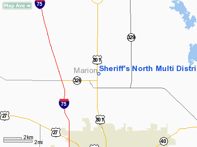
Sheriff's North Multi District Office Heliport |
Location
& QuickFacts
|
FAA Information Effective: |
2007-01-18 |
|
Airport
Identifier: |
1FL6 |
|
Airport
Status: |
Operational |
|
Longitude/Latitude: |
082-09-01.0000W/29-16-26.0000N
-82.150278/29.273889 (Estimated) |
|
Elevation: |
85
ft / 25.91 m (Estimated) |
|
Land: |
5
acres |
|
From
nearest city: |
5 nautical miles NW of Ocala, FL |
|
Location: |
Marion County, FL |
|
Magnetic Variation: |
04W (1995) |
Owner
& Manager
|
Ownership: |
Publicly owned |
|
Owner: |
Marion County Sheriff's Office |
|
Address: |
692 Nw 30th Avenue
Ocala, FL 34475 |
|
Phone
number: |
352-732-8181 |
|
Manager: |
Capt. Keith Fender |
|
Address: |
692 Nw 30th Avenue
Ocala, FL 34475 |
|
Phone number: |
352-732-8181 |
Airport
Operations and Facilities
|
Airport Use: |
Private |
|
Wind
indicator: |
Yes |
|
Segmented
Circle: |
No |
|
Control
Tower: |
No |
|
Lighting
Schedule: |
DUSK-DAWN |
|
Sectional
chart: |
Jacksonville |
|
Region: |
ASO - Southern |
|
Boundary
ARTCC: |
ZJX - Jacksonville |
|
Tie-in
FSS: |
GNV - Gainesville |
|
FSS
Phone: |
850-377-3291 |
|
FSS
Toll Free: |
1-800-WX-BRIEF |
|
Runway Information
Helipad H1
|
Dimension: |
65 x 65 ft / 19.8 x 19.8 m |
|
Surface: |
CONC, |
|
|
Runway H1 |
Runway |
|
Traffic
Pattern: |
Left |
Left |
|
Radio Navigation
Aids
|
ID |
Type |
Name |
Ch |
Freq |
Var |
Dist |
|
GN |
NDB |
Wynds |
|
269.00 |
04W |
23.8 nm |
|
IAK |
NDB |
Palatka |
|
243.00 |
05W |
28.9 nm |
|
LEE |
NDB |
Leesburg |
|
335.00 |
04W |
32.8 nm |
|
DED |
NDB |
Deland/dcmsnd |
|
201.00 |
05W |
47.6 nm |
|
OCF |
VORTAC |
Ocala |
084X |
113.70 |
00E |
7.0 nm |
|
GNV |
VORTAC |
Gators |
109X |
116.20 |
04W |
25.9 nm |
Remarks
- SEE
AIRSPACE CASE 97-ORL-172-NRA.
Sheriff's North Multi District Office
Heliport
Address:
Marion County, FL
Tel:
352-732-8181
Images
and information placed above are from
http://www.airport-data.com/airport/1FL6/
We
thank them for the data!
| General
Info |
| Country |
United
States |
| State |
FLORIDA
|
| FAA ID |
1FL6
|
| Latitude |
29-16-26.000N
|
| Longitude |
082-09-01.000W
|
| Elevation |
85 feet
|
| Near City |
OCALA
|
We don't guarantee the information is fresh and accurate. The data may
be wrong or outdated.
For more up-to-date information please refer to other sources.
|
|


