 |
|
Sebastian Municipal Airport |
Coordinates: 27°48′47.6450″N 080°29′44.1027″W / 27.81323472°N 80.495584083°W / 27.81323472; -80.495584083
| Sebastian Municipal Airport |
| IATA: none – ICAO: none – FAA LID: X26 |
| Summary |
| Airport type |
Public use |
| Owner |
City of Sebastian |
| Operator |
Joe Griffin |
| Serves |
Sebastian, Florida |
| Location |
Indian River County, Florida |
| Elevation AMSL |
21 ft / 6 m |
| Runways |
| Direction |
Length |
Surface |
| ft |
m |
| 04/22 |
4,024 |
1,227 |
Asphalt |
| 08/26 |
3,200 |
975 |
Asphalt |
| Statistics (1999) |
| Aircraft operations |
37,242 |
| Based aircraft |
52 |
| Source: Federal Aviation Administration |
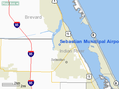
Sebastian Municipal Airport (FAA LID: X26) is a public-use airport located 1 mile (1.6 km) west of the central business district of the city of Sebastian in Indian River County, Florida, United States. The airport is publicly owned.
The above content comes from Wikipedia and is published under free licenses – click here to read more.
Location
& QuickFacts
|
FAA Information Effective: |
2007-01-18 |
|
Airport
Identifier: |
X26 |
|
Airport
Status: |
Operational |
|
Longitude/Latitude: |
080-29-45.2529W/27-48-45.3308N
-80.495904/27.812592 (Estimated) |
|
Elevation: |
21
ft / 6.40 m (Estimated) |
|
Land: |
626 acres |
|
From
nearest city: |
1 nautical miles W of Sebastian, FL |
|
Location: |
Indian River County, FL |
|
Magnetic Variation: |
03W (1985) |
Owner
& Manager
|
Ownership: |
Publicly owned |
|
Owner: |
City Of Sebastian |
|
Address: |
1225 Main Street
Sebastian, FL 32958 |
|
Phone
number: |
561-581-0111 |
|
Manager: |
Jason Milewski |
|
Address: |
1225 Main Street
Sebastian, FL 32958 |
|
Phone
number: |
561-581-0111 |
Airport
Operations and Facilities
|
Airport Use: |
Open to public |
|
Wind
indicator: |
Yes |
|
Segmented
Circle: |
No |
|
Control
Tower: |
No |
|
Lighting
Schedule: |
DUSK-DAWN |
|
Beacon
Color: |
Clear-Green (lighted land airport) |
|
Landing
fee charge: |
No |
|
Sectional
chart: |
Miami |
|
Region: |
ASO - Southern |
|
Boundary
ARTCC: |
ZMA - Miami |
|
Tie-in
FSS: |
PIE - Saint Petersburg |
|
FSS
on Airport: |
No |
|
FSS
Toll Free: |
1-800-WX-BRIEF |
|
NOTAMs
Facility: |
PIE (NOTAM-d service avaliable) |
|
Federal Agreements: |
NGPY |
Airport
Communications
|
CTAF: |
123.050 |
|
Unicom: |
123.050
AUTOMATED UNICOM. |
Airport
Services
|
Fuel available: |
100LLA |
|
Airframe Repair: |
MAJOR |
|
Power Plant Repair: |
MAJOR |
|
Bottled
Oxygen: |
NONE |
|
Bulk
Oxygen: |
NONE |
|
Runway Information
Runway 04/22
|
Dimension: |
4024 x 150 ft / 1226.5 x 45.7 m |
|
Surface: |
ASPH, Good Condition |
|
Weight
Limit: |
Single wheel: 22000 lbs. |
|
Edge
Lights: |
Low |
|
|
Runway 04 |
Runway 22 |
|
Longitude: |
080-30-01.1201W |
080-29-29.3856W |
|
Latitude: |
27-48-31.2676N |
27-48-59.3940N |
|
Elevation: |
18.00 ft |
22.00 ft |
|
Alignment: |
45 |
127 |
|
Traffic
Pattern: |
Left |
Right |
|
Markings: |
Basic, Good Condition |
Basic, Fair Condition |
|
Obstruction: |
15 ft trees, 510.0 ft from runway, 20:1 slope
to clear |
23 ft trees, 522.0 ft from runway, 14:1 slope
to clear |
|
Runway 08/26
|
Dimension: |
3200 x 75 ft / 975.4 x 22.9 m |
|
Surface: |
ASPH, |
|
|
Runway 08 |
Runway 26 |
|
Longitude: |
080-30-00.4816W |
080-29-24.8313W |
|
Latitude: |
27-48-50.5834N |
27-48-50.5269N |
|
Elevation: |
18.00 ft |
21.00 ft |
|
Traffic
Pattern: |
Left |
Right |
|
Markings: |
Basic, Good Condition |
Basic, Good Condition |
|
Radio Navigation
Aids
|
ID |
Type |
Name |
Ch |
Freq |
Var |
Dist |
|
VEP |
NDB |
Vero Beach |
|
392.00 |
04W |
9.8 nm |
|
SQT |
NDB |
Satellite |
|
257.00 |
03W |
20.4 nm |
|
FPR |
NDB |
Fort Pierce |
|
275.00 |
04W |
20.6 nm |
|
COI |
NDB |
Merritt Island |
|
247.00 |
05W |
33.3 nm |
|
GGL |
NDB |
Geiger Lake |
|
375.00 |
05W |
49.9 nm |
|
COF |
TACAN |
Patrick |
097X |
|
04W |
26.3 nm |
|
MLB |
VOR/DME |
Melbourne |
037X |
110.00 |
02W |
19.1 nm |
|
VRB |
VORTAC |
Vero Beach |
120X |
117.30 |
04W |
8.1 nm |
|
VRB |
VOT |
Vero Beach |
|
111.00 |
|
10.4 nm |
Remarks
- TREES
& BRUSH IN ALL TRANSITION SURFACES RY 22 & 26.
- EXISTED
PRIOR TO 1959.
Based
Aircraft
|
Aircraft
based on field: |
52 |
|
Single
Engine Airplanes: |
42 |
|
Multi
Engine Airplanes: |
8 |
|
Ultralights: |
2 |
Operational Statistics
Time Period: 1998-07-15
- 1999-07-14
|
Aircraft
Operations: |
103/Day |
|
Air Taxi: |
2.7% |
|
General
Aviation Local: |
32.9% |
|
General
Aviation Itinerant: |
64.4% |
Sebastian Municipal Airport
Address:
Indian River County, FL
Tel:
561-581-0111
Images
and information placed above are from
http://www.airport-data.com/airport/X26/
We
thank them for the data!
| General
Info |
| Country |
United
States |
| State |
FLORIDA
|
| FAA ID |
X26
|
| Latitude |
27-48-50.560N
|
| Longitude |
080-29-45.250W
|
| Elevation |
21 feet
|
| Near City |
SEBASTIAN
|
We don't guarantee the information is fresh and accurate. The data may
be wrong or outdated.
For more up-to-date information please refer to other sources.
|
|


