 |
|
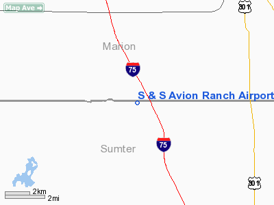
S and S Avion Ranch Airport |
Location
& QuickFacts
|
FAA Information Effective: |
2007-01-18 |
|
Airport
Identifier: |
31FA |
|
Airport
Status: |
Operational |
|
Longitude/Latitude: |
082-08-03.0000W/28-57-33.0000N
-82.134167/28.959167 (Estimated) |
|
Elevation: |
70 ft / 21.34 m (Estimated) |
|
Land: |
0 acres |
|
From
nearest city: |
7 nautical miles NW of Oxford, FL |
|
Location: |
Sumter County, FL |
|
Magnetic Variation: |
04W (2000) |
Owner
& Manager
|
Ownership: |
Privately owned |
|
Owner: |
Stanley Dollen |
|
Address: |
1120 C R 245 N
Oxford, FL 34484 |
|
Phone
number: |
352-748-0203 |
|
Manager: |
Shirley Matson |
|
Address: |
1120 C R 245 N
Oxford, FL 34484 |
|
Phone number: |
352-748-0203 |
Airport
Operations and Facilities
|
Airport Use: |
Private |
|
Segmented
Circle: |
No |
|
Control
Tower: |
No |
|
Sectional
chart: |
Miami |
|
Region: |
ASO - Southern |
|
Boundary
ARTCC: |
ZJX - Jacksonville |
|
Responsible
ARTCC: |
ZJX - Jacksonville |
|
Tie-in
FSS: |
PIE - Saint Petersburg |
|
FSS
Toll Free: |
1-800-WX-BRIEF |
|
Runway Information
Runway 09/27
|
Dimension: |
4060 x 80 ft / 1237.5 x 24.4 m |
|
Surface: |
TURF, |
|
|
Runway 09 |
Runway 27 |
|
Traffic
Pattern: |
Left |
Left |
|
Radio Navigation
Aids
|
ID |
Type |
Name |
Ch |
Freq |
Var |
Dist |
|
LEE |
NDB |
Leesburg |
|
335.00 |
04W |
19.2 nm |
|
GN |
NDB |
Wynds |
|
269.00 |
04W |
42.8 nm |
|
RHZ |
NDB |
Zephyrhills |
|
253.00 |
03W |
44.0 nm |
|
IAK |
NDB |
Palatka |
|
243.00 |
05W |
45.0 nm |
|
DED |
NDB |
Deland/dcmsnd |
|
201.00 |
05W |
45.7 nm |
|
SFB |
NDB |
Sanford |
|
408.00 |
05W |
48.0 nm |
|
OCF |
VORTAC |
Ocala |
084X |
113.70 |
00E |
14.0 nm |
|
GNV |
VORTAC |
Gators |
109X |
116.20 |
04W |
44.7 nm |
|
ORL |
VORTAC |
Orlando |
059X |
112.20 |
00E |
49.0 nm |
Remarks
- 300
FT TOWER 2 NM NNE; 35 FT TREES EAST & WEST OF RY ENDS.
- OWNER
DESIRES CHARTING.
- PRVDD
VFR PRIVATE USE.
Based
Aircraft
|
Aircraft
based on field: |
2 |
|
Single
Engine Airplanes: |
2 |
S and S Avion Ranch Airport
Address:
Sumter County, FL
Tel:
352-748-0203
Images
and information placed above are from
http://www.airport-data.com/airport/31FA/
We
thank them for the data!
| General
Info |
| Country |
United
States |
| State |
FLORIDA
|
| FAA ID |
31FA
|
| Latitude |
28-57-33.000N
|
| Longitude |
082-08-03.000W
|
| Elevation |
70 feet
|
| Near City |
OXFORD
|
We don't guarantee the information is fresh and accurate. The data may
be wrong or outdated.
For more up-to-date information please refer to other sources.
|
|


