 |
|
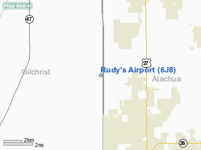
Location
& QuickFacts
|
FAA Information Effective: |
2007-01-18 |
|
Airport
Identifier: |
6J8 |
|
Airport
Status: |
Operational |
|
Longitude/Latitude: |
082-39-33.4190W/29-43-20.8640N
-82.659283/29.722462 (Estimated) |
|
Elevation: |
90 ft / 27.43 m (Estimated) |
|
Land: |
0 acres |
|
From
nearest city: |
7 nautical miles SW of High Springs, FL |
|
Location: |
Alachua County, FL |
|
Magnetic Variation: |
02W (1985) |
Owner
& Manager
|
Ownership: |
Privately owned |
|
Owner: |
Mike Wiesen |
|
Address: |
12623 199 St, N.e.
Waldo, FL 32694 |
|
Phone
number: |
386-464-5330 |
|
Manager: |
Mike Wiesen |
|
Address: |
12623 199 St, N.e.
Waldo, FL 32694 |
|
Phone number: |
386-464-5330 |
Airport
Operations and Facilities
|
Airport Use: |
Open to public |
|
Wind indicator: |
Yes |
|
Segmented Circle: |
No |
|
Control Tower: |
No |
|
Landing fee charge: |
Yes |
|
Sectional chart: |
Jacksonville |
|
Region: |
ASO - Southern |
|
Boundary ARTCC: |
ZJX - Jacksonville |
|
Tie-in FSS: |
GNV - Gainesville |
|
FSS on Airport: |
No |
|
FSS Phone: |
850-377-3291 |
|
FSS Toll Free: |
1-800-WX-BRIEF |
|
NOTAMs Facility: |
GNV |
Airport
Communications
|
Runway Information
Runway 10/28
|
Dimension: |
4800 x 75 ft / 1463.0 x 22.9 m |
|
Surface: |
TURF, |
|
|
Runway 10 |
Runway 28 |
|
Longitude: |
082-40-25.0000W |
082-39-30.8070W |
|
Latitude: |
29-43-13.0700N |
29-43-08.5950N |
|
Elevation: |
86.00 ft |
86.00 ft |
|
Traffic
Pattern: |
Left |
Left |
|
Runway 16/34
|
Dimension: |
2825 x 75 ft / 861.1 x 22.9 m |
|
Surface: |
TURF, Good Condition |
|
|
Runway 16 |
Runway 34 |
|
Traffic
Pattern: |
Left |
Left |
|
Displaced
threshold: |
235.00 ft |
700.00 ft
RY 16, 34 DSPLCD THR MARKED WITH YELLOW CONES. |
|
Obstruction: |
4 ft fence, 15.0 ft from runway
APCH RATIO 22:1 TO DSPLCD THLD. |
26 ft trees, 90.0 ft from runway, 3:1 slope
to clear
RY 34 APCH RATIO 20:1 TO DSPLCD THLD. |
|
Radio Navigation
Aids
|
ID |
Type |
Name |
Ch |
Freq |
Var |
Dist |
|
GN |
NDB |
Wynds |
|
269.00 |
04W |
25.6 nm |
|
LCQ |
NDB |
Lake City |
|
204.00 |
03W |
28.1 nm |
|
IAK |
NDB |
Palatka |
|
243.00 |
05W |
44.5 nm |
|
VQQ |
VOR |
Cecil |
|
117.90 |
03W |
49.7 nm |
|
GNV |
VORTAC |
Gators |
109X |
116.20 |
04W |
20.3 nm |
|
CTY |
VORTAC |
Cross City |
057X |
112.00 |
02W |
21.7 nm |
|
OCF |
VORTAC |
Ocala |
084X |
113.70 |
00E |
39.8 nm |
|
TAY |
VORTAC |
Taylor |
076X |
112.90 |
03W |
47.3 nm |
Remarks
Based Aircraft
|
Aircraft
based on field: |
3 |
|
Single
Engine Airplanes: |
2 |
|
Multi
Engine Airplanes: |
1 |
Operational Statistics
Time Period: 1998-05-31
- 1999-05-30
|
Aircraft
Operations: |
17/Month |
|
General
Aviation Local: |
50.0% |
|
General
Aviation Itinerant: |
50.0% |
Rudy's Airport
Address:
Alachua County, FL
Tel:
386-464-5330
Images
and information placed above are from
http://www.airport-data.com/airport/6J8/
We
thank them for the data!
| General
Info |
| Country |
United
States |
| State |
FLORIDA
|
| FAA ID |
6J8
|
| Latitude |
29-43-20.864N
|
| Longitude |
082-39-33.419W
|
| Elevation |
90 feet
|
| Near City |
HIGH SPRINGS
|
We don't guarantee the information is fresh and accurate. The data may
be wrong or outdated.
For more up-to-date information please refer to other sources.
|
|


