 |
|
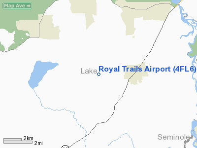
Location
& QuickFacts
|
FAA Information Effective: |
2007-01-18 |
|
Airport
Identifier: |
4FL6 |
|
Airport
Status: |
Operational |
|
Longitude/Latitude: |
081-28-25.2480W/28-56-15.9550N
-81.473680/28.937765 (Estimated) |
|
Elevation: |
49 ft / 14.94 m (Estimated) |
|
Land: |
7 acres |
|
From
nearest city: |
3 nautical miles N of Cassia, FL |
|
Location: |
Lake County, FL |
|
Magnetic Variation: |
03W (1985) |
Owner
& Manager
|
Ownership: |
Privately owned |
|
Owner: |
Ed Vergara |
|
Address: |
P.o. Box 951928
Lake Mary, FL 32795 |
|
Phone
number: |
407-330-3276 |
|
Manager: |
Ed Vergara |
|
Address: |
P.o. Box 951928
Lake Mary, FL 32795 |
|
Phone number: |
407-330-3276 |
Airport
Operations and Facilities
|
Airport Use: |
Private |
|
Wind
indicator: |
Yes |
|
Segmented
Circle: |
No |
|
Control
Tower: |
No |
|
Landing
fee charge: |
No |
|
Sectional
chart: |
Jacksonville |
|
Region: |
ASO - Southern |
|
Boundary
ARTCC: |
ZJX - Jacksonville |
|
Responsible
ARTCC: |
ZMA - Miami |
|
Tie-in
FSS: |
PIE - Saint Petersburg |
|
FSS
on Airport: |
No |
|
FSS
Toll Free: |
1-800-WX-BRIEF |
|
Runway Information
Runway 13/31
|
Dimension: |
3080 x 60 ft / 938.8 x 18.3 m |
|
Surface: |
TURF, |
|
|
Runway 13 |
Runway 31 |
|
Traffic
Pattern: |
Left |
Left |
|
Displaced
threshold: |
800.00 ft |
0.00
ft |
|
Obstruction: |
55 ft trees, 1000.0 ft from runway |
40 ft trees, 2500.0 ft from runway |
|
Radio Navigation
Aids
|
ID |
Type |
Name |
Ch |
Freq |
Var |
Dist |
|
DED |
NDB |
Deland/dcmsnd |
|
201.00 |
05W |
13.1 nm |
|
SFB |
NDB |
Sanford |
|
408.00 |
05W |
15.2 nm |
|
LEE |
NDB |
Leesburg |
|
335.00 |
04W |
19.0 nm |
|
EVB |
NDB |
New Smyrna Beach |
|
417.00 |
04W |
28.8 nm |
|
ISM |
NDB |
Kissimmee |
|
329.00 |
05W |
39.0 nm |
|
GGL |
NDB |
Geiger Lake |
|
375.00 |
05W |
40.4 nm |
|
IAK |
NDB |
Palatka |
|
243.00 |
05W |
46.5 nm |
|
TTS |
TACAN |
Kennedy Space Center |
059Y |
|
00E |
45.1 nm |
|
ORL |
VORTAC |
Orlando |
059X |
112.20 |
00E |
24.8 nm |
|
OMN |
VORTAC |
Ormond Beach |
073X |
112.60 |
00E |
29.0 nm |
|
OCF |
VORTAC |
Ocala |
084X |
113.70 |
00E |
42.1 nm |
|
DAB |
VOT |
Daytona Beach |
|
111.00 |
|
26.4 nm |
Remarks
- PVT
USE; VFR WX CONDS; TFC PATS ARE ESTABD ON SW SIDE OF ARPT.
Royal Trails Airport
Address:
Lake County, FL
Tel:
407-330-3276
Images
and information placed above are from
http://www.airport-data.com/airport/4FL6/
We
thank them for the data!
| General
Info |
| Country |
United
States |
| State |
FLORIDA
|
| FAA ID |
4FL6
|
| Latitude |
28-56-15.955N
|
| Longitude |
081-28-25.248W
|
| Elevation |
49 feet
|
| Near City |
CASSIA
|
We don't guarantee the information is fresh and accurate. The data may
be wrong or outdated.
For more up-to-date information please refer to other sources.
|
|


