 |
|
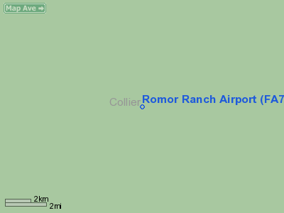
Location
& QuickFacts
|
FAA Information Effective: |
2007-01-18 |
|
Airport
Identifier: |
FA74 |
|
Airport
Status: |
Operational |
|
Longitude/Latitude: |
081-03-24.2520W/25-58-51.3380N
-81.056737/25.980927 (Estimated) |
|
Elevation: |
12 ft / 3.66 m (Estimated) |
|
Land: |
0 acres |
|
From
nearest city: |
15 nautical miles NE of Ochopee, FL |
|
Location: |
Collier County, FL |
|
Magnetic Variation: |
02W (1985) |
Owner
& Manager
|
Ownership: |
Privately owned |
|
Owner: |
Tim Griffin
ALSO GEORGE HODGE |
|
Address: |
23505 Sw 202 Ave
Homestead, FL 33031 |
|
Phone
number: |
305-667-4554 |
|
Manager: |
Robert R. Morton |
|
Address: |
630 San Juan Drive
Coral Gables, FL 33143 |
|
Phone number: |
305-667-4554 |
Airport
Operations and Facilities
|
Airport Use: |
Private |
|
Wind
indicator: |
No |
|
Segmented
Circle: |
No |
|
Control
Tower: |
No |
|
Landing
fee charge: |
No |
|
Sectional
chart: |
Miami |
|
Region: |
ASO - Southern |
|
Boundary
ARTCC: |
ZMA - Miami |
|
Tie-in
FSS: |
MIA - Miami |
|
FSS
on Airport: |
No |
|
FSS
Phone: |
305-233-2600 |
|
FSS
Toll Free: |
1-800-WX-BRIEF |
|
Runway Information
Runway 12/30
|
Dimension: |
1860 x 75 ft / 566.9 x 22.9 m |
|
Surface: |
TURF, |
|
|
Runway 12 |
Runway 30 |
|
Traffic
Pattern: |
Left |
Left |
|
Obstruction: |
50 ft trees |
|
|
Radio Navigation
Aids
|
ID |
Type |
Name |
Ch |
Freq |
Var |
Dist |
|
APF |
NDB |
Naples |
|
201.00 |
03W |
40.1 nm |
|
FX |
NDB |
Praiz |
|
221.00 |
02W |
42.7 nm |
|
PJN |
NDB |
Plantation |
|
242.00 |
03W |
46.1 nm |
|
HST |
TACAN |
Homestead |
019X |
|
03W |
47.1 nm |
|
CYY |
VOR/DME |
Cypress |
023X |
108.60 |
03W |
40.3 nm |
|
FLL |
VOR/DME |
Fort Lauderdale |
091X |
114.40 |
00E |
49.2 nm |
|
DHP |
VORTAC |
Dolphin |
086X |
113.90 |
04W |
39.8 nm |
|
MIA |
VOT |
Miami Intl |
|
112.00 |
|
43.5 nm |
Remarks
Based
Aircraft
|
Aircraft
based on field: |
1 |
|
Single
Engine Airplanes: |
1 |
Romor Ranch Airport
Address:
Collier County, FL
Tel:
305-667-4554
Images
and information placed above are from
http://www.airport-data.com/airport/FA74/
We
thank them for the data!
| General
Info |
| Country |
United
States |
| State |
FLORIDA
|
| FAA ID |
FA74
|
| Latitude |
25-58-51.338N
|
| Longitude |
081-03-24.252W
|
| Elevation |
12 feet
|
| Near City |
OCHOPEE
|
We don't guarantee the information is fresh and accurate. The data may
be wrong or outdated.
For more up-to-date information please refer to other sources.
|
|


