 |
|
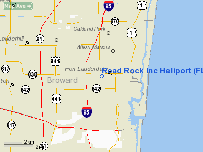
Road Rock Incorporated Heliport |
Location
& QuickFacts
|
FAA Information Effective: |
2007-01-18 |
|
Airport
Identifier: |
FL82 |
|
Airport
Status: |
Operational |
|
Longitude/Latitude: |
080-09-08.1630W/26-08-03.3080N
-80.152267/26.134252 (Estimated) |
|
Elevation: |
21 ft / 6.40 m (Surveyed) |
|
Land: |
0 acres |
|
From
nearest city: |
0 nautical miles N of Fort Lauderdale, FL |
|
Location: |
Broward County, FL |
|
Magnetic Variation: |
03W (1985) |
Owner
& Manager
|
Ownership: |
Privately owned |
|
Owner: |
Robert Elmore |
|
Address: |
900 Nw 8th Ave
Fort Lauderdale, FL 33311 |
|
Phone
number: |
305-523-3438 |
|
Manager: |
Robert Elmore |
|
Address: |
900 Nw 8th Ave
Fort Lauderdale, FL 33311 |
Airport
Operations and Facilities
|
Airport Use: |
Private |
|
Wind
indicator: |
Yes |
|
Segmented
Circle: |
No |
|
Control
Tower: |
No |
|
Landing
fee charge: |
No |
|
Sectional
chart: |
Miami |
|
Region: |
ASO - Southern |
|
Boundary
ARTCC: |
ZMA - Miami |
|
Tie-in
FSS: |
MIA - Miami |
|
FSS
on Airport: |
No |
|
FSS
Phone: |
305-233-2600 |
|
FSS
Toll Free: |
1-800-WX-BRIEF |
|
Runway Information
Helipad H1
|
Dimension: |
50 x 35 ft / 15.2 x 10.7 m |
|
Surface: |
CONC, |
|
|
Runway H1 |
Runway |
|
Traffic
Pattern: |
Left |
Left |
|
Radio Navigation
Aids
|
ID |
Type |
Name |
Ch |
Freq |
Var |
Dist |
|
PJN |
NDB |
Plantation |
|
242.00 |
03W |
3.6 nm |
|
FX |
NDB |
Praiz |
|
221.00 |
02W |
8.5 nm |
|
PB |
NDB |
Rubin |
|
356.00 |
03W |
33.4 nm |
|
UTX |
NDB |
United |
|
405.00 |
03W |
47.6 nm |
|
HST |
TACAN |
Homestead |
019X |
|
03W |
40.7 nm |
|
FLL |
VOR/DME |
Fort Lauderdale |
091X |
114.40 |
00E |
3.6 nm |
|
VKZ |
VOR/DME |
Virginia Key |
118X |
117.10 |
04W |
23.0 nm |
|
DHP |
VORTAC |
Dolphin |
086X |
113.90 |
04W |
22.7 nm |
|
PBI |
VORTAC |
Palm Beach |
104X |
115.70 |
03W |
33.0 nm |
|
PHK |
VORTAC |
Pahokee |
101X |
115.40 |
00E |
48.6 nm |
|
MIA |
VOT |
Miami Intl |
|
112.00 |
|
21.5 nm |
|
PBI |
VOT |
Palm Beach |
|
109.00 |
|
33.3 nm |
Remarks
- VFR
ONLY; PVT USE. COORD USE WITH GADO 5. EGRESS/INGRESS RTE WITH FLL ATCT.
Road Rock Incorporated Heliport
Address:
Broward County, FL
Tel:
305-523-3438
Images
and information placed above are from
http://www.airport-data.com/airport/FL82/
We
thank them for the data!
| General
Info |
| Country |
United
States |
| State |
FLORIDA
|
| FAA ID |
FL82
|
| Latitude |
26-08-03.308N
|
| Longitude |
080-09-08.163W
|
| Elevation |
21 feet
|
| Near City |
FORT LAUDERDALE
|
We don't guarantee the information is fresh and accurate. The data may
be wrong or outdated.
For more up-to-date information please refer to other sources.
|
|


